TOKYO • Analysis of a barely legible map on North Korean leader Kim Jong Un's desk has revealed a missile trajectory that potentially puts its strike inside Japan's territorial waters.
A Washington-based analyst's interpretation of details in a picture of Mr Kim taken during the launch of the North's first intercontinental ballistic missile (ICBM) has been obtained by The Japan Times.
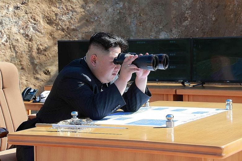
The image, taken on July 4 during the launch of the Hwasong-14 (HS-14), shows Mr Kim at a desk with a virtually illegible map of the missile's trajectory .
Mr Nathan Hunt, an open- source intelligence analyst with the Strategic Sentinel defence contractor, tried to make the unreadable document clearer. He compared his reassembled and unblurred map to a similar one seen in photos released by the North from its May 14 launch of an intermediate-range Hwasong-12 missile.
Strategic Sentinel said close analysis of the map appeared to show the splash-down point of the missile just off Okushiri Island located west of Hokkaido, Japan. That trajectory could have potentially put the missile inside Japan's territorial waters, the area of sovereign waters 12 nautical miles off any country. The North has not yet fired one so close to Japanese territory.
"It is, however, unlikely that North Korea actually intended the missile to travel along the abnormal trajectory that has been found," said Strategic Sentinel. It concluded that such a move would be dangerous on the part of North Korea and could have resulted in a military response from Japan. As the HS-14 could have easily travelled anywhere into Japanese territory, the report suggested that the trajectory shown on the map was meant to be a signal to Japan and its allies.
The Japan Times quoted Mr John Schilling, a North Korea expert and aerospace engineer, as saying the map may have been purposely displayed by Pyongyang as an indication of its capabilities. "I think it is very likely that North Korea either intended to signal that the ICBM test could have reached the edge of Japanese territorial waters, or intended the missile to actually reach Japanese waters and fell short, but there is no way to know which," Mr Schilling was quoted as saying.
But The Japan Times also quoted Mr Joshua Pollack, editor of the US-based Nonproliferation Review and a leading expert on nuclear and missile proliferation, commenting that there may be an element of "overthinking" on the part of analysts. Instead, he suggested that the North had either "decided at the last minute to give themselves a greater margin of comfort, and the map didn't reflect that" or simply missed its target, according to The Japan Times. "Either is possible," he said. "It is a new missile, and they are flirting with the edge here."