Singapore could experience heavier rain over the next two months due to Indian Ocean Dipole
Sign up now: Get ST's newsletters delivered to your inbox
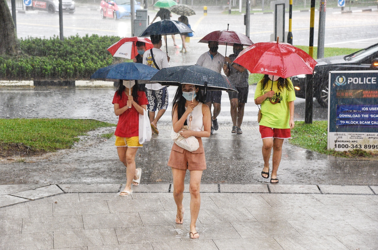
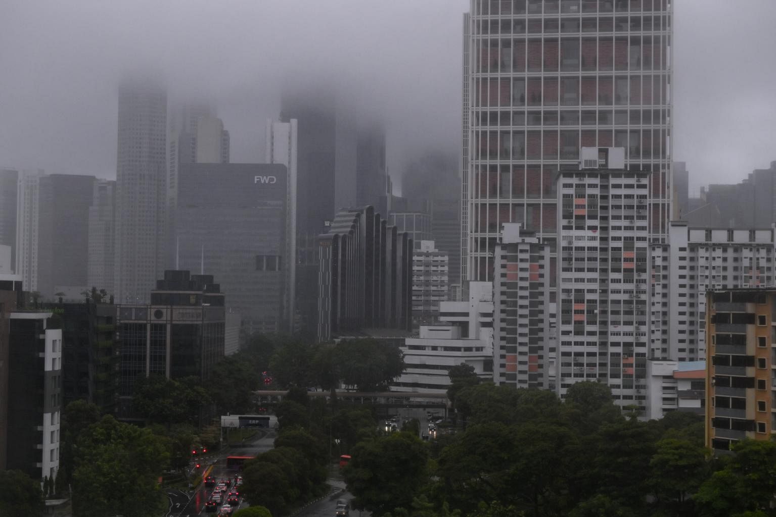
Meteorological Service Singapore figures show that this month is already the third wettest August since 1991.
PHOTO: BERITA HARIAN
SINGAPORE - Heavier rain is expected over Singapore in the next two months due to the influence of a weather phenomenon known as the Indian Ocean Dipole (IOD), which entered a negative phase this month.
In this phase, the IOD brings more rain than usual to countries in the eastern end of the Indian Ocean basin, including Singapore.
"The current negative phase of the IOD is expected to persist till October 2021 and gradually weaken thereafter," said a spokesman for the Meteorological Service Singapore (MSS), a unit under the National Environment Agency.
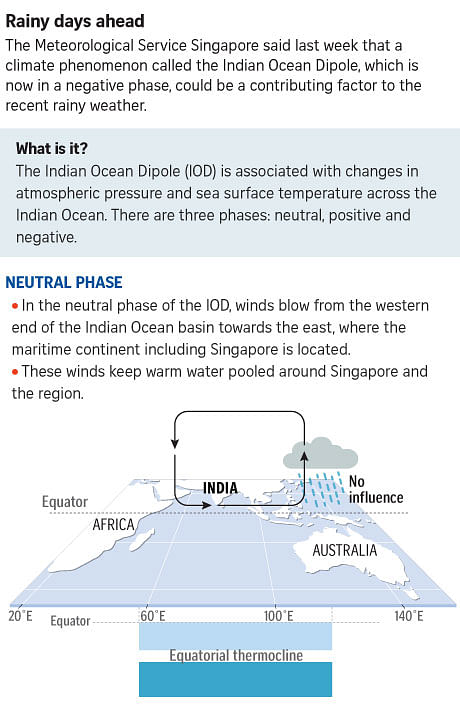
The weather phenomenon is associated with changes in atmospheric pressure and sea surface temperature across the Indian Ocean.
There are three phases: neutral, positive and negative.
In its neutral phase, winds blow from the western end of the Indian Ocean basin towards the east, keeping warm water pooled around Singapore and the maritime continent.
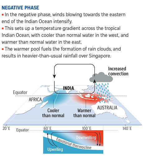
In the negative phase, the winds blowing towards the eastern end of the Indian Ocean intensify.
This sets up a temperature gradient across the tropical Indian Ocean, with cooler-than-normal water in the west, and warmer-than-normal water in the east.
The warmer pool fuels the formation of rain clouds, and results in heavier-than-usual rainfall over Singapore.
Associate Professor Koh Tieh Yong, a weather and climate scientist at the Singapore University of Social Sciences, said: "The developing negative IOD, where the sea south-west of Sumatra gets warmer than usual, may help explain this month's anomaly."
He was referring to the higher rainfall than usual experienced here. MSS figures show that this month is already the third wettest August since 1991.
Prof Koh added: "As the sea surface temperature rises there, south-westerly monsoon winds converge more strongly in our region. This leads to a larger supply of moisture, and favours cloud and rain formation."
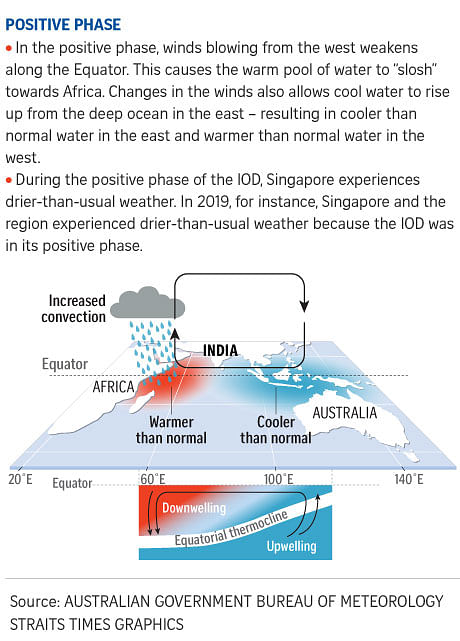
In the positive phase of the IOD, the opposite happens.
The winds slacken, and the warm water pooled around the maritime continent "sloshes" towards Africa instead.
Changes in the wind patterns also allows cool water to rise up from the deep ocean in the east - resulting in cooler than normal water in the east and warmer than normal water in the west.
During the positive phase of the IOD, Singapore experiences drier-than-usual weather.
The United States' National Weather Service had earlier forecast that a La Nina climate phenomenon could develop between August and October.
Like the negative phase of the IOD , a La Nina event will also bring more rainfall to Singapore.
The difference is that while the IOD describes changes to wind patterns and sea surface temperatures across the Indian Ocean, La Nina is part of the El Nino Southern Oscillation centred in the Pacific Ocean.
Singapore is sandwiched between the Pacific and Indian Oceans, and can be affected by changes in both.
In 2015, for instance, a positive IOD coincided with a strong El Nino event - the "brother" to La Nina, which causes hotter and drier weather here.
The result was hotter and drier weather that caused the region's most severe haze crisis on record.
Asked if the current negative phase of IOD and the possibility of a La Nina event could bring about a "double whammy" of two different weather phenomena dumping rain over Singapore, Prof Koh said: "On the whole, most models indicate roughly equal chance of the tropical Pacific Ocean staying neutral or developing a weak La Nina.
"The consensus view at present is that a double whammy is unlikely, although it cannot be totally ruled out yet."
