Bayshore, Upper Changi to have public, private housing; URA's new plan unveils future housing towns
Sign up now: Get ST's newsletters delivered to your inbox

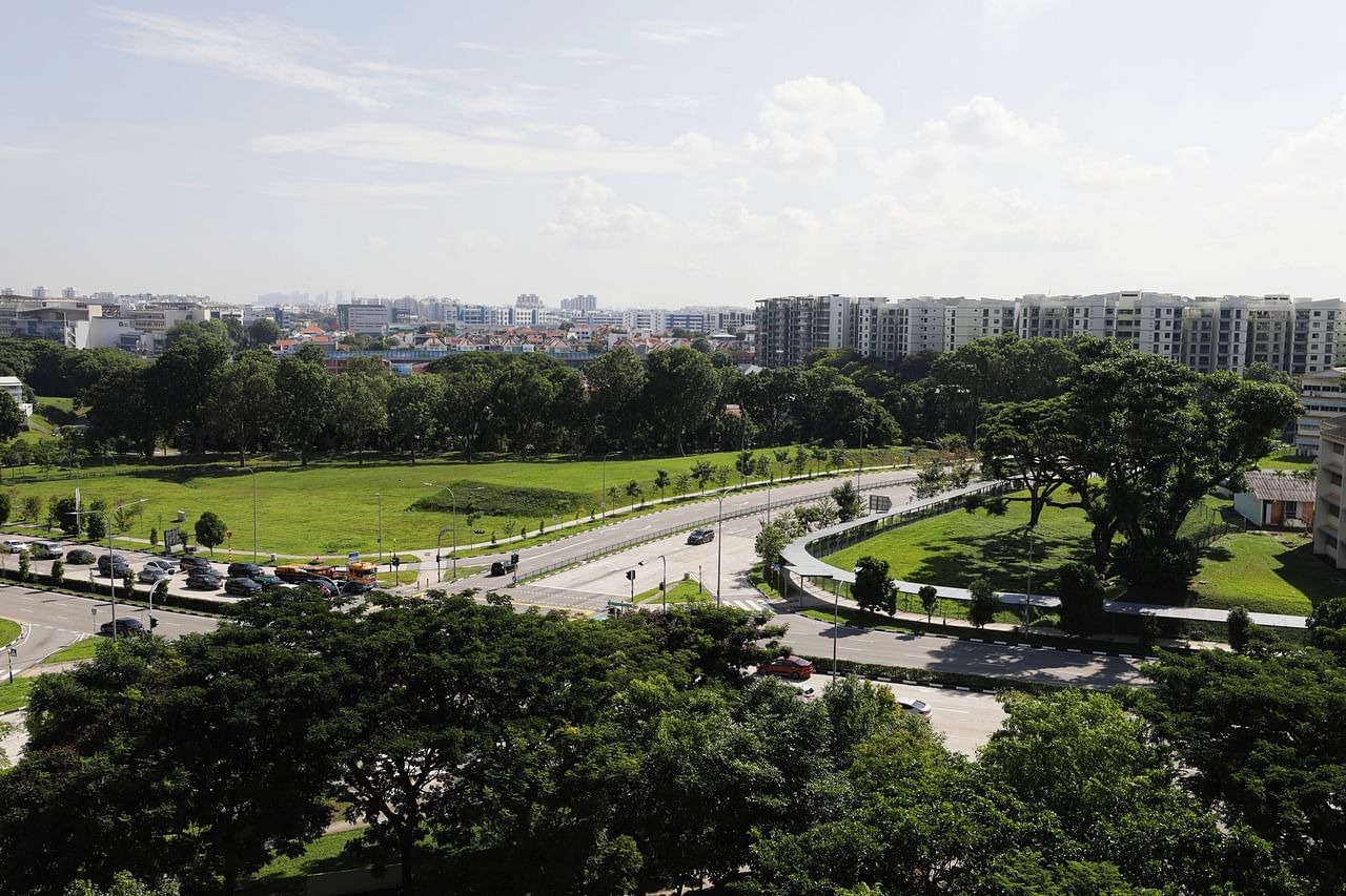
URA's long-term plan showed that future public and private housing have been planned for areas around Upper Changi MRT station.
ST PHOTO: KELVIN CHNG
Follow topic:
SINGAPORE - Public housing will be built at the residential estates of Bayshore and around Upper Changi MRT station, as part of a broader plan to add homes closer to jobs and have a better mix of public and private housing islandwide.
The move is among the plans unveiled by the Urban Redevelopment Authority (URA) on Monday (June 6), in its latest review of Singapore's long-term plan that charts the way ahead for the next 50 years and beyond.
Proposals in the latest plan give planners more flexibility to navigate an increasingly uncertain environment, with the Covid-19 pandemic bringing about shifts such as flexible work arrangements.
For instance, towns will have space reserved to meet future or unexpected needs and some commercial sites will be offered with shorter leases to allow businesses to adapt to fast-changing trends.
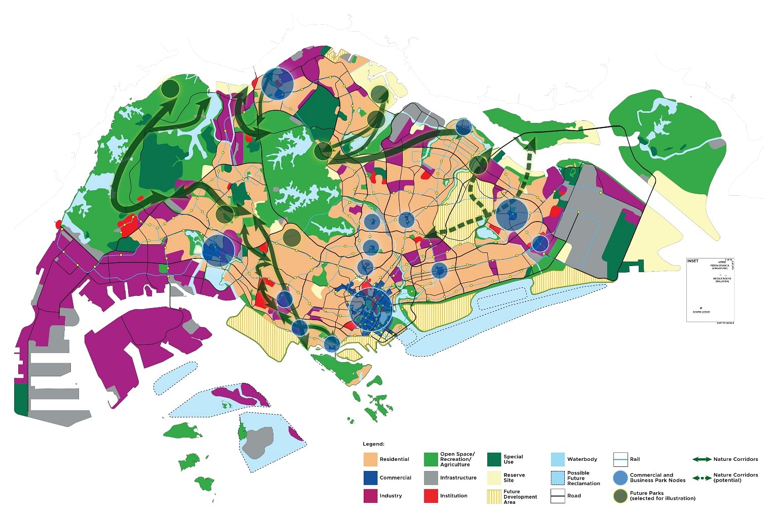
Besides setting out how Singapore will increase its land supply through reclamation and redeveloping large tracts of land like the Paya Lebar Air Base, the plan also details how the country will preserve key green spaces and heritage areas.

Speaking at the long-term plan review exhibition at the URA Centre, National Development Minister Desmond Lee said Singapore's rapid transformation within the last few decades was due to bold long-term planning.
The URA said government agencies will plan for more towns and estates with both public and private homes, in a nod to calls for more inclusive housing towns.
Besides Bayshore and the areas around Upper Changi MRT station in Simei, the URA's plans showed that new homes could also be built in areas such as Marina East, Marina South, Lower Seletar and Chencharu in Yishun.
Other new housing areas near existing estates include Sembawang North, Woodlands North and Sengkang West.
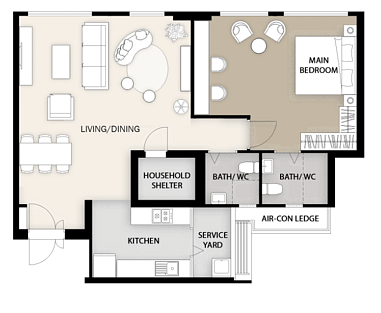
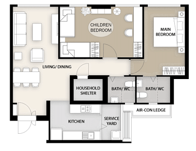
To allow Housing Board flat home owners more flexibility in configuring various spaces according to their needs, there are plans to offer a wider variety of internal flat layouts.


At the town level, planners are looking at time-sharing of public spaces to accommodate multiple users throughout the day, and how to make better use of underutilised spaces, such as those under expressways or MRT viaduct.
Across the island, more road space will be repurposed for walking and cycling. Public buses will also get more priority via transit priority corridors.
Mr Lee noted in his speech that many participants in the long-term plan review had “expressed their desire for our future city to be a distinctive, and at the same time endearing, one that the inhabitants love and are familiar with”.
To that end, the URA has developed a heritage and identity structure plan to guide efforts to protect and improve access to Singapore's heritage.
It has also identified five "identity corridors" islandwide with unique streetscapes and history, including a Thomson-Kallang Corridor running towards the north and an Inner Ring, which brings together neighbourhoods in the city fringe from Zion to Crawford roads.
Mr Lee said another constant theme expressed by Singaporeans is the challenge of balancing developmental needs while retaining green and blue spaces.
"We seek to conserve our most biodiverse areas, enhance ecological connectivity and integrate greenery sensitively with developments," he noted.
To do so, the National Parks Board has identified four new ecological corridors in Khatib, Kranji, Lim Chu Kang and Seletar.
Lower Seletar Reservoir Park will be expanded and two new parks developed as part of the Khatib nature corridor, which will serve as a highway for wildlife between two core habitats - the Central Catchment Nature Reserve and the upcoming Khatib Bongsu Nature Park.
Another corridor could also be identified in the east after the Paya Lebar Airbase is relocated in the 2030s. URA set out plans to transform the 800ha site into a new generation town with homes, jobs and lifestyle options anchored on its identity as a former international airport.
Mr Lee said some of the early concepts included anchoring the area’s identity as a former international airport, while others suggested designing workplaces and towns from scratch to be optimised for remote working and future industries.
He noted that the development of the site of Paya Lebar Air Base, along with other long-term projects such as the consolidating of ports at Tuas to make way for the Greater Southern Waterfront, will take significant investment, careful planning and decades of hard work to realise.
"But we are making these moves now, so that we can create enough space - not just for our dreams today, but also for the dreams of our future generations," he added.
Singapore's long-term plans are reviewed once every decade to take into account evolving trends and changing demands. The first such plan - previously known as the Concept Plan - was launched in 1971.
The exhibition at The URA Centre is open to the public for free from now until Aug 4.

