Why ‘rapid intensification’ is transforming hurricane season
Sign up now: Get ST's newsletters delivered to your inbox

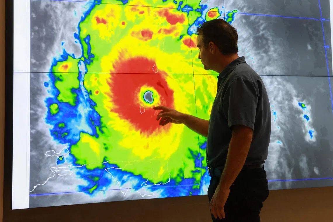
A satellite image of Hurricane Beryl, the first hurricane of the 2024 season, at the National Hurricane Centre in Miami, Florida, on July 1, 2024.
PHOTO: AFP
MIAMI – Many hurricanes slowly build strength as they churn across the open ocean. But Hurricane Beryl, like Ian in 2022 and a string of other recent hurricanes, grew from a tropical storm with stunning speed.
Its winds doubled from 104.6kmh to 209kmh in just 24 hours, and then escalated further to Category 5, the highest threshold. Meteorologists call that kind of dramatic shift “rapid intensification”, and say that climate change appears to be making the effect more common.
How common is rapid intensification?
The technical definition, according to the National Oceanic and Atmospheric Administration (NOAA), is when a hurricane’s winds increase by 56kmh or more in 24 hours or less.
Multiple studies have shown that rapid intensification has become more common over the past three decades, pushing large storms to become even stronger. It has happened with some of the most devastating storms to slam North American shores in recent years.
In 2023, for instance, Hurricane Otis grew into a Category 5 storm as it approached Acapulco on Mexico’s Pacific coast, where it killed at least 52 people. In 2022, Hurricane Ian underwent rapid intensification before striking first Cuba and then Florida, killing more than 150 people and causing US$112 billion (S$152 billion) in damage.
What’s the impact?
The main thing to know is that the element of surprise can be deadly and expensive. Hurricanes that quickly gain power are more likely to catch people unaware, with catastrophic consequences.
When Hurricane Laura went from a Category 1 to a Category 4 storm in less than 24 hours in 2020, projections of its storm surge jumped from 3.4m to 6m; some Louisianans intent on riding out a weaker storm were forced to make an 11th-hour decision to evacuate.
In 2015, more than 30 crew on a cargo ship called El Faro drowned after setting out to sea based on forecasts of a weak tropical storm, only to have it balloon into a Category 4 giant in less than 24 hours.
What’s causing the change?
The reason hurricanes are getting more powerful with such speed is no secret: warmer ocean water. Warmer water produces more water vapour, which provides fuel for storms. Warmer air can also hold more water vapour, which can bring more intense rainfall during storms.
Higher sea surface temperatures can also intensify wind speeds. “It’s a known effect of climate change,” said Dr Greg Foltz, an oceanographer with NOAA. “Increasing ocean heat is causing strong hurricanes to become stronger.”
The Atlantic Ocean between the Caribbean and Africa – the breeding ground for East Coast hurricanes – is the warmest it has ever been this time of year, with temperatures closer to what would be expected in August or September. Beryl is the earliest Category 5 storm (with sustained winds of 252kmh or higher) ever recorded in the Atlantic.
Can anything be done about this?
The ultimate question is what steps are taken to limit climate change.
But a better understanding of storm mechanics and better forecasting can lead to timelier warnings; upgrades to a network of floating ocean temperature sensors known as Argos, run by an international consortium of scientific agencies, have proved instrumental in the latter.
With Beryl, the National Hurricane Centre was able to accurately forecast that the storm would strengthen to a hurricane – possibly even Category 3 or higher – well before it struck the Caribbean’s Windward Islands. BLOOMBERG


