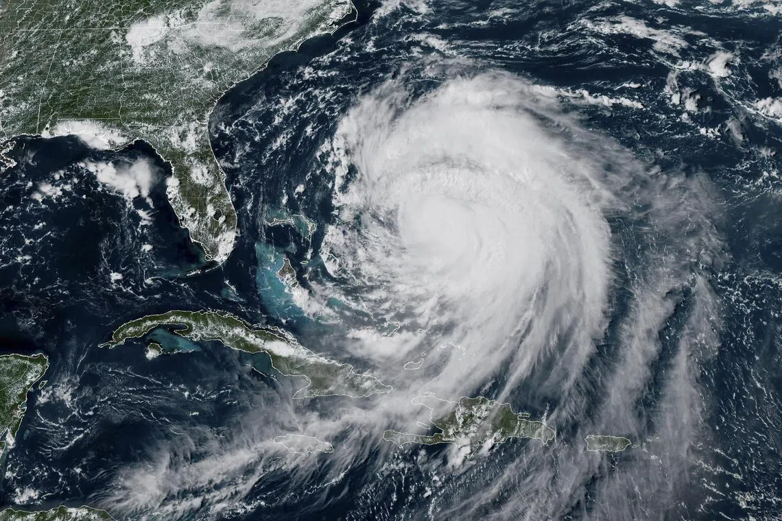
North Carolina coasts prepare for flooding as Hurricane Erin churns offshore
Sign up now: Get ST's newsletters delivered to your inbox

The storm underwent historically rapid intensification and briefly peaked at Category 5 on the Saffir-Simpson scale.
PHOTO: EPA
WASHINGTON – Hurricane Erin maintained its Category 2 strength early on the morning of Aug 20 as North Carolina’s coasts prepared for life-threatening coastal flooding, with mandatory evacuations under way for some islands, US authorities said.
The storm, which underwent historically rapid intensification and briefly peaked at Category 5 on the Saffir-Simpson scale, swamped homes and roads in the US island territory of Puerto Rico.
Although its core is projected to remain far offshore, meteorologists are concerned by Erin’s large size, with tropical storm-force winds extending hundreds of metres from its core.
“Weather conditions (are) expected to deteriorate along the coast of North Carolina by this evening,” the National Hurricane Centre (NHC) warned in its latest advisory.
Erin was located 730km south-east of North Carolina’s Cape Hatteras, with maximum sustained winds of 161kmh, and was moving north-north-west, according to the NHC.
Governor Josh Stein declared a state of emergency on the evening of Aug 19.
“Hurricane Erin will bring threats of coastal flooding, beach erosion and dangerous surf conditions,” he said.
“North Carolinians along the coast should get prepared now, ensure their emergency kit is ready and listen to local emergency guidelines.”
Storm surge warnings were issued for Cape Lookout in North Carolina’s south-east further north to the town of Duck, with water levels potentially reaching 60cm to 120cm above ground.
A broader swathe of coastline, from North Carolina to southern Virginia and Bermuda, was under a lower-grade Tropical Storm Watch.
Mandatory evacuations were ordered for Ocracoke and Hatteras islands, while Dare and Hyde counties declared local emergencies, according to the governor’s office.
The Atlantic hurricane season, which runs from June 1 to Nov 30, has entered its historical peak.
Despite a relatively quiet start with just four named storms so far, the National Oceanic and Atmospheric Administration continues to forecast an “above-normal” season.
Scientists say that climate change is supercharging tropical cyclones: warmer oceans fuel stronger winds, a warmer atmosphere intensifies rainfall and higher sea levels magnify storm surge.
There is also some evidence, though less certain, that climate change is making hurricanes more frequent. AFP


