Extreme cold grips millions as US digs out of deadly snowstorm
Sign up now: Get ST's newsletters delivered to your inbox

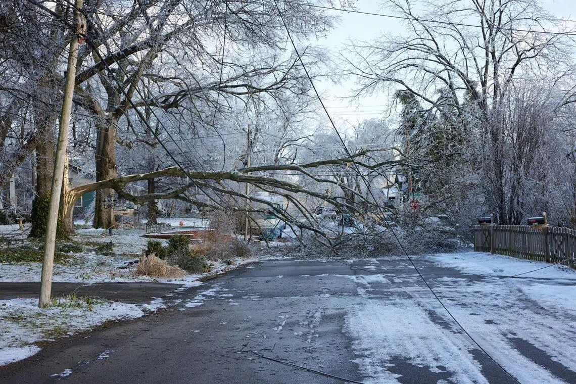
Damaged ice-covered trees and downed power lines blocking a road during a winter storm in east Nashville, Tennessee, on Jan 26.
PHOTO: BLOOMBERG
NEW YORK – Perilously cold temperatures threatened millions of Americans on Jan 26 in the wake of a sprawling winter storm that left at least 23 people dead as it knocked out power and paralysed transportation.
A frigid, life-threatening Arctic air mass could delay recovery as municipalities from New Mexico to Maine tried to dig out following the storm, which dropped a vicious cocktail of heavy snow and wind along with freezing rain and sleet.
Forecasters warned that much of the northern half of the US will see temperatures that are “continuously below freezing through Feb 1”, and “record low temperatures (on Jan 26) across the South are particularly dangerous in the wake of the weekend winter storm with many still without power”, the National Weather Service said in an X post.
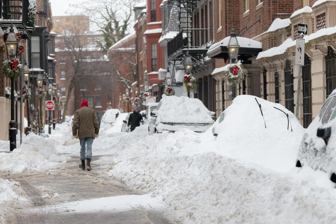
While skies began clearing in parts of the country, relentless snowfall in the north-east meant parts of Connecticut saw over 56cm of snow, with more than 40.6cm recorded in Boston, Massachusetts.
The storm was linked to at least 23 deaths, according to a compilation of state government and local media reports, with causes including hypothermia and accidents related to traffic, sledging, all-terrain vehicles and snowploughs.
One man was found in the snow unresponsive, with a shovel in his hand.
In New York City, eight more people were found dead amid plummeting temperatures, and an investigation to determine the causes was under way.
It was not known if all of these fatalities were storm related.
Electricity began blinking back on across the south, but as at the evening of Jan 26, well over 600,000 customers remained without it, according to the tracking site Poweroutage.com.
Tennessee, Texas, Mississippi and Louisiana – southern states unaccustomed to intense winter weather – were especially impacted.
Approximately 190 million people across the United States were under some form of extreme cold alert, the National Weather Service (NWS) told AFP.
The Great Lakes region’s residents woke up to extreme temperatures that could cause frostbite on exposed skin within minutes. In parts of Minnesota and Wisconsin, the NWS reported early on the morning of Jan 26 temperatures as low as minus 30.6 deg C, with windchills exacerbating the bite.
Over the weekend, nearly half of the states in the contiguous US received at least 30cm of snow and in many cases, far more.
The NWS said New Mexico’s Bonito Lake accumulated the highest US total over the weekend with about 79cm.
Nashville Mayor Freddie O’Connell told journalists that trees were continuing to fall under the weight of encrusted ice across the Tennessee capital city – sometimes knocking out power that had already been restored.

A pedestrian passing snow-covered vehicles following a winter storm in Boston, Massachusetts, on Jan 26.
PHOTO: BLOOMBERG
Nashville and other municipalities across the country were establishing emergency warming shelters.
NWS meteorologist Allison Santorelli told AFP that this storm recovery was particularly arduous because so many states were impacted – meaning northern states with more winter supplies were unable to share their resources with less-prepared southern regions.
“A lot of those locations don’t have the means or the resources to clean up after these events,” she said. “We’re particularly concerned about the folks in areas that are without power right now.”
Polar vortex
At least 20 states and the capital, Washington, DC, were under states of emergency, allowing the deployment of emergency personnel and resources.
The snowfall and biting icy pellets that pummelled cities left roads impassable, along with cancelled buses, trains and flights – thousands of departures and arrivals were scrapped over the weekend.
The storm system was the result of a stretched polar vortex, an arctic region of cold, low-pressure air that normally forms a relatively compact, circular system but sometimes morphs into a more oval shape, sending cold air pouring across North America.
Scientists say the increasing frequency of such weather disruptions may be linked to climate change, though the debate is not settled and natural variability also plays a role.
Mr Dave Radell, an NWS meteorologist based in New York, told AFP that the character of this storm’s snow was “very dry” and “fluffy”, meaning the wind could lash it around with ease, impeding visibility and efforts to clear roads.
“That makes it even more challenging,” he said. AFP


