Bomb cyclone pounds Northwest US, leaving 600,000 without power
Sign up now: Get ST's newsletters delivered to your inbox

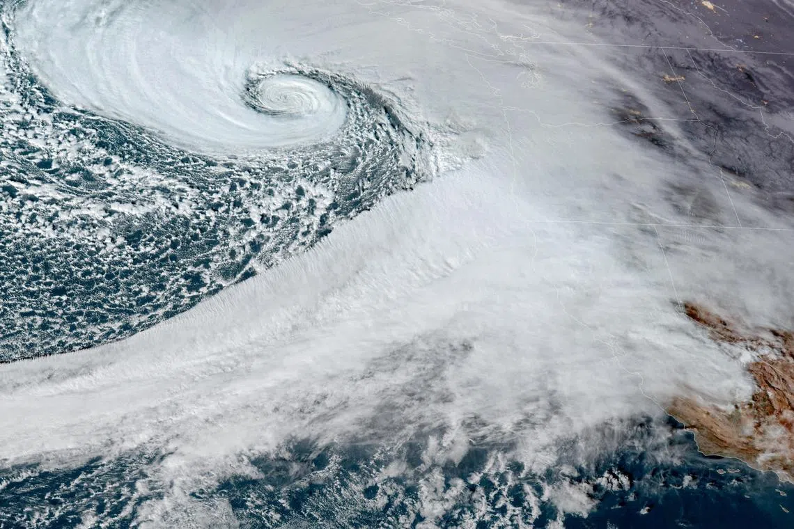
A low pressure storm system - known as a "bomb cyclone" - forms off the coast of the US Pacific Northwest and western Canada, in a composite satellite image from Nov 19.
PHOTO: REUTERS
DeeperDive is a beta AI feature. Refer to full articles for the facts.
SEATTLE, Washington - A powerful storm was clobbering Washington state on Nov 20, knocking out power to hundreds of thousands while wreaking havoc on road travel and causing at least one death and two injuries.
A woman was killed on Nov 19 when a tree fell on a homeless encampment in Lynnwood, just north of Seattle, local fire department officials said on social media.
Two people were also injured when a tree fell on their trailer in Maple Valley, south-east of Seattle.
Schools across western Washington cancelled classes or postponed the start of school on Nov 20.
The storm with tropical storm force winds of 80kmh and gusts around 110kmh felled trees and power lines overnight.
It knocked out electricity to more than 600,000 homes and businesses in Washington, Southwest Oregon and Northern California, according to the Poweroutage.us.
An NBC affiliate in Seattle broadcast images of cars smashed by fallen trees and damaged homes.
The Snohomish County Regional Fire and Rescue service in Western Washington posted on X, “There are so many trees and power lines down, we would be posting the locations till the lights turn on. Stay home and stay safe!”
Overnight, the fire department of Bellevue, east of Seattle posted on X, “Trees are coming down all over the city & falling onto homes. If you can, go to the lowest floor and stay away from windows. Do not go outside if you can avoid it.”
The strong winds should die down across the region by midday on Nov 20, but the storm is already above California, the National Weather Service said, and it is set to bring extreme rainfall totals by the end of the week.
"The storm is just beginning," said Mr Rich Otto, a meteorologist with the NWS Weather Prediction Centew in College Park, Maryland.
"We haven't gotten a ton of rain yet, just 2-3 inches (5-7cm) over Southwest Oregon and Northern California," Mr Otto said.
But the storm, called a "bomb cyclone" which happens when the storm rapidly intensifies, is going to stall over Northern California in the next few days, he said.
"The biggest surge is Thursday. We're looking at 10-15 inches (25-38cm) of rain by Friday, some places, 20 inches (50cm)," Mr Otto said, with the main concerns for south-west Oregon and Northern California.
A bomb cyclone rapidly intensifies in 24 hours or less when a cold air mass from the polar region collides with warm tropical air in a process that meteorologists call bombogenesis.
The weather service has issued a plethora of warnings and watches across the Pacific Northwest for high winds, flood watches and warnings, and including blizzard warnings from Northern Washington to the Sierra Nevada Range.
According to the state's department of transportation, the storm was making road travel treacherous. Downed trees and weather conditions were slowing traffic across the state, as the department warned motorists to be cautious while on the roadways. REUTERS


