A once-dormant hurricane season is spinning into action in the US
Sign up now: Get ST's newsletters delivered to your inbox

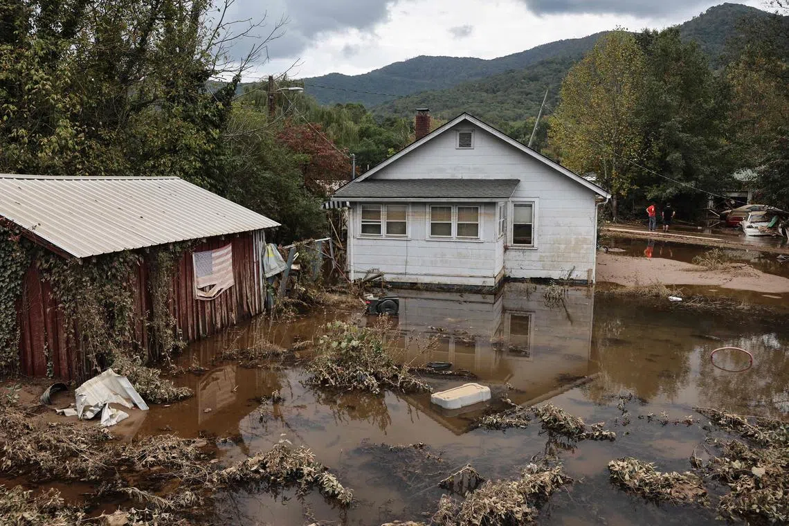
Floodwaters remaining from Hurricane Helene in Swannanoa, North Carolina, on Oct 4.
PHOTO: AFP
Follow topic:
There are just under two months left before the official Atlantic hurricane season ends in November, and with millions of people across the South-east United States still assessing the damage of Hurricane Helene
What was expected to be a “hyperactive” hurricane season has turned out to be only average by the start of October. It may not have felt average to anyone who lives in the South-east, where, in addition to Helene, three other hurricanes have already made landfall in 2024. But in a typical hurricane season in the US, two or three hurricanes make landfall; in the busiest year on record, 2020, there were six.
“So, in some ways, it’s been busy, and in some ways, it hasn’t been busy,” said Mr Matthew Rosencrans, lead forecaster for the National Oceanic and Atmospheric Administration’s (NOAA) seasonal hurricane outlook. His organisation was one of many last spring that predicted an abnormally busy season.
In May, NOAA said it expected 17 to 25 named tropical cyclones, eight to 13 of which would become hurricanes. An updated assessment in August, issued during a long lull in storms, held generally the same forecast. There have been 13 named storms this year, and eight have become hurricanes. The latest, Tropical Storm Milton, formed on Oct 6 in the Gulf of Mexico, and forecasters warned that it, too, could become a hurricane by the time it reaches Florida next week.
Things typically calm down slightly in October and November. When graphed, an average season looks like a tall mountain with a solid peak of activity at the beginning of September. But seasonal hurricane experts such as Mr Phil Klotzbach at Colorado State University believe 2024 will instead bring three hurricane seasons. “A busy start, a super-quiet peak and a busy finish,” he said. When graphed, this season will look like two mountain peaks with a distinct valley in the centre.
In early July, Hurricane Beryl,
Scientists are already trying to diagnose what happened, in hopes of informing future forecasts and better preparing coastal residents. One possible explanation is that the African Monsoon, a weather pattern that can spin up storms off Africa’s west coast, was too far north. Instead of moving over warm tropical water, this year’s storms hit cooler conditions that were less conducive to helping them form. Another hypothesis is that the air was too warm at higher levels, which meant that the already warmer air at the surface of the ocean could not rise up to form thunderstorms.
Then, almost overnight, just after the midpoint of hurricane season in mid-September, the lull broke. Francine formed and hit Louisiana, and not far behind it were more: Gordon, Kirk and Leslie, which churned generally harmlessly in the middle of the Atlantic. The worst came last week: Helene rapidly intensified in the Gulf of Mexico, striking the Florida shores as the strongest hurricane to ever hit the state’s Big Bend coastline. Its tropical downpours dropped more than 61cm of rain on parts of the Appalachian Mountains, causing widespread destruction.
Despite the quick succession of recent storms, “we’re probably a little behind where I would have expected to be at the beginning of the season, given the outlook we had”, Mr Rosencrans said.
When Leslie formed this week, the season officially became average, at least as far as the number of overall storms. But of the named storms, 66 per cent have become hurricanes. So, the average season may yet have an above-average number of hurricanes.
Even though the total storm count is likely to be lower than forecasters predicted in the spring, details this year have surprised them.
Historically, in October, a storm is much more likely to form in the Caribbean Sea or the Gulf of Mexico than in the eastern Atlantic. But Hurricane Kirk and Leslie, which became a hurricane on Oct 4 night, have done just that, forming off the coast of Africa and moving through Atlantic waters this week. Mr Klotzbach called that “impressive”.
Mr Rosencrans added: “The conditions that would make this an above-normal season – the warm sea-surface temperatures, the coming of La Nina – are still in place.”
An average year could produce three named storms in October and one in November. So, another five or six storms are not out of the question, he added, and this would be close to the lower end of NOAA’s forecast of 17.
The hurricane season officially ends on Nov 30. Still, Mr Rosencrans cautions that during La Nina years, with warm sea-surface temperatures in the Atlantic, the active season can last into December. That happened in 2005 when Hurricane Epsilon formed in late November and stretched into the first week of December, and then Tropical Storm Zeta formed at the end of the year, lasting into the first week of 2006. NYTIMES

