Powerful Hurricane Beryl pummels Caribbean islands
Sign up now: Get ST's newsletters delivered to your inbox

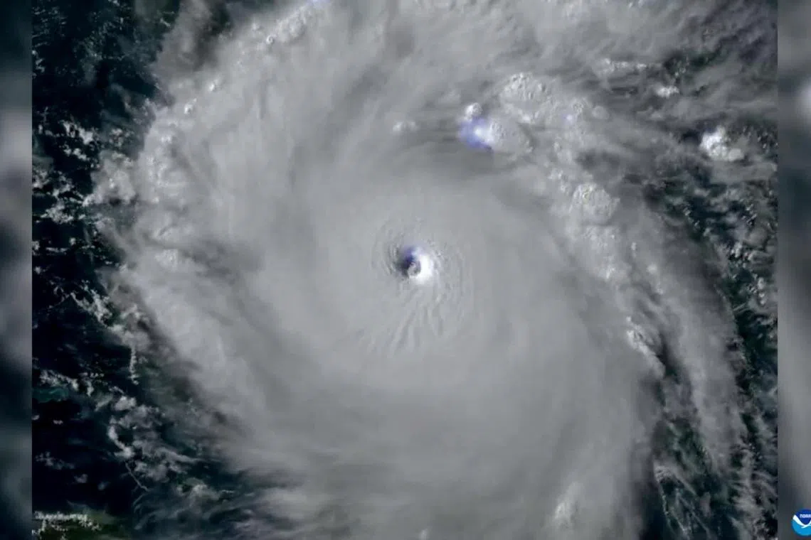
Imagery provided by the Goes-16 satellite showing Hurricane Beryl over the Caribbean Sea on July 1, 2024.
PHOTO: REUTERS
BRIDGETOWN – Hurricane Beryl strengthened into a top-level Category 5 storm late on July 1 after it swept across several islands in the south-eastern Caribbean, dumping heavy rain and unleashing devastating winds.
It is now the earliest Category 5 storm in the Atlantic in any year on record, and has developed into a “potentially catastrophic” hurricane with maximum sustained winds of 260kmh, the US National Hurricane Centre (NHC) said.
Early in the day, Grenada’s Carriacou Island took a direct hit from the storm’s “extremely dangerous eyewall”, with sustained winds at upwards of 240km, the NHC said.
Nearby islands, including St Vincent and the Grenadines, also experienced “catastrophic winds and life-threatening storm surge”, according to the NHC.
“In half an hour, Carriacou was flattened,” Grenada’s Prime Minister Dickon Mitchell told a press conference.
“We are not yet out of the woods,” he added, noting that while no deaths had been reported so far, he could not say for sure that none had occurred.
Video footage obtained by Agence France-Presse from St George’s in Grenada showed heavy downpours with trees buffeted by gusts.
Later on social media, Mr Mitchell said the government was working to get relief supplies to both Carriacou and the island of Petite Martinique on July 2.
“The state of emergency is still in effect. Remain indoors,” he wrote on Facebook.
Rare early strong storm
The storm became the first hurricane of the 2024 Atlantic season on June 29 and quickly gathered strength.
Experts say that such a powerful storm forming this early in the Atlantic hurricane season – which runs from early June to late November – is extremely rare.
It is the first hurricane since NHC records began to reach the Category 4 level in June, and the earliest to reach Category 5 in July.
“Only five major (Category 3+) hurricanes have been recorded in the Atlantic before the first week of July,” hurricane expert Michael Lowry posted on social media platform X.
A Category 3 or higher on the Saffir-Simpson scale is considered a major hurricane, and a Category 5 storm packs sustained winds of at least 251kmh.
The US National Oceanic and Atmospheric Administration said in late May that it expects 2024 to be an “extraordinary” hurricane season, with up to seven storms of Category 3 or higher.
The agency cited warm Atlantic Ocean temperatures and conditions related to the weather phenomenon La Nina in the Pacific for the expected increase in storms.
Barbados largely spared
Barbados appeared to be spared the worst of the storm but was still hit with high winds and pelting rain, as officials reported no injuries so far.
The island’s meteorological agency downgraded a hurricane warning on July 1 to a wind advisory.
Barbados seems to have “dodged a bullet”, Minister of Home Affairs and Information Wilfred Abrahams said in an online video, but nonetheless “gusts are still coming, the storm-force winds are still coming” he said.
The hurricane warning was also lifted in Tobago, the smaller of the two islands that make up Trinidad and Tobago, officials said.
The storm prompted the cancellation of classes in schools on July 1 in several of the islands, while a meeting this week in Grenada of the Caribbean regional bloc Caricom was postponed.
Jamaica has issued a hurricane warning, ahead of the storm’s expected arrival on July 3. The NHC also warned the Cayman Islands and areas on the Yucatan Peninsula to monitor the storm’s progress.
Climate change’s fingerprints
Scientists say climate change most likely added to how quickly Hurricane Beryl formed.
Global warming has helped push temperatures in the North Atlantic to all-time highs, causing more surface water to evaporate, which in turn provides additional fuel for more intense hurricanes with higher wind speeds.
Scientists surveyed by Reuters see the powerful hurricane as a harbinger of an unusually active hurricane season made possible by record-high temperatures in the Atlantic Ocean.
“Climate change is loading the dice for more intense hurricanes to form,” said Dr Christopher Rozoff, an atmospheric scientist at the US National Centre for Atmospheric Research in Boulder, Colorado.
Dr Andra Garner, a New Jersey-based meteorologist, noted that Beryl jumped from a Category 1 to a Category 4 storm in less than 10 hours.
Scientists have already predicted that events like Beryl will grow more likely with climate change, she said.
Her research has shown that as water temperatures have risen over the last five decades, it has become more than twice as likely for storms to jump from weak storms to major hurricanes in less than 24 hours. AFP, REUTERS


