NUS, ST Engineering join forces on satellite-based tech that can monitor sea levels and more
Sign up now: Get ST's newsletters delivered to your inbox

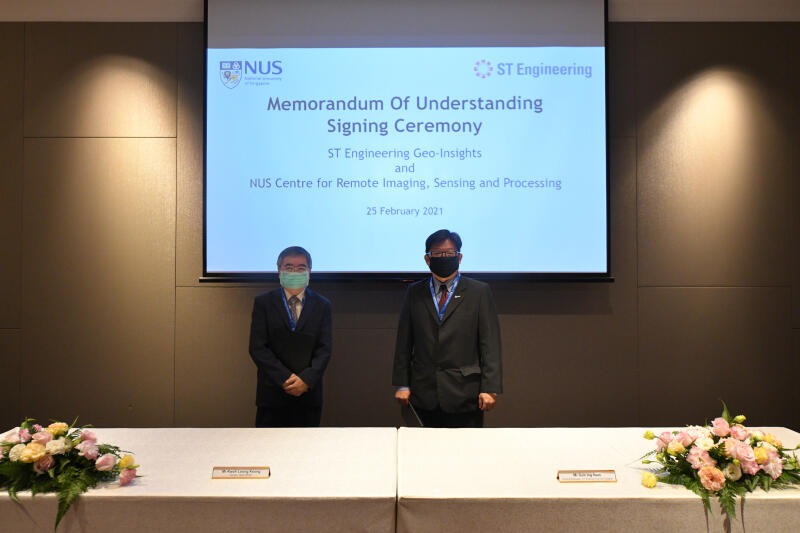
Crisp director Kwoh Leong Keong (left) and ST Engineering Geo-Insights general manager Goh Ing Nam at the signing of the MOU.
PHOTO: SINGAPORE SPACE & TECHNOLOGY LIMITED
SINGAPORE - The fight against climate change could get a leg-up with a collaboration between two players to enhance solutions that can be applied to areas such as monitoring greenhouse gas emissions and the quality of coastal waters.
ST Engineering Geo-Insights and the National University of Singapore's Centre for Remote Imaging, Sensing and Processing (NUS Crisp) are joining forces to research, develop and commercialise advanced remote sensing technologies and geospatial imagery analytics solutions.
Remote sensing technology refers to the use of a sensor, such as a camera mounted on a satellite, to capture images of a particular area, while in geospatial imagery analytics, software using artificial intelligence (AI), for example, is used to extract information from images collected by the cameras.
These solutions can be used in areas such as climate change, mega infrastructure development and agricultural growth tracking.
Currently, the monitoring of the quality of coastal waters, for instance, is done manually or by using ground sensors, which can have limited coverage.
ST Engineering Geo-Insights general manager Goh Ing Nam said: "With more satellites being launched, fuelling a growing variety and volume of satellite data, and coupled with increasing complexities in business and operational environments, demand for advanced satellite imagery data analytics and algorithm developments that deliver more powerful business insights is on the rise all over the world."
Under a memorandum of understanding signed on Thursday (Feb 25), the collaboration will see both parties leveraging each other's strengths, such as Crisp's expertise in AI and big data analytics, and ST Engineering Geo-Insights' strength in commercialising these solutions in global markets.
Both parties will also collaborate to set up a geospatial imagery data hub, a cloud-based server with satellite imagery and tools that can be accessed by various stakeholders such as research institutions.
Crisp director Kwoh Leong Keong said: "Crisp's study and use of satellite data for environmental monitoring has gained international recognition and acclaim in areas such as forest fires, oil spill and natural disasters.
"This collaboration with ST Engineering Geo-Insights is another significant milestone in the transition of our research into practical commercial solutions for the Singapore, regional and international markets."


