Article provided by National Library Board
What are the rare maps on display at On Paper: Singapore before 1867?
Sign up now: Get ST's newsletters delivered to your inbox
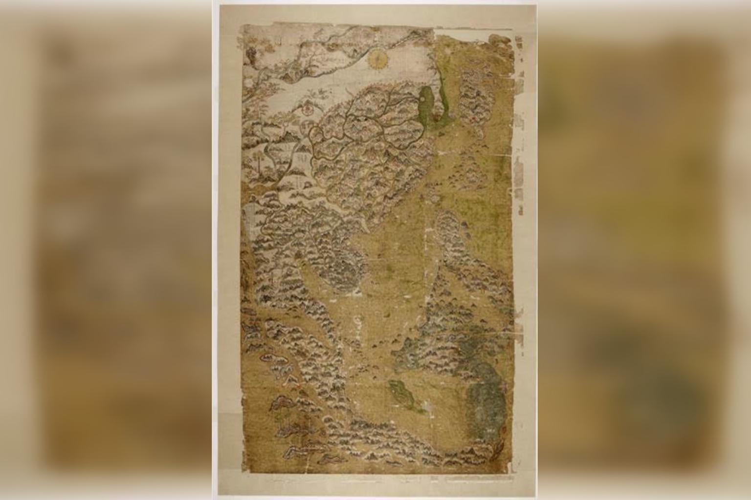
Selden’s Map of China and Southeast Asia c. 1606–1623. On loan from Bodleian Libraries, University of Oxford MS. Selden supra 105.
PHOTO: NATIONAL LIBRARY BOARD
The On Paper: Singapore Before 1867 exhibition showcases many important documents from different parts of Singapore's history. They track Singapore's development from as early as the 17th century to 1867, when the Straits Settlement was made a British Crown Colony, with Singapore as its capital. Here are some rare maps not to be missed!
1. The Selden Map of China
This map is the only Ming Dynasty map of this large scale and size that covers Southeast Asia, and one of the earliest Chinese merchant maps still surviving. It is the first time the Selden Map is shown in Singapore. The map marks out as many as 60 ports across East and Southeast Asia, connected by sailing and trade routes to Fujian Province. It is especially significant for Singapore, documenting the area around the Singapore Straits as a very busy waterway, with multiple routes running around it. The place name 乌丁礁林 (Ujong Tanah or "land's end" in Malay) found at the tip of the Malay Peninsula is thought by academics to refer to either Singapore or Johor.
Find the Selden Map at the very start of the exhibition, in Singapore before 1800s.
2. The Bute Map
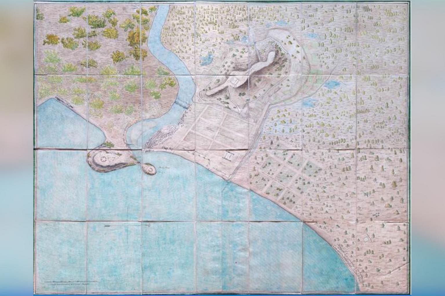
This map was completed around 1820 and is the earliest known landward map of Singapore. It documents remnants of ancient Singapore, shown on the map as "the ancient lines of Singapore" - an embankment that ran westwards from the mouth of the Watering Place (Stamford Canal) towards the north side of Bukit Larangan (Fort Canning). The map also marks out the palace of Sultan Husain in Kampong Glam, and includes infrastructure works that were in planning, such as a proposed bridge across the river, located between present-day Coleman Bridge and Elgin Bridge.
The Bute Map is about mid-way through the exhibition, in Singapura/Singapore: 1819 - 1824.
3. Malaca, L'Inde Orientale et le Cathay (Declaracam de Malaca e India Meridional)
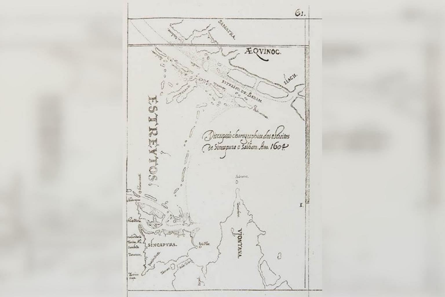
Drawn in 1604, this map is noteworthy for its fine detail. It identifies recognisable places in Singapore, such as Tana Mera (Tanah Merah), Sungie Bedok, and Tanlon Ru (Tanjong Rhu). Singapore, referred to as Singcapura on this map, is also indicated as the location of the Xabanderia (or Shanbandahar), meaning the harbourmaster's compound. This reveals the presence of a harbour or port official in Singapre as early as the 1600s. The sketch was created as part of its cartographer, Manuel Erédia's (1563 - 1623) failed expedition to find "the land of gold", and is one of only two known maps to locate an early port on the island of Singapore.
This little map is in the first section of the exhibition, Singapore before 1800s.
4. Plan of the Singapore Harbour
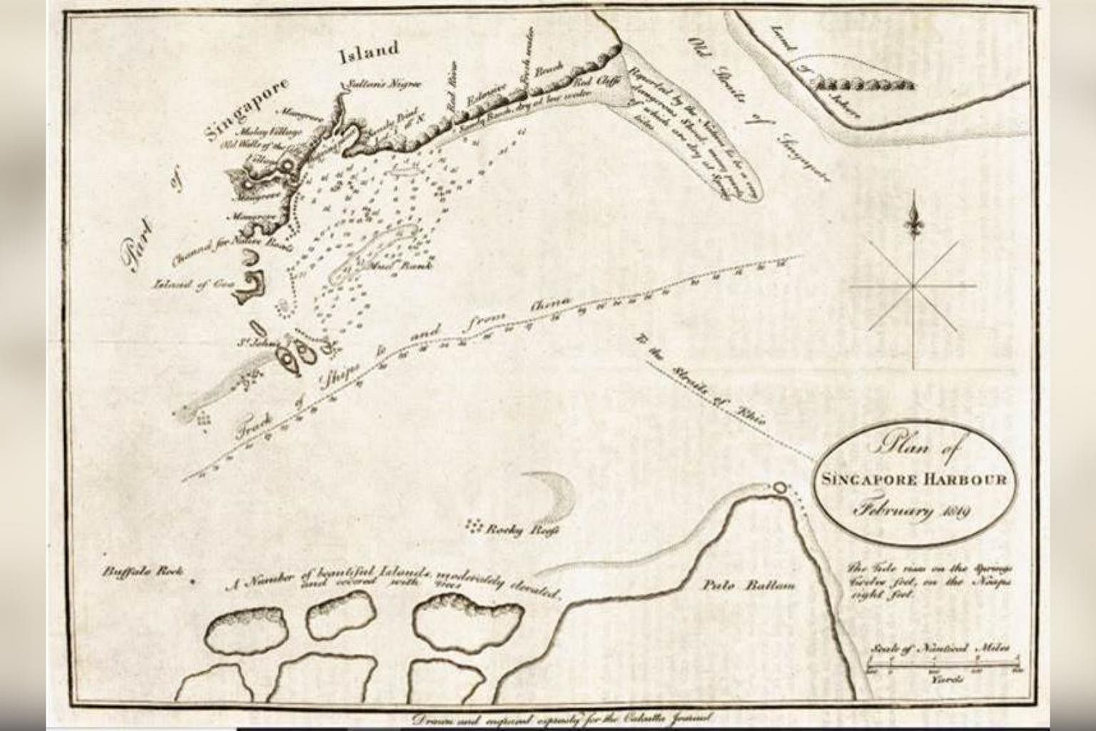
This map presents several firsts for Singapore's mapping. Before the creation of this map, only unreliable estimates of Singapore's geography existed. This plan was the first to chart in detail Singapore's harbour and southeast shoreline. This map is also the first to feature the spelling of 'Singapore', instead of 'Sincapure' or 'Singapoora'. Commissioned by Raffles while seeking out a suitable location for a trading post in the region, the map and its accompanying report was instrumental to sparking public support for the establishment of the British port in Singapore.
Find the plan next to the Treaty of Singapore, in the middle of Singapura/Singapore: 1819 - 1824.
5. Pencil-drawn map of Singapore
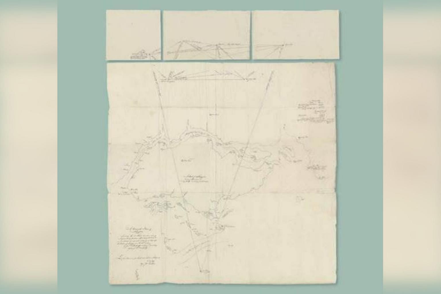
On loan from the Nationaal Archief, the National Archives of the Netherlands, this hand-drawn map shows an early view of Singapore, and is the first depiction of Singapore's actual shape and size. The map was based off a survey of Singapore's coastlines by Captain James Franklin, with the assistance of Francis Bernard.
It seems the surveyors took it upon themselves to name various parts of the island after themselves.
The starting point of the survey was the easternmost end of Singapore, at Tanjong Changi (named in this map as Point Franklin, after the surveyor). From there the survey was conducted in an anti-clockwise direction around the island. The Farquhar Straits were named after the then Resident of Singapore, William Farquhar, and Pulau Merlimau (now part of Jurong Island) was named Pulo Bernardo, after Francis Bernard (who, incidentally was Farquhar's son-in-law).
Located just before the third section, across from the Bute Map, in Singapura/Singapore: 1819 - 1824.
If you need more time to study the artefacts in the exhibition, three limited edition prints are available for online purchase, and collection at Level 8 of the Lee Kong Chian Reference Library in the National Library Building. View the available prints at go.gov.sg/onpaperprints.


