Unmanned drone now part of SLA's Southern Islands inspection regime
Sign up now: Get ST's newsletters delivered to your inbox

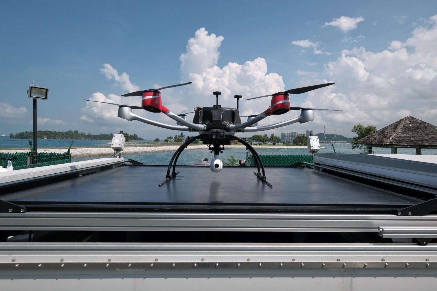
The drone is housed in a pod on Pulau Seringat, from which it is launched and returns to after each flight.
ST PHOTO: GAVIN FOO
SINGAPORE - A plan by the Singapore Land Authority (SLA) to have an unmanned drone inspect the Southern Islands has taken flight.
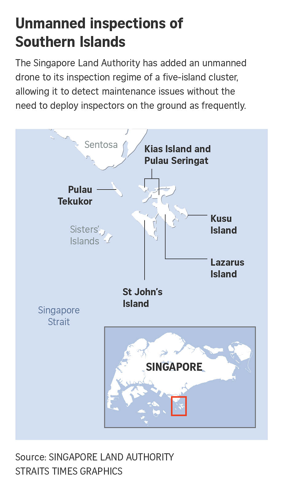
Since last week, a drone housed on Pulau Seringat has been making its rounds over islands linked to and near it, reducing the need for physical inspections of the islands and facilities by about three times.
The places covered are Pulau Seringat and Kias Island; Lazarus Island; St John's Island; Kusu Island; and Pulau Tekukor.
The successful roll-out of the drone follows a series of trials that began in 2018 to ensure the safety and effectiveness of inspections by beyond-visual-line-of-sight (BVLOS) drones.
An SLA spokesman said videos from the drone will be analysed by a machine learning algorithm to pick up potential security and maintenance issues, including litter and damage to roofs on buildings located on the islands.
Mr Vincent Aw, head of the authority's land development and asset management division, said that with drone inspections, his team of about 10 SLA officers have more time for their other responsibilities.
These include maintenance of utilities and campsites, liaising with contractors, repair and improvement works, and responding to public feedback.
With a team about half the size of that used by Sentosa Development Corporation, which managed the islands until 2017, SLA had to find a way conduct the labour-intensive inspections more effectively.
With the drone, officers now spend about one to two days a week on the ground for inspections, compared with four to five days previously.
The drone, which complies with the Civil Aviation Authority of Singapore's BVLOS regulations, is housed in a pod on Pulau Seringat, from which it is launched and returns to after each flight.
The pod contains five spare batteries, and battery swops and charging are automated. Each battery allows a flight of about 30 minutes.
Pre-flight safety checks are also automated and take place within the pod, before the drone is launched.
Twenty-nine flights on pre-determined paths are required by the drone to cover the entire cluster of islands, and video footage is fed over a 4G cellular network in real time to SLA officers' devices, allowing them to keep tabs on inspection progress.

SLA's Land Development and Asset Management Division head Vincent Aw looking at a live video feed from the drone at Pulau Seringat.
ST PHOTO: GAVIN FOO

Live video feed from the drone at Pulau Seringat.
ST PHOTO: GAVIN FOO
Mr Aw said the drone also makes work safer for officers, as it covers areas that were previously difficult to reach. These include forested areas, seawalls and rooftops.
He added that the drone allows for the early detection of maintenance issues, which may result in cost savings of up to 40 per cent.
Plans are in place for a second drone to inspect another two-island cluster by April 2022.
The two islands - Pulau Hantu Besar and Pulau Hantu Kechil - are about 10km away from Pulau Seringat, and SLA is exploring ways for the second drone to be more energy-efficient, such as by running it on solar power.


