Prominent signs in Chestnut Nature Park warn riders and hikers of live-firing areas
Sign up now: Get ST's newsletters delivered to your inbox
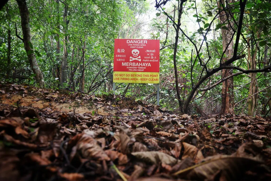
Some mountain bikers and hikers choose to ignore these prominent signs when they venture into restricted areas.
ST PHOTO: JASON QUAH
Follow topic:
SINGAPORE - A shock of red and yellow amid leafy foliage, bearing an ominous skull and crossbones sign and an unmistakable message: This is a live-firing area. Keep clear.
Some mountain bikers and hikers choose to ignore these signs, displayed prominently along the edge of Chestnut Nature Park, and venture into restricted areas.
On June 15, a man was hit in the back by a bullet slug
At the time, the SAF was conducting an exercise at its Nee Soon Range, about 2.3km from the site where the man was injured.
The Woodcutter’s Trail is a popular cycling route in the CCNR, known for its steep slopes and winding track. It is in a restricted area closed off to the public.
Riders typically start at Chestnut Nature Park, off Bukit Panjang, and cycle about 6km to get to the trail, usually exiting it near Mandai Crematorium or Seletar Reservoir via areas clearly marked as restricted.
The Straits Times ventured along the park’s official trail at about 1pm on June 17 to see how riders typically access the cycling trail, mapped only by riding and hiking apps.
The park was mostly quiet, with only a handful of hikers and cyclists on a weekday afternoon.
The official hiking and cycling trails are clearly indicated at the starting mark at Chestnut Point, with each running about 2km northwards. At the 1km mark, a large sign at the side of the cycling path warns riders that they are near a live-firing area. Behind it is dense foliage with no clear trails.
There was clear military presence in the area, with the whirring of helicopters and jets overhead droning out the sounds of birds chirping.
A few hundred metres later, we reached the bike park, which offers paved tracks of various difficulty levels. Another live-firing area warning sign stands 30 steps away.
Nearby, a National Parks Board sign marks the end of the 2km northern trail. A fallen signpost covered with leaves and bearing faded “No Cycling” and “No Entry” signs lies beside it.
Some riders choose to ignore the prominent signs and go eastwards into the unmarked CCNR to reach the Woodcutter’s Trail.
Videos posted online by these riders show them ploughing through narrow paths to adrenaline-inducing soundtracks, speeding past several warnings of live-firing areas along the way.
Avid mountain biker Xiao Yi, 18, said that most bikers look for trails that consist of uphills and downhills, with obstacles such as rocks and roots that can allow riders to use different biking skills to navigate over.
Xiao said he has stuck to legal biking trails, but added that others in the riding community have mapped out unofficial and “more elusive tracks”.
“With the limited tracks we have, over time, it may get repetitive and boring. So, sometimes riders go down unofficial routes to change things up a bit,” said Xiao.
Hikers and bikers have frequented the Woodcutter’s Trail for years without incident, said another cyclist who wanted to be known only as Mr Han, 53.
“It is very safe. Some families bring their elderly and kids to hike inside too, there is nothing much to be worried about,” said Mr Han, who has been cycling for almost 15 years in the CCNR.
He said the authorities could consider designating more legal trails or permit riders to use them when there are no military exercises ongoing.
There are other riding trails in Kent Ridge Park, Bukit Timah Nature Reserve and the Ketam Mountain Bike Park on Pulau Ubin, which is on the fringe of the disused Ketam Quarry.
But Woodcutter’s Trail is described as the best for advanced riders. In December 2024, two cyclists had to be rescued by police and the Gurkha Contingent after they lost their way in the same area.
Mr Han, who used to own a bicycle shop, said the cycling community is abuzz after news of the man’s injury. Now, he advises fellow cyclists to avoid restricted areas. “Let’s not risk getting arrested. Don’t kill the sport,” he said.
Prominent warning signs along cycling trail
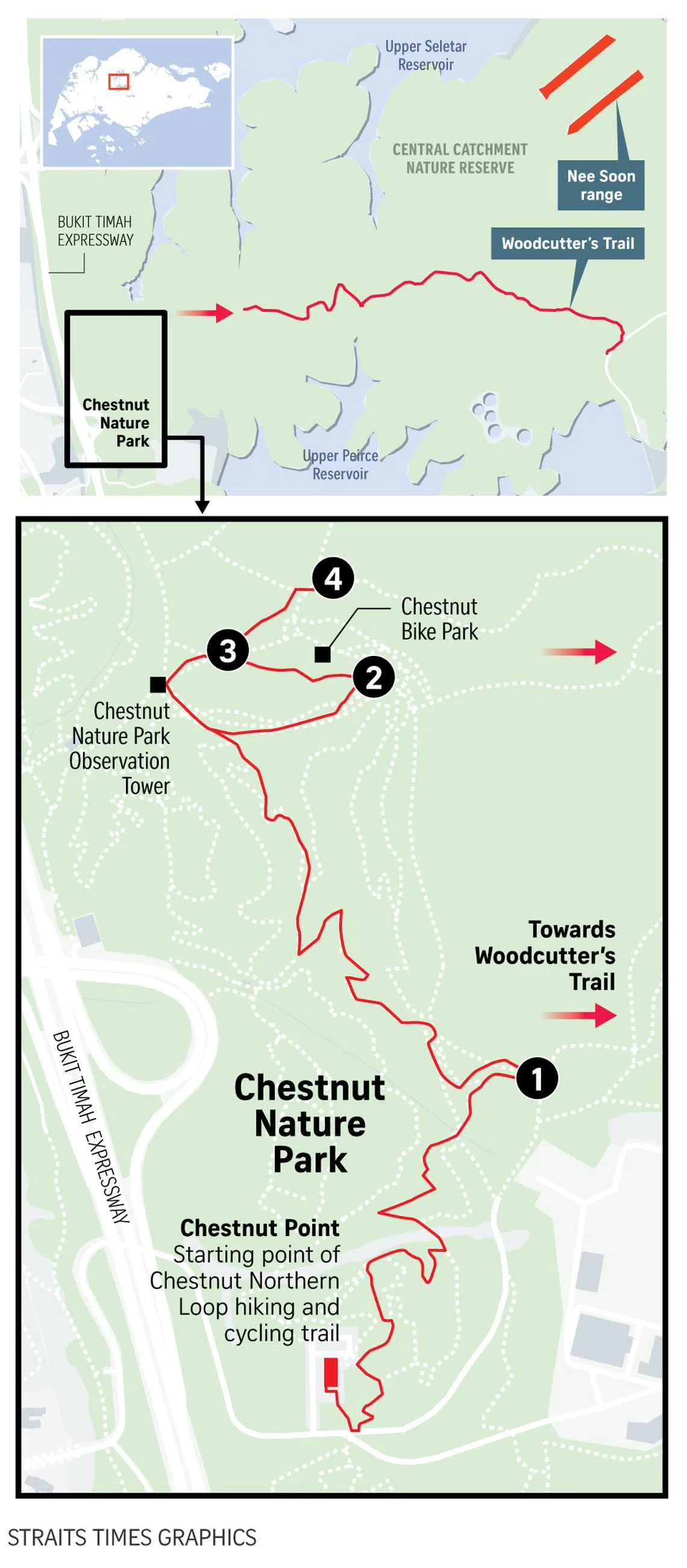
1. The first warning about a live firing area along the northern cycling trail of Chestnut Nature Park.
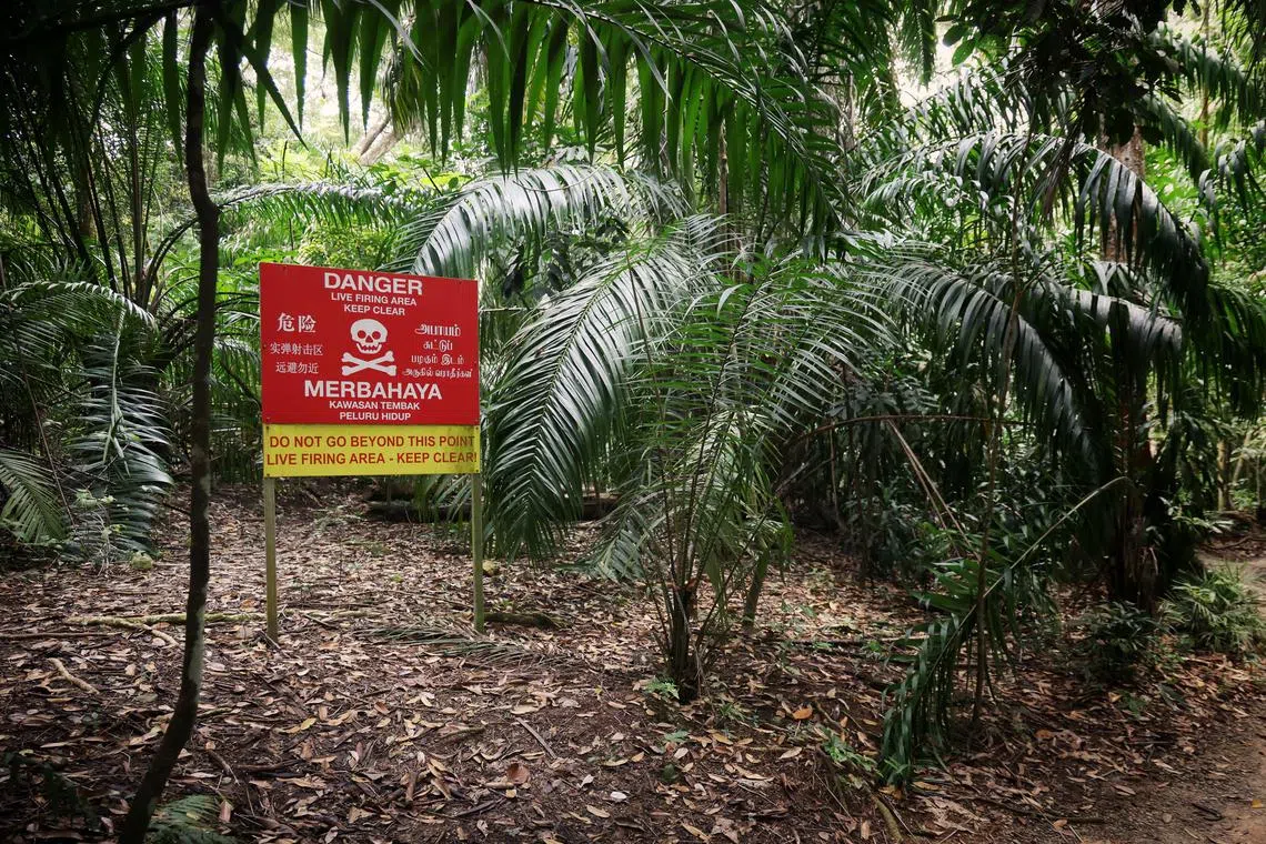
The first warning about a live firing area along the northern cycling trail of Chestnut Nature Park on June 17, 2025.
ST PHOTO: JASON QUAH
2. About 30 steps away from the official Chestnut Bike Park, a prominent warning sign of danger from a live firing can be seen.
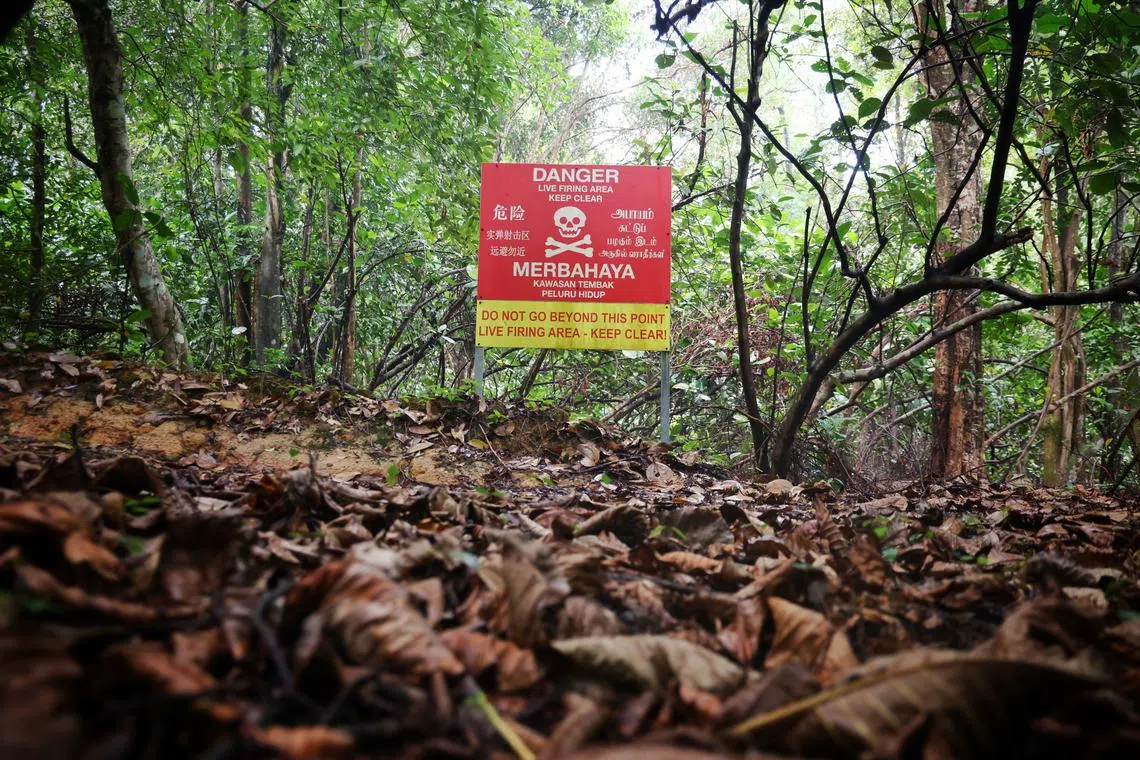
About 30 steps away from the official Chestnut Bike Park, a prominent warning sign of danger from a live firing can be seen on June 17, 2025.
ST PHOTO: JASON QUAH
3. A similar warning sign along the footpath leading towards the park’s observation tower.
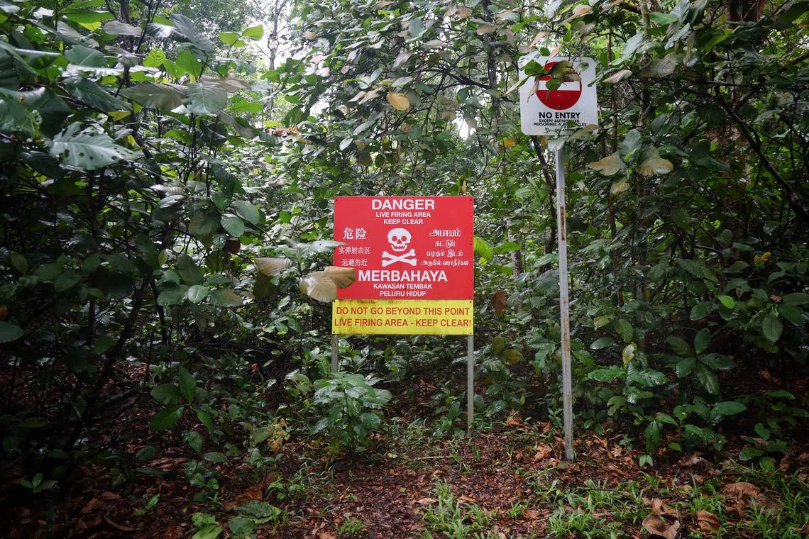
A sign warning about danger from live firing seen along the footpath leading towards the Chestnut Park’s observation tower on June 17, 2025.
ST PHOTO: JASON QUAH
4. Near the end of the trail, an NParks sign indicates regulations for the nature reserve. A fallen signpost bearing “No Cycling” and “No Entry” signs lies beside it.
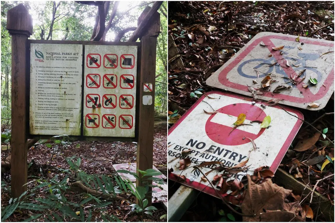
ST PHOTO: JASON QUAH
Additional reporting by Stacey Ngiam


