More than 10km of cycling paths completed in Toa Payoh
Sign up now: Get ST's newsletters delivered to your inbox

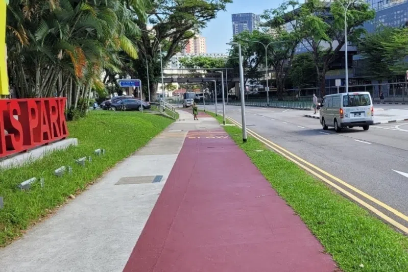
The cycling paths improve Toa Payoh residents' connectivity to not just transport nodes, but also nearby towns.
PHOTO: LTA
SINGAPORE - Residents in Toa Payoh can now travel beyond the estate more easily and safely – as well as sustainably – with the completion of more than 10km of cycling paths.
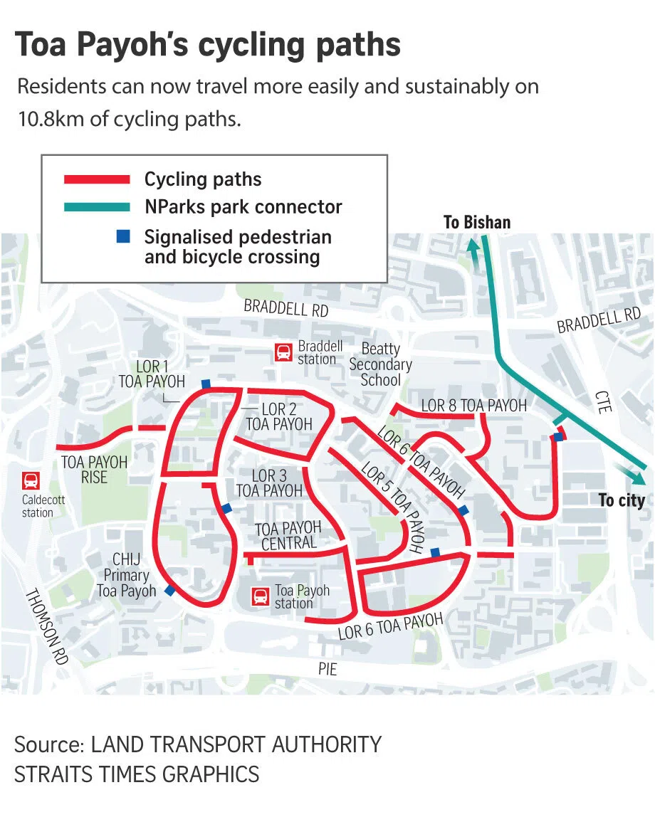
The Land Transport Authority (LTA) said in a statement on Oct 18 that the cycling paths, which span around 10.8km, improve connectivity not just to MRT stations in the vicinity of Toa Payoh, such as Braddell and Caldecott, but also to nearby towns.
An example it cited was how Toa Payoh residents can now cycle to Bishan-Ang Mo Kio Park in less than 15 minutes, where they can continue to follow the Kallang River and get to Marina Bay.
“These new cycling paths will support more active lifestyles and car-free mobility options by making it convenient for residents to walk or cycle for their daily activities or simply enjoy scenic routes through their neighbourhood, contributing to personal well-being and a more sustainable Singapore,” said LTA.
Some of the paths were actually converted from 2.8km of open drains, which had been covered up and reconstructed into underground ones, to make more space for pedestrians and cyclists to share the pavement.
Other changes made include the introduction of new bypass paths at more than 15 bus stops, as well as wider pedestrian crossings at more than eight traffic junctions.
An additional 64 bicycle parking racks were also installed at Braddell MRT station – a move that LTA said would “support first- and last-mile journeys”.
By 2030, the cycling network around the island will span around 1,300km, so eight in 10 HDB residents will be within minutes of their nearest cycling path.


