Have an idea to improve the Kallang River area? Kayak first, then give feedback
Sign up now: Get ST's newsletters delivered to your inbox

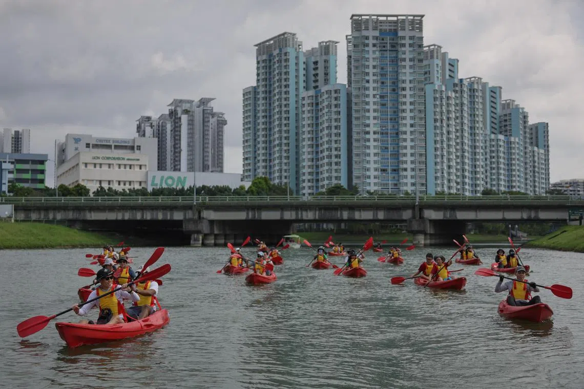
Participants kayaked along Kallang River starting from Kolam Ayer Kayaking Centre to PAssion Wave @ Marina Bay.
ST PHOTO: GIN TAY
Follow topic:
SINGAPORE – For Geylang Bahru residents, sighting otters in the Kallang River is par for the course. But on a Sunday morning in July, residents were greeted by a somewhat less familiar sight – more than 30 members of the public paddling on the river in bright red kayaks.
Many were in the river for the first time. They had signed up for the Urban Redevelopment Authority’s (URA) public engagement on its upcoming Draft Master Plan 2025
A far cry from a typical focus group discussion, the kayaking expedition gave participants a first-hand look at the area for which their views on public spaces and recreational options were being sought.
Participants, aged 12 and up, were from all walks of life, with teenagers, groups of friends and a middle-aged couple among those who showed up on July 21. No prior kayaking experience was required, and life vests were provided.
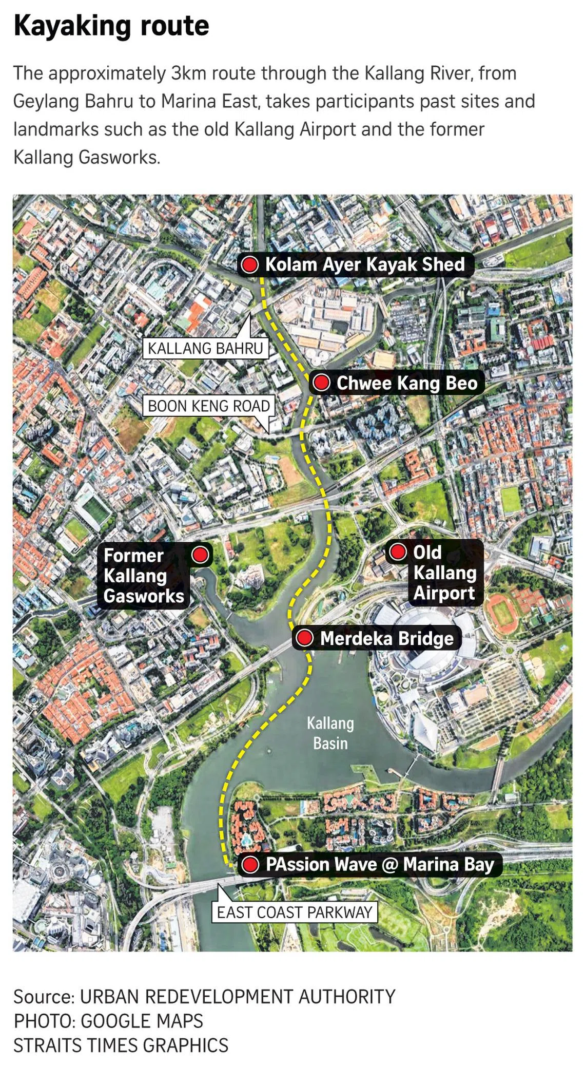
They paddled about 3km from the Kolam Ayer Kayak Shed in Geylang Bahru to PAssion Wave@Marina Bay in Marina East.
Mr Nicholas Li, URA’s director of urban design for Singapore’s east, said: “Even for us as planners and urban designers, how we feel about a place totally changes when we go down to observe people over the day at different times of the day, and how they use spaces.
“It is important that the participants also get to experience it this way rather than meeting them straight away in a closed room.”
The kayakers could be invited back to focus group discussions on the corridor that are slated for November.

Participants at the start of the kayaking expedition, near the Kolam Ayer Kayak Shed.
ST PHOTO: GIN TAY
Among the draft masterplan’s facets are five identity corridors, or stretches across the island that have rich heritage, one of which is the Thomson-Kallang Corridor, including the river.
Running 10km long, the Kallang River is Singapore’s longest river and passes historical sites such as the old Kallang Airport and the former Kallang Gasworks.
The other four corridors are the Historic East Corridor, the Rail Corridor, Southern Ridges and Coast, and Inner Ring, which includes neighbourhoods on the city fringe such as Balestier.
Before setting off on the kayaking expedition, participants heard from Mr Li and other URA officers about the history of the Kallang River, and about key sites such as Bishan-Ang Mo Kio Park, Moonstone Lane estate and Kolam Ayer.
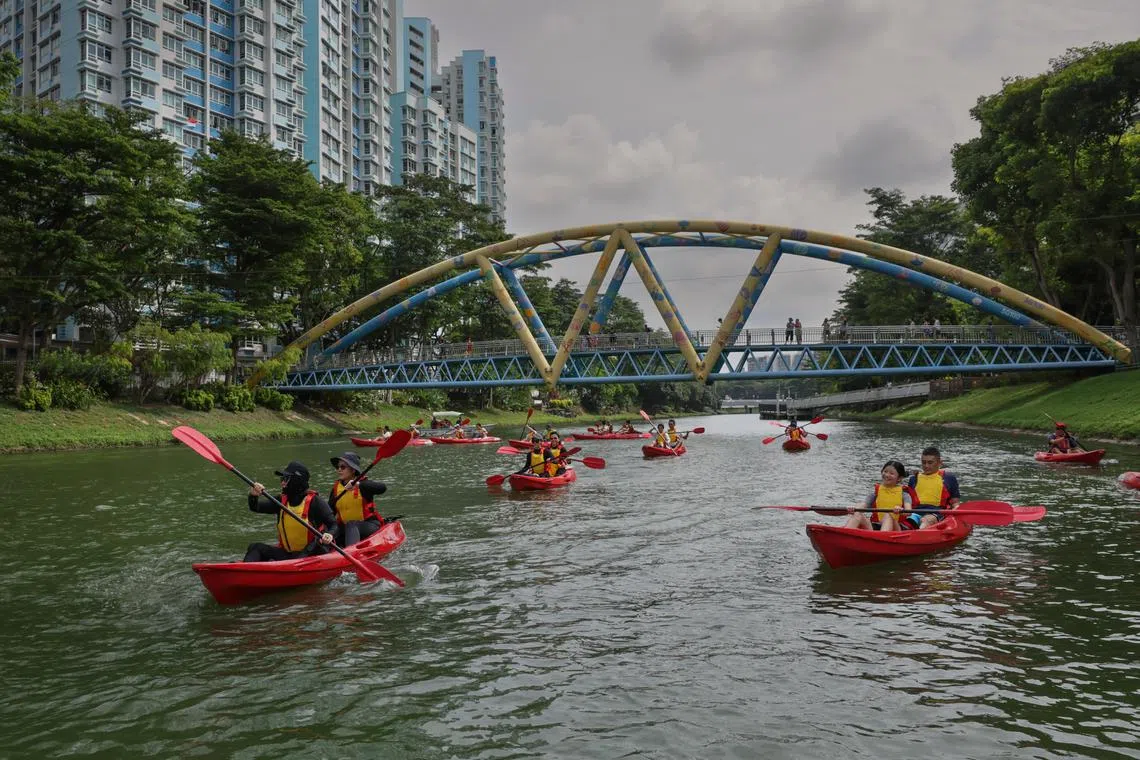
Along the way, they saw and heard about other interesting sites, such as the Chwee Kang Beo, a riverine Chinese temple that was started after World War II, and Merdeka Bridge, a symbol of Singapore’s aspirations for independence when it was completed in 1956.
Participants were encouraged to think about improvements in three areas: opportunities for connectivity, improved public spaces, and recreational activities. Afterwards, they filled in a feedback form.

Participants kayaking past Chinese temple Chwee Kang Beo (background) during the session on July 21.
ST PHOTO: GIN TAY
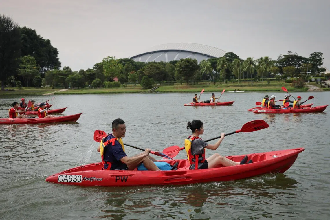
Architect Steve Qwek was on the expedition with his 13-year-old daughter.
The 49-year-old, who was kayaking in the river for the first time, said Kallang River is an undiscovered gem – known to and used by residents in the estates along it, but underutilised by other Singaporeans.
Mr Qwek said walking beneath many residential blocks from an MRT station to reach the river “felt like finding light at the end of a tunnel” as he emerged into an attractive recreational space that was hidden by housing blocks.
He suggested that navigation signage could be improved so that more people could be drawn to the river, which is lined by park connectors.
Citing the Rail Corridor’s Bukit Timah Railway Station community node, he said similar nodes could be set up along the river as entry points.

Mr Steve Qwek (foreground, in blue) and his daughter kayaking past the National Stadium (background) near the Kallang Basin.
ST PHOTO: GIN TAY
Ms Alison Wong, who works in public relations, joined the expedition with three friends.
The 38-year-old, who chanced on an invitation to participate in the expedition while viewing a URA exhibition in Kallang Wave Mall, said she was not aware that the public could rent kayaks and paddle in the Kallang River until the expedition.
She benefited most from hearing about the history of various sites along the route, which she said most Singaporeans would otherwise not have heard about in their schooling years.
Commenting on the novel form of public engagement, Mr Larry Yeung, executive director of community design non-profit Participate in Design, said the increasing use of more hands-on and experiential public engagement opportunities by government agencies “illustrates a broader shift in the citizen engagement landscape”.
The public now has a wider variety of platforms to offer its input and ideas. He cited recent projects such as the Somerset Belt Masterplan, which had photo walks as part of its youth engagement, and pop-up markets by the Land Transport Authority on the repurposing of Tanah Merah MRT Viaduct for community use.
Noting that experiential engagements allow participants to “express themselves more freely and authentically”, Mr Yeung said: “Not everyone excels at articulating their thoughts in writing or on sticky notes, so these interactive formats provide a more dynamic way for individuals to communicate.”
He said it was important that engagement processes include various methods so that people have meaningful opportunities to contribute, no matter their background or preferences.
Participants should also be told how their feedback and ideas eventually shape outcomes, said Mr Yeung, as this will strengthen the trust between the community and government agencies.

URA’s Mr Li said the authority is thinking about site walks for other identity corridors such as the Historic East and Inner Ring, adding that the exact format of focus group discussions for the corridors is still being planned.
He added that the public can already take part in discussions at go.gov.sg/identity-corridors
They can also register for future kayaking sessions on the river. Three sessions have taken place so far, and more may be afoot in October and November.
Said the architect Mr Qwek: “It’s very exciting to have URA officers come out from the institution to be with the public and go through the full experience on the ground. And for us, it’s one thing to look at plans in pictures and text, but another to experience it physically.”


