Highest-ever January rainfall in Singapore recorded on Pulau Tekong
Sign up now: Get ST's newsletters delivered to your inbox

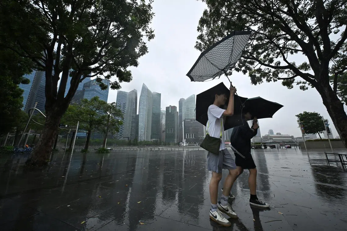
Prolonged rain dumped on Singapore between Jan 10 and 13 was the result of a recent monsoon surge.
ST PHOTO: LIM YAOHUI
SINGAPORE - The recent downpours amid a monsoon surge in Singapore hit a new peak for rainfall, with the heaviest-ever showers to fall in January recorded on Pulau Tekong on Jan 10.
Rainfall on the offshore island was more than double the average amount of rain that fell on Jan 10 across Singapore’s 32 weather stations, since records began in 1980.
Pulau Tekong recorded 241.8mm of rain that day, surpassing the previous high of 238.2mm recorded on Jan 30, 2011, on Pulau Ubin, said the Meteorological Service Singapore (MSS) on Jan 14 in response to queries from The Straits Times.
The highest rainfalls are usually recorded over the northern and eastern parts of Singapore, it added.
Prolonged rain dumped on Singapore between Jan 10 and 13 was the result of a recent monsoon surge, which is a seasonal weather phenomenon that brings about increased showers in the tropics.
During this period, islandwide average daily total rainfall ranged from 44.4mm to 120.2mm, said the MSS, which is part of the National Environment Agency (NEA).
These surges are typical for the wet phase of the north-east monsoon that tends to last from December to January.
However, the recent monsoon surge is “one of the longer and more intense surge events in recent years”, said the national meteorological service.
On average, Singapore experiences two to four monsoon surges annually, although there was none in 2024, the MSS said. Each weather event can last between one and five days.
Across the Republic, the mercury fell to lows ranging from 21.6 deg C in Newton to 22.8 deg C in Changi between Jan 10 and 13.
Overall, more rain fell in Singapore during this period than the amount of rain that usually falls for the whole of January.
For instance, the NEA station in Kallang on Jan 12 recorded nearly double the average rainfall that fell across the island that day.
The recent monsoon surge has ended, but the north-east monsoon conditions remain, said the MSS.
For now, the lowest daily minimum temperature during the recent bout of rainy weather stands at 21.6 deg C on Jan 11, which is still higher than the record low for January – 19.4 deg C – logged in Mount Faber in 1934 on Jan 30 and 31.

Professor of urban climate Winston Chow of SMU said that while the recent monsoon surge is not unusual, South-east Asia is projected to experience more precipitation in the long term due to climate change.
He said: “Rising temperatures increase the likelihood of flooding in monsoon regions in South, South-east and East Asia.”
Wetter and cooler conditions could continue after January, with the La Nina climate phenomenon forecast to return some time between now and March.
La Nina involves the large-scale cooling of ocean surface temperatures in the central and eastern equatorial Pacific, affecting global temperatures and bringing drought to some places and floods to others.
During a La Nina event, westward-blowing trade winds intensify, causing warm water to be more tightly confined around the maritime continent – the region between the Indian and Pacific oceans, which includes Singapore and Indonesia.
This fuels the formation of rain clouds over equatorial South-east Asia, triggering above-average rainfall and flooding.
Should a La Nina event occur, the typically drier months of February and March could experience increased and possibly extended rainfall.
Additional reporting by Sherlyn Sim and Shabana Begum
Ang Qing is a correspondent covering local and international breaking news at The Straits Times, with a focus on the environment, crime, technology and social issues.


