New weather forecasting system in place to better handle flash floods: PUB
Sign up now: Get ST's newsletters delivered to your inbox
SINGAPORE - A new rainfall monitoring and prediction system has been developed to provide earlier rainfall warnings and pinpoint locations of potential flash floods so that response operations can be better deployed.
National water agency PUB said on Thursday (Jan 23) that since its implementation at the end of 2018, the new system has produced forecasts 30 minutes ahead of a rainfall event with 65 per cent accuracy.
Responding to queries from The Straits Times, the PUB said that it then incorporated the system fully into its flood management operations towards the end of 2019, in anticipation of the year-end north-east monsoon.
The national water agency said its Joint Operations Centre can use the system's Web interface to deploy quick response team vehicles early to locations at risk of flooding.
Once on site, its officers can assess the situation and direct traffic or deploy flood barriers to divert floodwaters, if necessary.
PUB director of catchment and waterways Yeo Keng Soon said: "In anticipation of more frequent extreme weather events due to climate change, we are tapping technology to make sure that our officers can be deployed as quickly as possible in the event of heavy rainfall.
"We hope that this will help to reduce inconvenience to the public and keep them out of harm's way," he added.
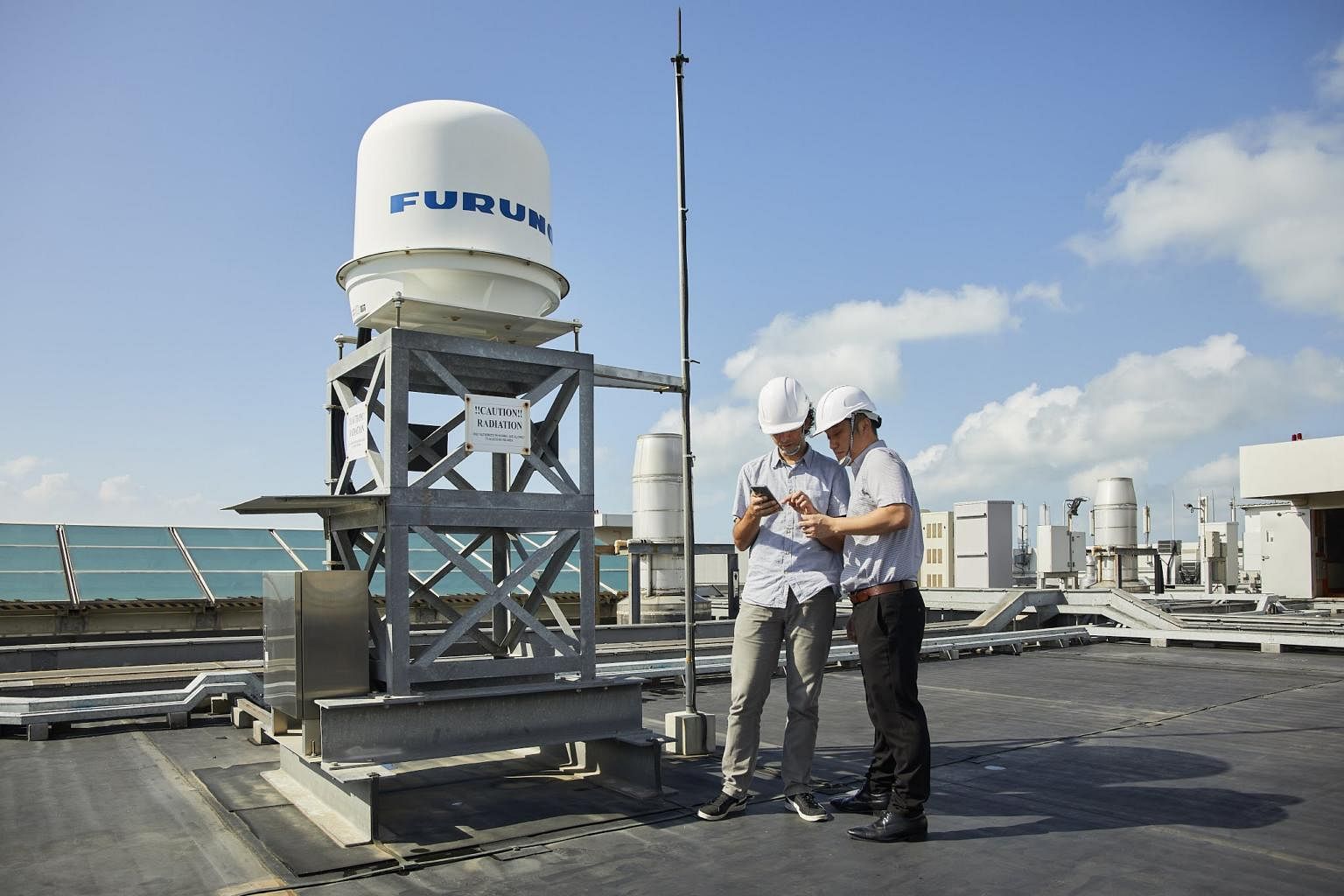
The system uses the rainfall monitoring capabilities of X-band radars, which are typically used for localised weather monitoring, as well as for air traffic control and maritime vessel navigation.
An X-band radar can monitor rainfall within a radius of up to 50km.
The radars are combined with an algorithm that provides forecasts for short periods by observing the current movement, growth and decay of rainclouds.
The PUB first started developing the system in June 2016, working with the Hydroinformatics Institute and industrial electronics firm Furuno Singapore.

It was completed in December 2018 and three X-band Radars were placed at CleanTech One building in Jurong, Woodlands NEWater Service Reservoir and Changi Water Reclamation Plant.
The PUB said that it is still working to refine the system by adding three more radars in the next two years - in Seletar, Tuas, and central Singapore - and a machine learning algorithm, which will further boost its accuracy in forecasting rainfall.
The PUB previously relied largely on the Meteorological Service Singapore (MSS) for its forecasts.
On June 2 last year, the PUB warned of flash floods on Commonwealth Lane and Craig Road in Tanjong Pagar after the MSS forecast that rainfall in the first two weeks of the month would be "above normal" over most of Singapore.
The new system, the national water agency said, adds to data collected by the MSS.
The announcement of the new system which allows for greater accuracy and response times comes after flash floods disrupted traffic in Jurong East Street 32 and Choa Chu Kang Ave 1 at 3.20pm on Dec 2 last year.


