AI-powered underwater robot to help coral scientists see better in Singapore’s murky waters
Sign up now: Get ST's newsletters delivered to your inbox

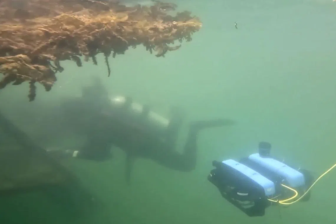
Marine biologist Sam Shu Qin checking on corals in Sentosa waters with the underwater robot from the SUTD MARVL Lab that can enhance grainy images.
PHOTO: SUTD MARVL LAB
SINGAPORE – For marine biologists like Ms Sam Shu Qin, monitoring coral reefs and restoring them requires a lot of manual work.
After diving in Sisters’ Islands Marine Park with a camera to check on corals growing on artificial reefs, Ms Sam would spend about 1½ days going through the footage and images, and measuring the corals’ growth on her desktop.
It does not help that visibility in Singapore’s waters tends to be limited to just 2m or less due to high levels of suspended sediment. That makes it harder to take clear photos of corals, said Ms Sam, a lecturer at NUS College and co-founder of the non-profit Our Singapore Reefs.
Realising the labour-intensive nature of the work, Assistant Professor Malika Meghjani from the Singapore University of Technology and Design – also an avid diver – developed software powered by artificial intelligence (AI) that can enhance grainy underwater images, identify coral species and flag important observations such as sightings of rare residents of reefs.
The digital system, integrated with machine learning, is installed in a commercially available underwater vehicle. When programmed to monitor unhealthy corals, the robot captures clear images of any bleached or diseased corals it encounters during its voyage.

An underwater image before (left) and after enhancements by the AI-powered software.
PHOTO: SUTD MARVL LAB
The images and footage will be transmitted in real time to the scientist’s laptop.
The system can also measure the size of each coral to help scientists track its growth over time, which is critical in restoration work.
Prof Meghjani’s technology, developed over three years with Ms Sam’s team, was recently tested on a reef patch at One Degree15 Marina on Sentosa.
The software is now being optimised and the team is exploring how the robot can be used to track coral growth.
It was demonstrated off Lazarus Island on Oct 11 at a media event organised by The International SeaKeepers Society Asia, which promotes ocean research, conservation and education with the yachting community.
In line with the efforts in conservation, the National Parks Board announced a plan in 2023 to plant 100,000 corals over at least 10 years, in its most ambitious reef restoration to date. This project was expected to begin in 2024.
Prof Meghjani and Ms Sam are hoping to test the AI-powered underwater vehicle in restoration and reef monitoring missions. It could, for example, look for rare corals and marine life around planted clusters.
“Sizes (of young corals) are very important because they need to grow to a particular size before they can be transplanted. When the restoration process has started, you’d want to be able to monitor them every week or every month,” said Prof Meghjani, who is a faculty member of SUTD’s Information Systems Technology and Design pillar.
After an oil spill in June,
With the help of the AI software, Ms Sam hopes to dedicate more time to doing analysis.

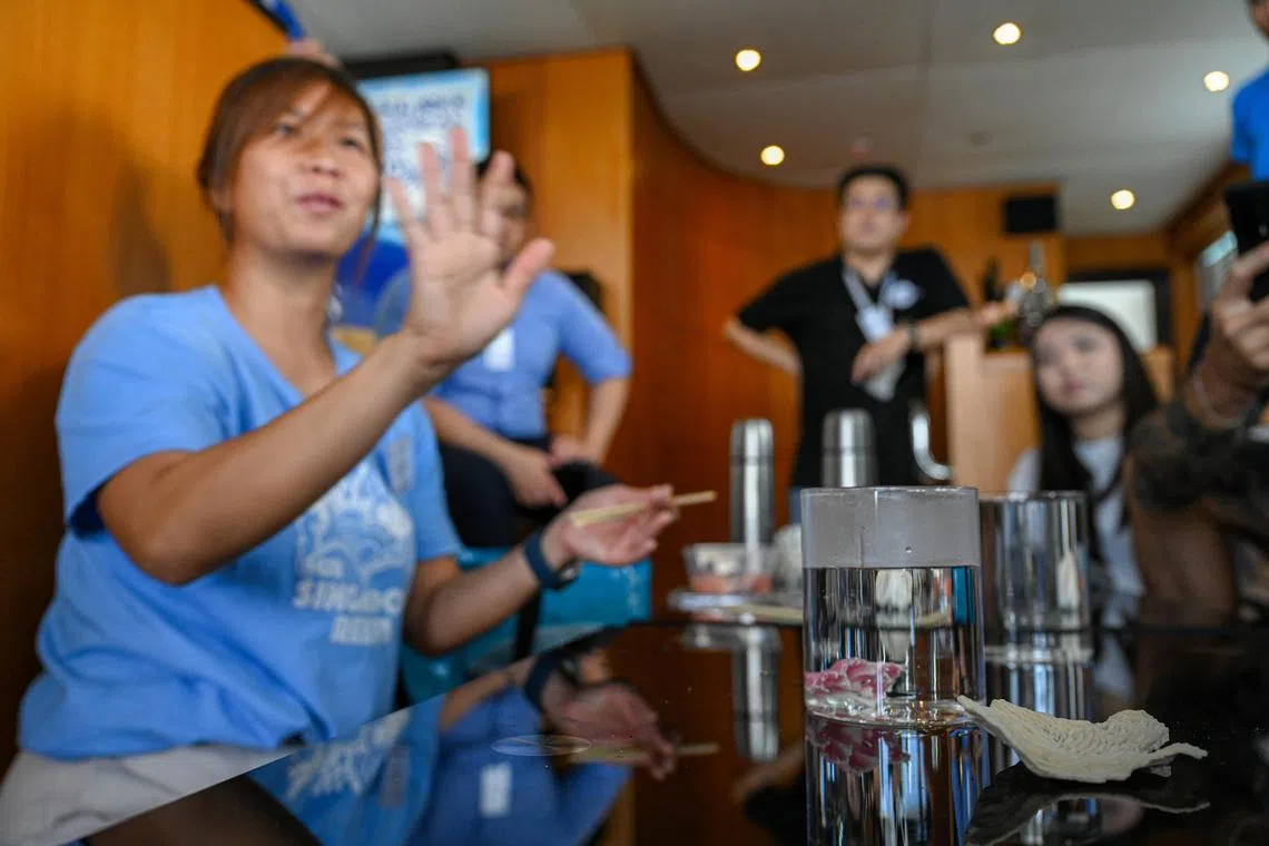
Ms Sam Shu Qin conducting an education session on Oct 11.
PHOTO: BERITA HARIAN
As for Prof Meghjani, she aims to use her technology to monitor underwater infrastructure such as bridges, which may have defects or be covered in barnacles.
Meanwhile, The International SeaKeepers Society Asia is urging owners of recreational vessels here – especially superyachts that cruise across the region – to contribute to a global project that aims to map the world’s seabed by 2030.
A complete map of the ocean’s floors will help scientists understand ocean circulation better, improve tsunami forecasting and manage cable and pipeline routing, among other benefits.
Under the Seabed 2030 project, 26 per cent of the ocean’s floors has been mapped so far, up from 6 per cent in 2017, said Ms Melissa White, director of the South Pacific chapter of the society.
She hopes to enlist vessels that are smaller than ships, such as superyachts, to help collect data from waters near the coast.

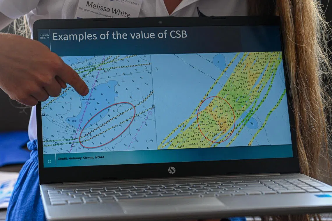
Ms Melissa White showcasing how the yachts’ loggers can contribute data on the seafloor during voyages.
PHOTO: BERITA HARIAN
The society provides thumb drive-like loggers for yachts that measure parameters such as the Global Positioning System coordinates and depth of the sea.
Of the 50 to 60 superyachts in Singapore, fewer than 10 have the loggers installed, said Mr Diederik Brinkman, yacht consultant for the society’s Asia chapter.
“Singapore’s waterways are very small. Most of it is mapped already. We are looking at yachts that are based in Singapore and going to Indonesia, Malaysia, Thailand,” added Mr Brinkman.
The understudied parts along the coasts of Malaysia, for example, could have sea life or habitats that need to be protected from ship anchors, he explained.
The data collected by participating vessels is processed and sent to the International Hydrographic Organisation – headquartered in Monaco – which is helping to create the 2030 map.


