Parliament: Only 2 of 9 flash flood locations on Jan 8 had history of flooding; not feasible to build drains for all extreme rainfall events
Sign up now: Get ST's newsletters delivered to your inbox

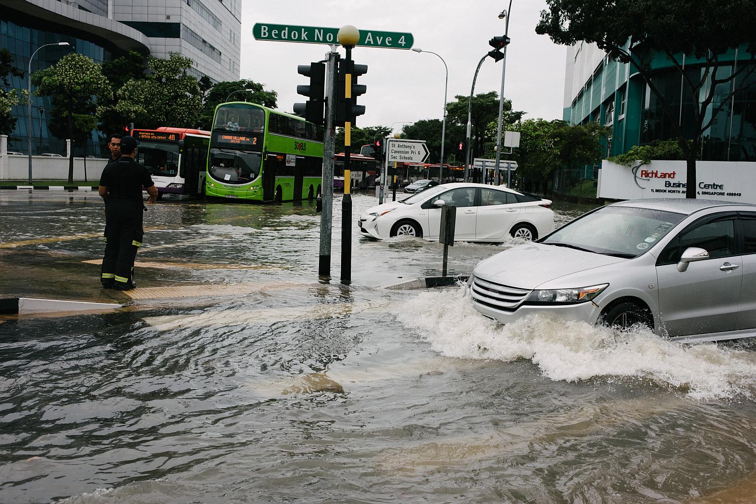
Vehicles travelling through the flooded junction of Upper Changi and Bedok North Ave 4 on Jan 8, 2018.
ST PHOTO: ALVIN HO
Follow topic:
SINGAPORE - Only two of the nine locations in the eastern Singapore that experienced flash floods on Jan 8 had a history of flooding, Minister for the Environment and Water Resources Masagos Zulkifli said in Parliament on Monday (Feb 5).
And with climate change, Singapore can expect more intense rainfall to be the norm in future, he said. This means that Singapore may experience flash floods in areas that previously had no record of flooding.
But, Mr Masagos cautioned, it is not feasible to build drains to accommodate every extreme rainfall event as this would require massive land take and much higher costs.
Mr Masagos was responding to questions on the Jan 8 incident raised by five MPs including Mr Murali Pillai (Bukit Batok SMC) and Non-Constituency MP Dennis Tan.
On Jan 8, flash floods occurred in nine locations in eastern Singapore. Within just four hours, 118.8mm of rain - half of Singapore's average monthly rainfall for January - fell, submerging cars, flooding bus cabins and disrupting some businesses.
And even though eight of the nine locations are low-lying and susceptible to flash floods, only two areas had a history of flooding.
They are Tampines Road, opposite Jalan Teliti, and Arumugam Road in the Ubi area.
National water agency PUB said that between 2015 and this year, Tampines Road has flooded five times, whereas Arumugam Road has flooded thrice.
"The flash floods were caused by the intense rainfall temporarily exceeding the existing design capacity of the drains," Mr Masagos told Parliament.
"Although the flood waters affected only certain stretches of the roads, and subsided within 15 to 60 minutes, we acknowledge that members of the public were inconvenienced and a number of cars were stalled," he added.
The annual frequency of heavy rain events has been going up since 1980.
Annual maximum hourly rainfall was about 80mm in 1980. In 2016, it rose to 90mm.
To address this, the Government has moved to invest in drainage infrastructure. Since 2012, drainage improvement works have been carried out at 327 locations, and another 73 locations are currently having their drainage systems upgraded. Twenty-two more are being planned for this year, Mr Masagos said.
On the Jan 8 case, Mr Masagos told the House on Monday (Feb 5) that drainage improvement works are already being carried out in eight of the nine affected areas, "to enable the drains there to discharge more water in a shorter time when completed".
As for the ninth location in Tampines Avenue 12, it was the building of an unauthorised road that intensified the flash flood on Jan 8. Mr Masagos said PUB has worked with the developer to improve the drainage there, and is working towards a longer term measure of installing a permanent drainage system, which will be built in tandem with the upcoming development project at the adjacent worksite.

But building new drains or upgrading existing ones cannot be the sole answer to solving flash flood problems.
Mr Masagos cited the example of the Bedok Canal, which takes in water from four of the nine locations affected by the Jan 8 flash floods.
This is being widened from the current 38.5m to 44m at a cost of $128 million, and is expected to be completed by the first quarter of next year (2019).
This, Mr Masagos said, is wide enough to accommodate an expressway of 10 lanes. But to deal with extreme rainfall events, the Bedok Canal would need to be widened to at least 62m - a 16-lane expressway. This would displace the Bedok Park Connector and community spaces adjacent to the Canal, and possibly even affecting the surrounding residential areas.
There were floods on 14 days last year, compared with 10 in 2016, and six in 2015. This year, four flash flood days were recorded in January.

