Designing a new future for Ang Mo Kio estate
Sign up now: Get ST's newsletters delivered to your inbox
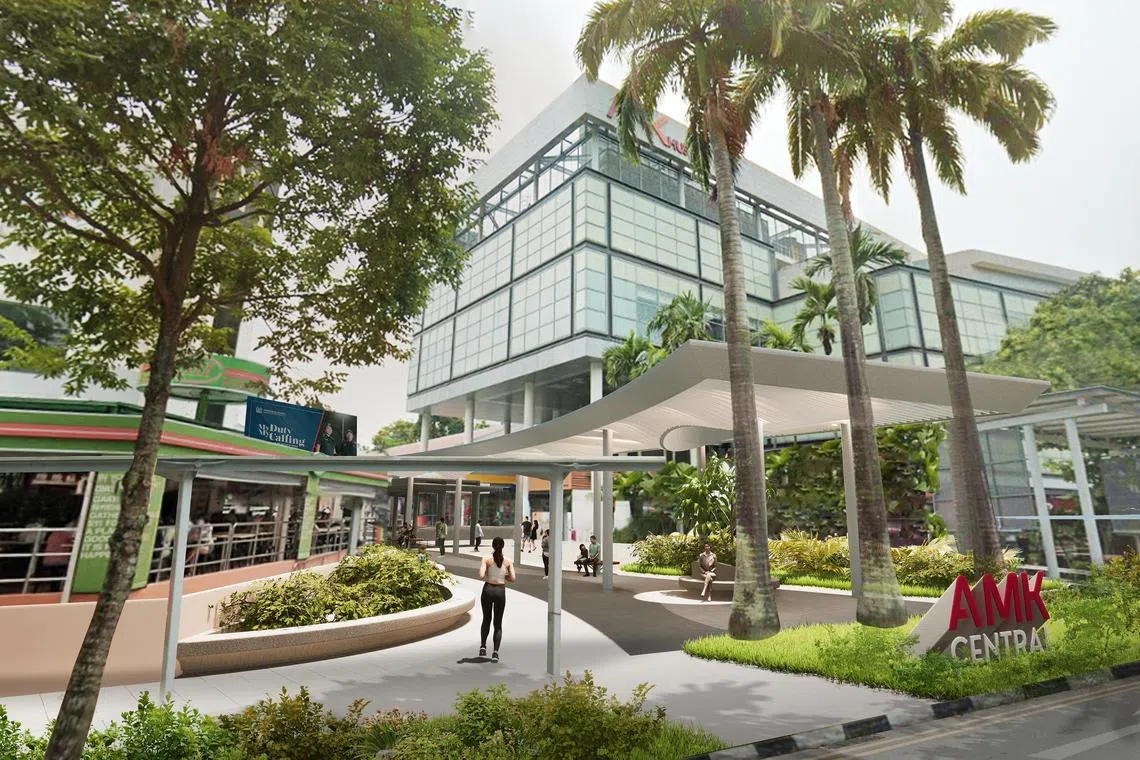
Arrival Square – the New Arrival Canopy is a Central Spine Marker that provides a shaded link towards the central spine and seamless integration with covered linkways to Ang Mo Kio Hub.
PHOTO: ZARCH COLLABORATIVES
SINGAPORE – Ang Mo Kio, built in the 1970s, is in the first phase of a long-term rejuvenation exercise designed to transform its town centre into a community hub for the entire estate.
The town centre’s upgrading exercise was first announced in August 2022
The initial phase will start from the square outside AMK Hub and 51@AMK to the outdoor shopping street, right up to Ang Mo Kio Central Stage. It will end near Block 720 in Ang Mo Kio Avenue 6, which is also close to Jubilee Square. Work on this phase is expected to be completed by the end of 2024.
The town centre will have more sheltered rest areas and feature inclusive elements such as barrier-free access for the elderly and wheelchair users.
The playground beside Ang Mo Kio Central Stage will also be rebuilt and named the Saga Seed Playground, featuring a design inspired by the saga tree. Also called Adenanthera pavonina, the saga tree has long, curved pods which release bright red inedible seeds that are heart-shaped.
As part of the rejuvenation plan, the National Parks Board (NParks) will develop a new park which is about 8ha in size at Lentor Hills Estate. The park will link the Central Catchment Nature Reserve to Khatib Nature Corridor, and will combine an existing forested hillock with a new therapeutic garden and a nature playgarden. It will be completed progressively from the end of 2024.
“The park will also be connected to a new 1km-long park connector at Lentor Canal that will be completed by end-2024,” says Ms Kartini Omar, group director of Parks Development at NParks.
“The park connector will also connect residents to a larger recreational network including Bishan-Ang Mo Kio Park and other neighbouring green spaces, thus providing more opportunities for nature-based activities. This is part of NParks’ plans to establish 500km of park connectors by 2030 and contributes to our goal of enabling all households to live within a 10-minute walk of a park,’‘ she adds.
Also planned is a network of Nature Ways, which will involve planting native trees and shrubs that mimic forest structures. They will be progressively planted along roadsides and other green spaces throughout Ang Mo Kio.
“This will strengthen connectivity and offer residents greater access to the island’s green spaces as Singapore transforms into a City in Nature,” says Ms Kartini.
The new plans also include public housing projects such as Yio Chu Kang Beacon near Yio Chu Kang MRT station, which is expected to be ready in 2024.
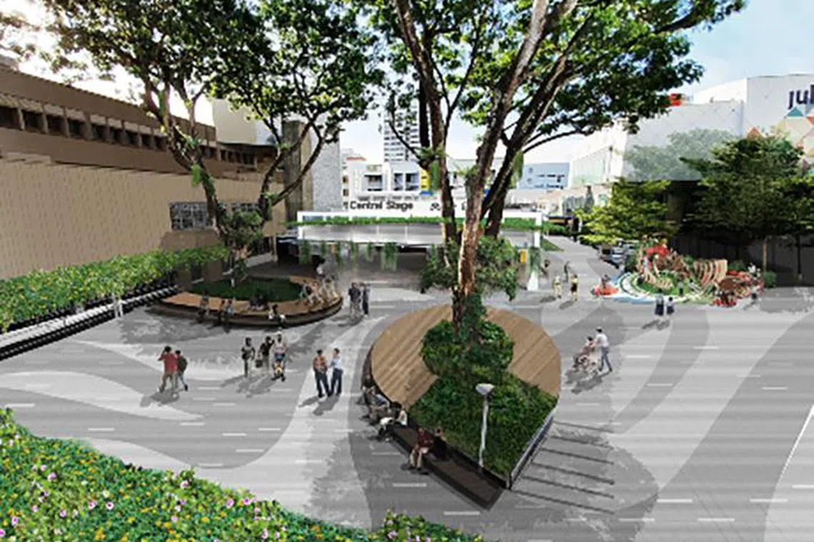
The central community stage will be refurbished, and its surrounding public amenities enhanced with new rest areas under natural shade.
PHOTO: ZARCH COLLABORATIVES
New and extended MRT lines are also on the cards. The Cross Island Line Phase 1, which has 12 stations from Aviation Park to Bright Hill, is expected to be completed by 2030.
Mr Henry Kwek, MP for Kebun Baru and the vice-chair for Ang Mo Kio Town Council (AMKTC), helped to organise an exhibition in January which showcased the redesign and upgrades that will be rolled out till 2030. AMKTC manages Ang Mo Kio GRC, Kebun Baru SMC and Yio Chu Kang SMC.
Among the key features highlighted at the exhibition was a well-connected transport network for drivers, cyclists and pedestrians. Wider footpaths being planned are part of an initiative to create “Friendly Streets” which are less vehicle-centric and create a safer walking and cycling experience for the young, old and those living with disabilities.
The improvements will build on Ang Mo Kio’s distinct identity which has been forged since the 1970s when it was earmarked as the seventh new town by the Housing Board (HDB), says AMKTC chairman Darryl David.
“We were among the pioneer batch of Ang Mo Kio families in the 1970s,” Mr David, 53, tells The Straits Times. “I developed such an attachment to the town that I returned many years later when I moved into the landmark HDB circular point block 259.”
Describing himself as an “Ang Mo Kio boy at heart”, Mr David, who is also an MP and grassroots adviser for Ang Mo Kio GRC, recalls how the estate reflected the larger growth trajectory of Singapore through its many “firsts”.
“Ang Mo Kio was the first HDB estate where the town council concept was launched as part of a pilot project in 1986,” says the father of two.
The town council was responsible for the maintenance and management of the various constituencies under its purview. Following the successful pilot project at Ang Mo Kio, the concept was later implemented throughout Singapore from 1988.
Mr David adds that Ang Mo Kio’s road network was fashioned after a hierarchy where major roads are named “avenues” and the smaller roads “streets”.
It was one of the first to have a grid-like pattern where streets filtered traffic from the avenues to individual HDB blocks for easy access.
“There was also the Emporium shopping mall in the town centre, which featured everything from a restaurant to a range of retail offerings, so there was no need to go downtown for a fun day out,” recounts Mr David, who visits the town centre at least once a week.
“Since the 1970s, Ang Mo Kio has been the place where our urban planners tested out ideas and that has made the estate what it is today: a vibrant, energetic and dynamic place to live, work, play and learn.
“This is what the new integrated Ang Mo Kio Town Centre will reflect,” adds Mr David. “Ang Mo Kio’s distinct urban identity and a vibrant place where residents from all over the housing estate can meet for community bonding.”
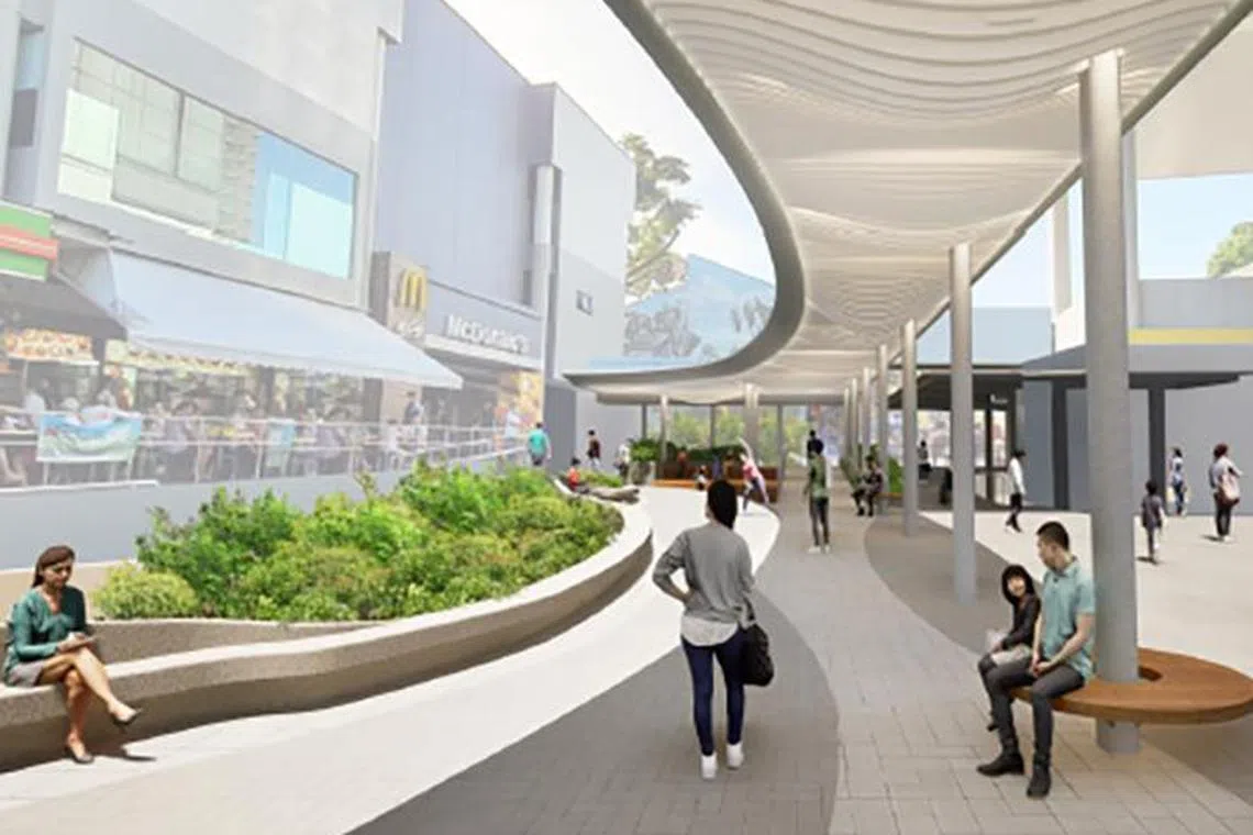
The Arrival Square Canopy leads towards the Ang Mo Kio centre spine with new accessible ramps as well as sheltered rest area.
PHOTO: ZARCH COLLABORATIVES
Mr Randy Chan is the principal architect of Zarch Collaboratives, which was commissioned in 2022 by AMKTC to create the integrated design for the project. He says the inspiration for his team was the idea of a dynamic piazza or community hub, called the Arrival Square at AMK Central, to add buzz to a mature housing estate.
“We created a new Arrival Square Canopy that functions as a ‘spine’ that provides a shaded link and seamless integration with covered linkways to Ang Mo Kio Hub, as well as future attractions in the heart of the town,” says Mr Chan, 52, who heads a multidisciplinary team of designers at the home-grown studio, which was founded in 2000.
He says the design aims to enhance community spaces with improved accessibility, upgraded shopfronts and lush landscaped rest areas.
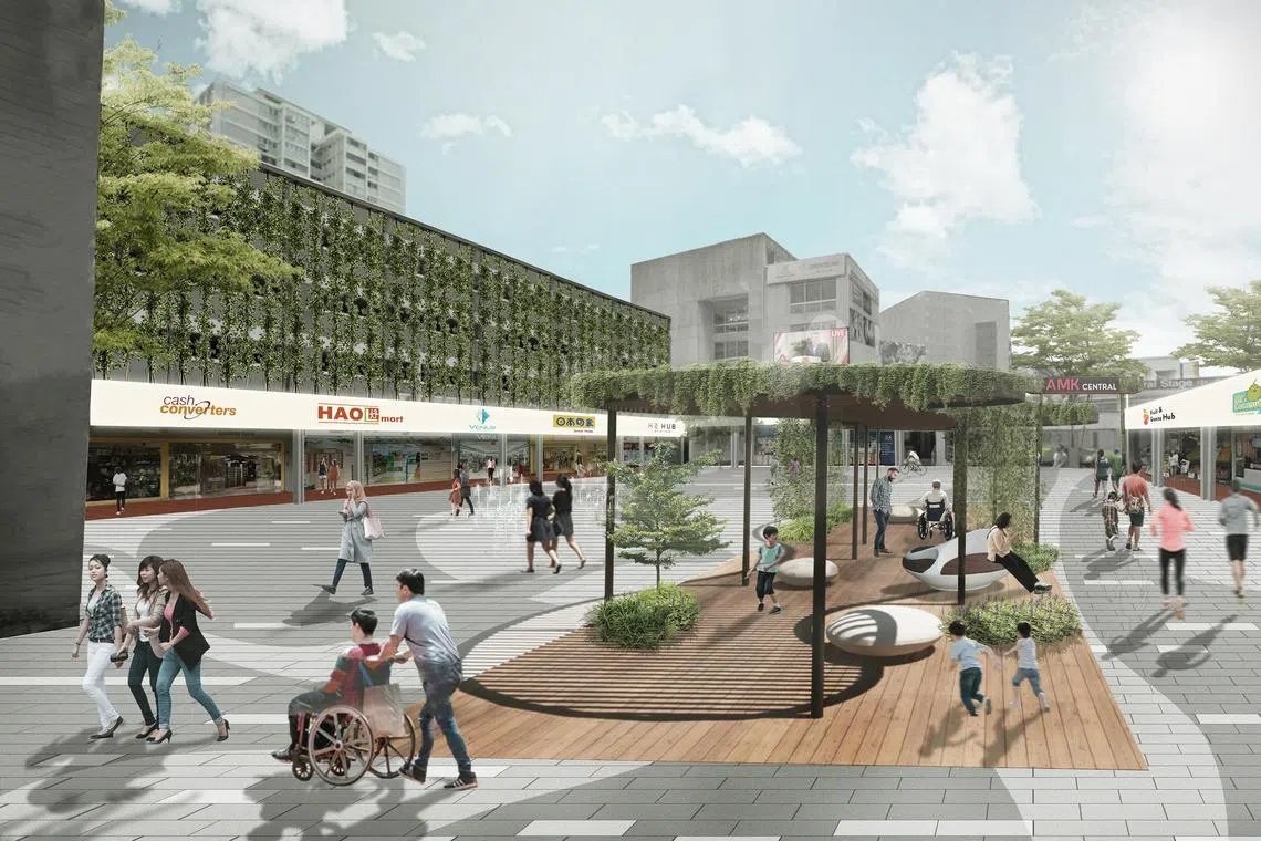
The Ang Mo Kio Heritage Square will be enlivened with vertical greenery, new rest areas and a dry deck fountain in the middle of the square.
PHOTO: ZARCH COLLABORATIVES
Another key attraction is the Ang Mo Kio Heritage Square, which in the early 1970s had a water fountain as one of its landmarks.
“The square will have a new ‘fountain’ which is an extension of the current AMK Town Centre,” says Mr Chan. “It will also incorporate heritage markers such as pasar malam (night markets) at the ground floor to bring back nostalgia and a sense of history.”
He adds that Heritage Square will also feature spaces which record its urban development milestones, such as the pilot town council concept and people who contributed to its success in the past.
Having lived in Ang Mo Kio for the last six years, Mr Ho Kim Long says he is delighted with the reimagining of the town centre.
“It will be easier for residents as well as visitors from around the island to navigate,” says the 47-year-old businessman, who is married to a human resource executive. The couple live in a five-room flat at Block 310B in Ang Mo Kio Avenue 1.
Mr Ho, who attended the exhibition, says the idea of an enhanced community square will benefit not only residents but also small businesses and shops, which will receive more footfall. It will also be a spot for residents both young and old to mingle, he adds.
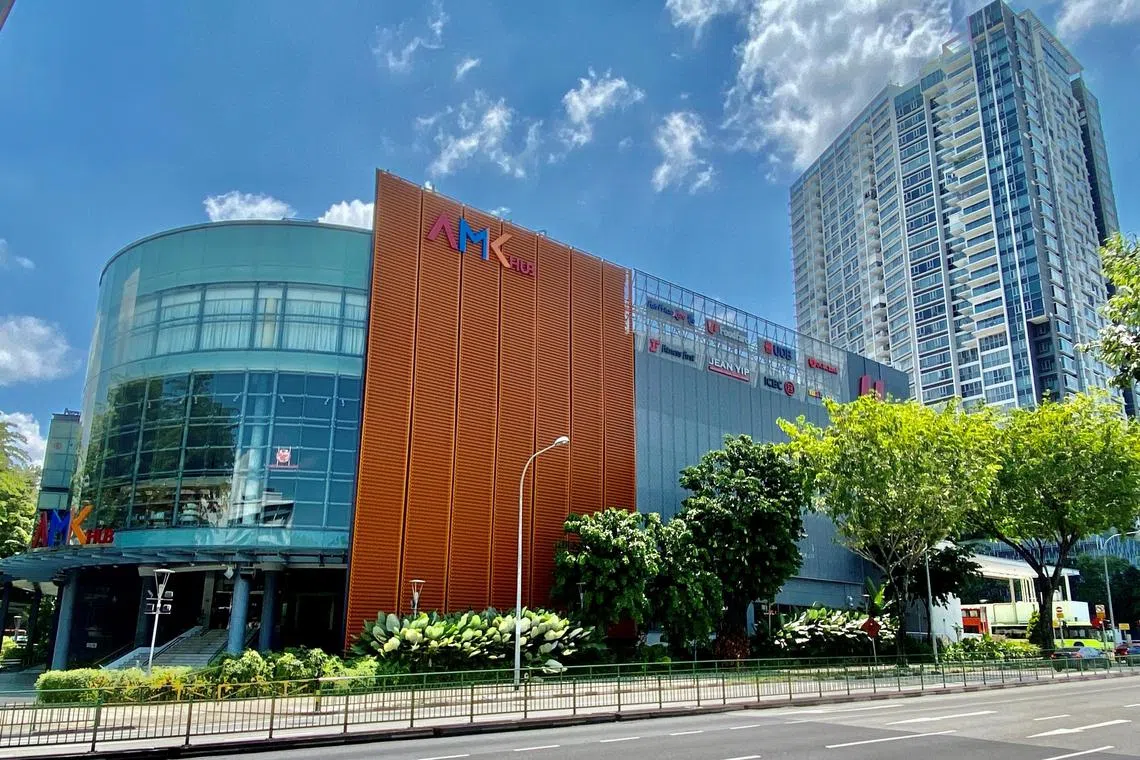
The initial phase will start from the square outside AMK Hub and 51@AMK to the outdoor shopping street, right up to Ang Mo Kio Central Stage, and is expected to be completed by end-2024.
PHOTO: MERCATUS CO-OPERATIVE
The rejuvenation also reflects the need for health and well-being, says assistant professor Jeffrey Chan of the Design and Artificial Intelligence programme at the Singapore University of Technology and Design.
He says the project will help to revitalise the precinct by providing sports amenities and greater accessibility to serve an anticipated larger group of elderly residents living in the area.
“These new amenities reflect the changing needs and wants of residents in Ang Mo Kio that will in turn encourage greater use of these public amenities and spaces, and improve community and social bonds between people,” says Dr Chan.
Piecing together Ang Mo Kio’s origin story
In November 2015, Indian Prime Minister Narendra Modi presented Singapore’s Prime Minister Lee Hsien Loong with a reproduction of an original 1849 map from the National Archives of India that is hailed by local historians as a “treasure trove” of information about early Singapore.
The map is one of the last detailed records by John Turnbull Thomson, Government Surveyor of the Straits Settlements from 1841 to 1853. It depicts an area called “Amokiah Village”, as well as a district called “Amokiah”.
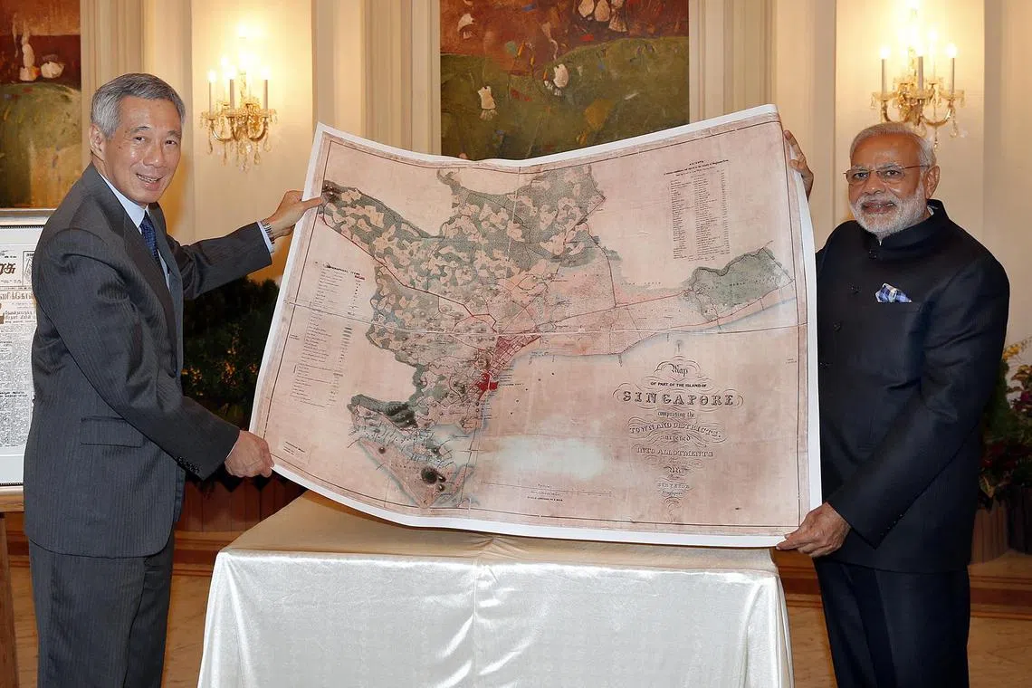
Indian Prime Minister Narendra Modi (right) presenting PM Lee Hsien Loong with a reproduction of a map of the island of Singapore dating back to 1849, on Nov 24, 2015.
PHOTO: ST FILE
Map research consultant and cartographer Mok Ly Yng, who has been studying Singapore’s colonial-era maps for more than 20 years, says that the earliest mention of “Amokiah” appears in Thomson’s 1844 District Map, used mainly for land administration purposes and drawn in separate sheets for each district.
But, in 1849, all these various District Maps surveyed from 1842 to 1845 were compiled into a single reference showing a bigger picture that included proper roads and the adjacent district to Amokiah, then called “Toah Payoh”, as well as Singapore’s coastline.
“This marvellous 1849 map from PM Modi was the largest-scale map of Singapore Island up until that time – that showed all the known topographical details as well as detailed land administration information,” says the cartographer.
“Thomson was the first person to record the name of ‘Amokiah’ on our maps,” adds Mr Mok, 55, who used to work at the Singapore Armed Forces (SAF) Mapping Unit, the national mapping agency. “His predecessors did not do that. The surveyors preceding Thomson were either military officers or contracted surveyors such as G.D. Coleman.”
He points out that from 1819, the year Sir Stamford Raffles landed in Singapore, numerous disputes related to land use and ownership were never resolved, as the British system of land administration required a good map to know who owned what and where.
“An accurate and complete land survey is essential for a good map to be produced,” says Mr Mok.
That was how Thomson came to be appointed Government Surveyor in 1841 by the British East India Company. Before that, he had been working as a private land surveyor in Penang since 1838.
“His surveying work in Penang was highly regarded and that’s why he was chosen to become Singapore’s first Government Surveyor,” says Mr Mok.
Thomson completed a huge part of his surveys of Singapore island alone and on horseback in the scorching tropical heat. It was a dangerous undertaking, as there were tigers and snakes in the forests as well as rampant murders in the rural areas due to clashes between Chinese secret societies.
One plausible explanation as to how Ang Mo Kio got its name is based on farmers referring to nine bridges, called “kow tiao kio” in both Teochew and Hokkien, that connected the land in the area.
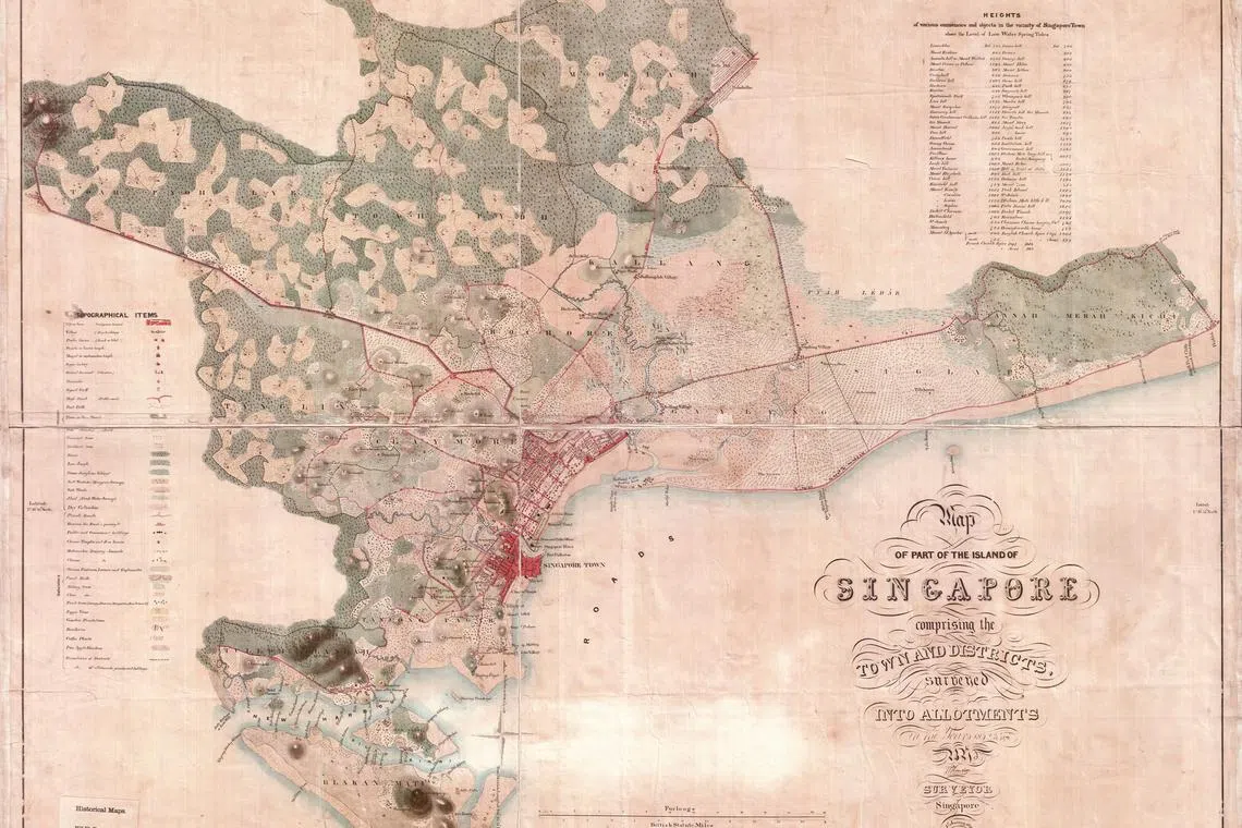
Based on John Turnbull Thomson’s 1849 map, the district of Amokiah showed vast swathes of land from heavily forested areas being cleared by the Chinese to grow gambier and pepper, as well as coconut, betel nut and fruit trees.
PHOTO: NATIONAL ARCHIVES OF INDIA COLLECTION, COURTESY OF NATIONAL ARCHIVES OF SINGAPORE
Mr Mok says that there is a common misconception that tomatoes were grown there, as “ang mo kio” is Hokkien for “tomato”. But based on Thomson’s 1849 map, the district of Amokiah showed vast swathes of land from heavily forested areas being cleared by the Chinese to grow gambier and pepper, as well as coconut, betel nut and fruit trees. Before the rubber boom of the 1900s, Amokiah was made up mainly of farms and attap houses.
After it was completed, the map was despatched to Calcutta at the behest of Thomson’s boss, Henry Edward Landor Thuillier, the Deputy Surveyor-General of Bengal.
“The 1849 map in fact originated in Singapore,” says Mr Mok. “According to written records, Thomson had intended for this map to be published properly somewhere. Again, this map was never known to have been published at all. It probably got lost among the papers on the Deputy Surveyor-General of Bengal’s desk.”
Thomson left Singapore in 1853 and took up the post of Chief Surveyor in 1856 in New Zealand. He died there in 1884 at the age of 63.
Thomson’s successors in the Singapore’s Survey Department tried to continue with the template that Thomson had created for the Ang Mo Kio area until the 1930s, when a new style of map drawing was introduced, adds Mr Mok.
“But they were never able to produce another map similar in style and content as Thomson’s 1849 masterpiece.”


