Bali flights affected by volcano eruption: 5 things to know about Mount Lewotobi Laki-Laki
Sign up now: Get ST's newsletters delivered to your inbox
Follow topic:
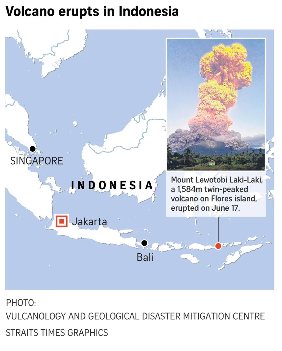
SINGAPORE - Mount Lewotobi Laki-Laki erupted at 5.35pm local time (6.35pm Singapore time) on June 17, forming an ash column exceeding 10km. It erupted again at 7.45am local time on June 18.
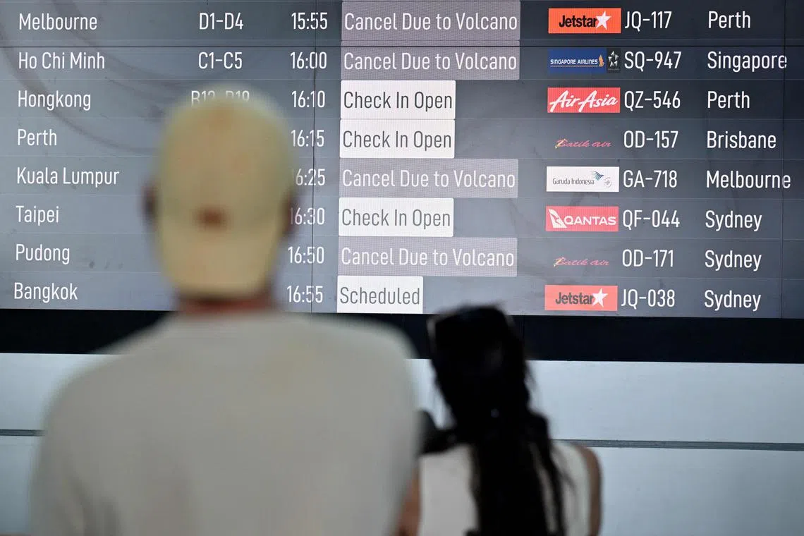
The latest eruption prompted the cancellation of dozens of flights
Volcanic ash rained down on several villages
1. Where is Mount Lewotobi Laki-Laki?
Laki-Laki, which means “man” in Indonesian, is twinned with a calmer volcano Perempuan, named after the Indonesian word for “woman”. The 1,703m twin-peaked active volcano is situated on the Indonesian island of Flores, in East Nusa Tenggara province, about 800km from Bali. It is about 1,700km away from Singapore.
2. How dangerous is Mount Lewotobi Laki-Laki?
The Indonesian Ministry of Energy and Mineral Resources (ESDM) raised Mount Lewotobi Laki-Laki’s eruption alerts to Level 4, the highest level in a four-tiered system, on June 17.
The danger zone has been expanded to 8km from the crater.
A check on the agency’s interactive website showed that Mount Lewotobi Laki-Laki is currently the only volcano in Indonesia with a Level 4 warning alert.
A Level 4 alert indicates that an eruption could spread and threaten residential areas.
The alert level for another active volcano, Mount Merapi, located in Yogyakarta, is currently at Level 3, a standby alert.
Warnings have been issued by the ESDM on the potentiality of rain-induced lava floods, or lahars, in rivers that originate from Mount Lewotobi Laki-Laki’s peak.
According to Singapore’s National Environment Agency website, the volcanic ash from Mount Lewotobi Laki-Laki is not expected to affect Singapore under prevailing wind conditions.
Meteorological Service Singapore is monitoring the situation.
3. How frequently does Mount Lewotobi Laki-Laki erupt?
The volcano has erupted at least four times in 2025, with the most recent one occurring on May 19 when it spewed an ash cloud more than 1km high.
On March 21, an eruption spewed ash clouds more than 8km high and caused airlines to cancel some flights from Bali.
On Feb 13, the Indonesian authorities raised the volcano’s alert status to its highest level, widening an exclusion zone and ordering half a dozen villages to evacuate.
While some notable eruptions took place in 1921, 1935, 1970 and 1991, the most recent eruption sequence began in late 2023, according to a statement by the National Disaster Management Agency on June 17.
4. What was the impact of its last major eruption?
The most major eruption happened in early November 2024 when Mount Lewotobi Laki-Laki erupted multiple times, killing nine people and injuring dozens of others. More than 2,000 houses were damaged and 13,000 residents were forced to evacuate.
The disaster also destroyed seven schools and a convent.
The eruption also caused the cancellation of more than 160 international flights to and from Bali.

Passengers looking at an electronic board displaying cancelled flights after the nearby volcano Lewotobi Laki-Laki erupted, at Ngurah Rai International Airport in Bali on June 18.
PHOTO: AFP
5. How many volcanoes are there in Indonesia and how many are active?
Located along the Pacific Ring of Fire, a horseshoe-shaped series of seismic fault lines along the Pacific Ocean, Indonesia is a geological hot spot for seismic activity.
Both active and dormant volcanoes stretch from the western to the eastern end of the archipelago.
Mount Lewotobi Laki-Laki stands among one of the 120 active volcanoes in Indonesia, according to the Associated Press. Other active volcanoes include Mount Marapi on the island of Sumatra, and Mount Semeru in the province of East Java, to name a few.


