Hong Kong warns hurricane-force winds may threaten city as Typhoon Koinu draws closer
Sign up now: Get insights on Asia's fast-moving developments

A man struggling with strong winds in Hong Kong on Oct 8 as the city raised its storm warning to the third-highest level.
PHOTO: AFP
HONG KONG – Hong Kong warned it may raise its storm alert to near the maximum as hurricane-force winds from Typhoon Koinu draw closer to the city than previously forecast.
“Koinu is a mature typhoon, with its eye wall edging closer to the seas south of the territory,” the Hong Kong Observatory said in a 3.45pm update.
“Gale winds are already prevailing in many places in the southern part of Hong Kong and winds may strengthen further.”
The typhoon, which has 145kmh winds near its centre, will be closest to the financial hub on Sunday night, the observatory said.
The agency added that it may issue higher warning signals if Koinu’s hurricane-strength winds continue to move closer to the city.
The observatory earlier issued its No. 8 warning, the third-highest on its scale of five.
The next level is No. 9, which means gale-force winds are increasing significantly in strength.
That is followed by No. 10 – defined as hurricane-force winds with a sustained speed of 118kmh and gusts that may exceed 220kmh.
Hong Kong raised its No. 10 signal in September for the first time in five years when Typhoon Saola pummelled the territory. The last time the city issued its maximum hurricane warning twice in the same year was in 1964, when it was hit by typhoons Ruby and Dot.
Koinu means puppy in Japanese. It is forecast to skirt about 70km south of the city, the observatory said.
Maximum sustained winds recorded at the city’s Tate’s Cairn were 92kmh at around midday, with gusts exceeding 118kmh.
Koinu was centred about 80km south of the observatory at 4pm local time.
It is forecast to slowly move west or west-north-west towards the Pearl River estuary, according to the weather agency.
Heavy squally showers were expected on Sunday and Monday, it added.
Most of the city’s main entertainment centres, including Disneyland and Ocean Park, announced they were closed because of the weather.
The Hong Kong Jockey Club said its horse race meeting in Sha Tin was cancelled “in the interest of public and equine safety”.
The authorities said a total of 27 temporary shelters operated by the District Offices would be open for people in need.
The observatory did not provide an estimate for when the city may lower its storm signals.
If No. 8 or higher is still in place in the morning, schools will remain closed, along with many businesses.
Stock-market trading would also not take place until the warning is lowered to below No. 8.

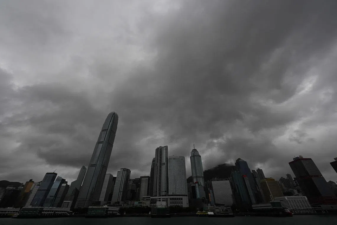
Heavy rain clouds are seen over Central district as Hong Kong hoisted typhoon signal No. 8 around noon on Oct 8.
PHOTO: AFP
Hong Kong lies at the northern fringe of the subtropical zone and has suffered a period of extreme weather in 2023.
Koinu’s approach to Hong Kong comes after the city experienced repeated bouts of extreme weather in recent weeks.
In addition to Saola, record-breaking rain caused by the remnants of Typhoon Haikui flooded streets, submerged vehicles and triggered landslides.
A lack of forewarning about the intensity of the rain prompted public criticism of the authorities.
Hong Kong insurance claims caused by natural disasters may climb to a record and exceed US$500 million (S$683 million) in 2023 should Koinu bring more heavy rain and cause flood losses, said Bloomberg Intelligence analyst Steven Lam in a note.
According to Reuters, Koinu killed one person and injured almost 400 people in Taiwan, causing some of the most extensive damage on remote Orchid Island off the island’s east coast.
In nearby Macau, the authorities said on Sunday they may raise the current No. 3 signal to No. 8 between 4pm and 8pm. BLOOMBERG


