Thousands more evacuate in Sydney even though heavy rains ease
Sign up now: Get insights on Asia's fast-moving developments

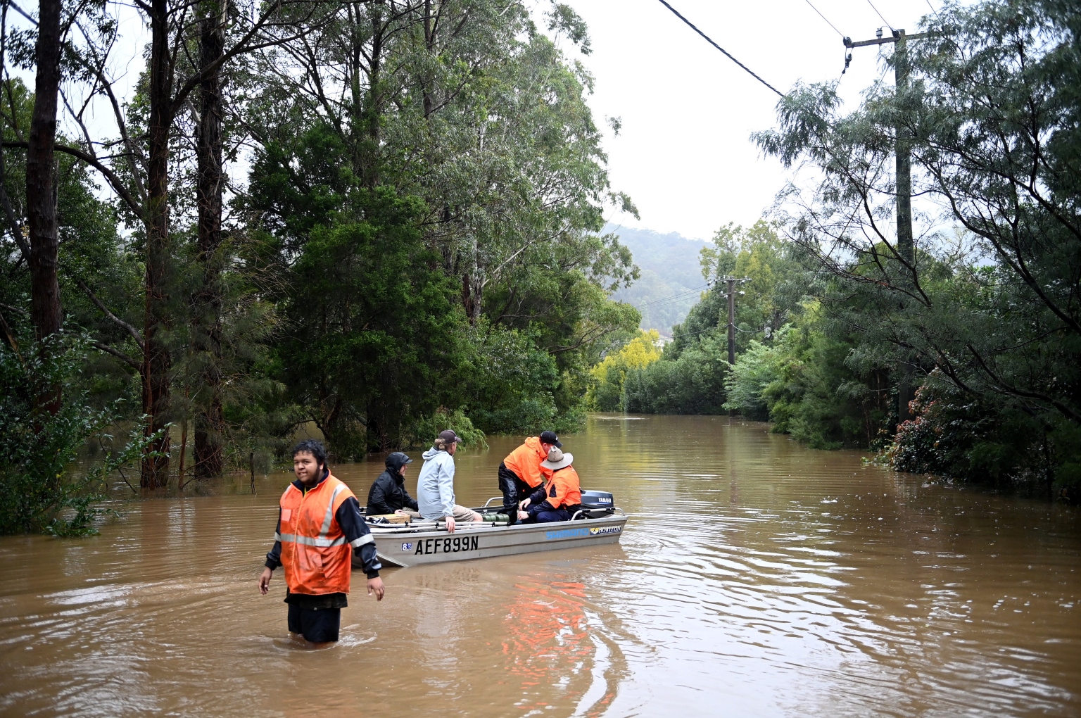
Local residents transport fuel and supplies to stranded residents in New South Wales on July 5, 2022.
PHOTO: EPA-EFE
SYDNEY (REUTERS) - A wild storm system that has pounded several parts of Sydney with torrential rain for four days has moved away from the city, satellite images showed on Wednesday (July 6), although rivers remained above danger levels, forcing more evacuations.
In Australia’s third major flooding episode this year, more than 85,000 people in New South Wales, most in Sydney’s western suburbs, have been asked to either evacuate or warned they might receive evacuation orders, up from Tuesday’s 50,000, authorities said.
"This still remains a dangerous situation and we need to respond appropriately," Prime Minister Anthony Albanese said during a media briefing, as he declared a one-off emergency cash payment of A$1,000 (S$957) for flood-hit residents.
Yet frustration with the government’s response was evident as Mr Albanese visited a volunteer emergency relief shelter to meet affected people.
"Everyone is talking about fixing the same problem... nothing has happened," television channels showed a resident telling Mr Albanese. "The locals are always prepared, the government is not."
Australia’s east coast weather has been dominated by the La Nina phenomenon, typically associated with greater rainfall, for two years in a row. La Nina ended in June, but there is a 50-50 chance it may return later this year, according to the Bureau of Meteorology (BoM).
The intense low-pressure system off Australia's east coast moved to the mid-north coast of New South Wales stretching across 300km , with the weather bureau predicting rainfall in excess of 200mm there over six hours.
Torrential rains since Saturday continue to dump waters into river catchments around Sydney, already near full capacity before the latest deluge, as authorities warned the floods crisis could prolong until early next week.
The rains and flooding forced the Australian Rail Track Corp to shut the key rail network carrying coal to Newcastle, the world’s biggest coal export port, late on Tuesday, although the operator said it hoped to re-open the line within 48 hours.
Miner Glencore, the top coal producer in Australia, said its operations in the Hunter region in New South Wales had faced some “short-term impacts due to the current wet weather”but did not provide any specific details.
A Port of Newcastle spokesperson said there had been intermittent disruption since Monday but operations were expected to return to normal around midday on Wednesday.
Social media footage showed residents using boats to transport fuel and essential supplies to homes cut off by floods. Many were seen piling up sandbags to protect homes and businesses, while emergency crews rescued stranded farm animals.
A cargo ship, the Portland Bay, which had been stranded in treacherous waters since Monday, was finally rescued on Wednesday and towed to port in Sydney.
“This ship came within a couple of hours of shipwreck, an outcome that would have risked lives and environmental disaster,” Transport Minister Catherine King said in a statement.
“This ship came within a couple of hours of shipwreck, an outcome that would have risked lives and environmental disaster,” Transport Minister Catherine King said in a statement.
Some regions in New South Wales were hit with up to 700mm of rainfall since Saturday, more than the annual average, but conditions have begun to ease in Sydney.
"We're looking at some dry conditions (in Sydney) tomorrow and then Friday, some slight showers returning on the weekend but nothing quite as heavy as what we have seen," meteorologist Jonathan How told Australian Broadcasting Corp


