Smoke from Aussie bush fires to circle the Earth, spreading pollution: Nasa
Sign up now: Get insights on Asia's fast-moving developments

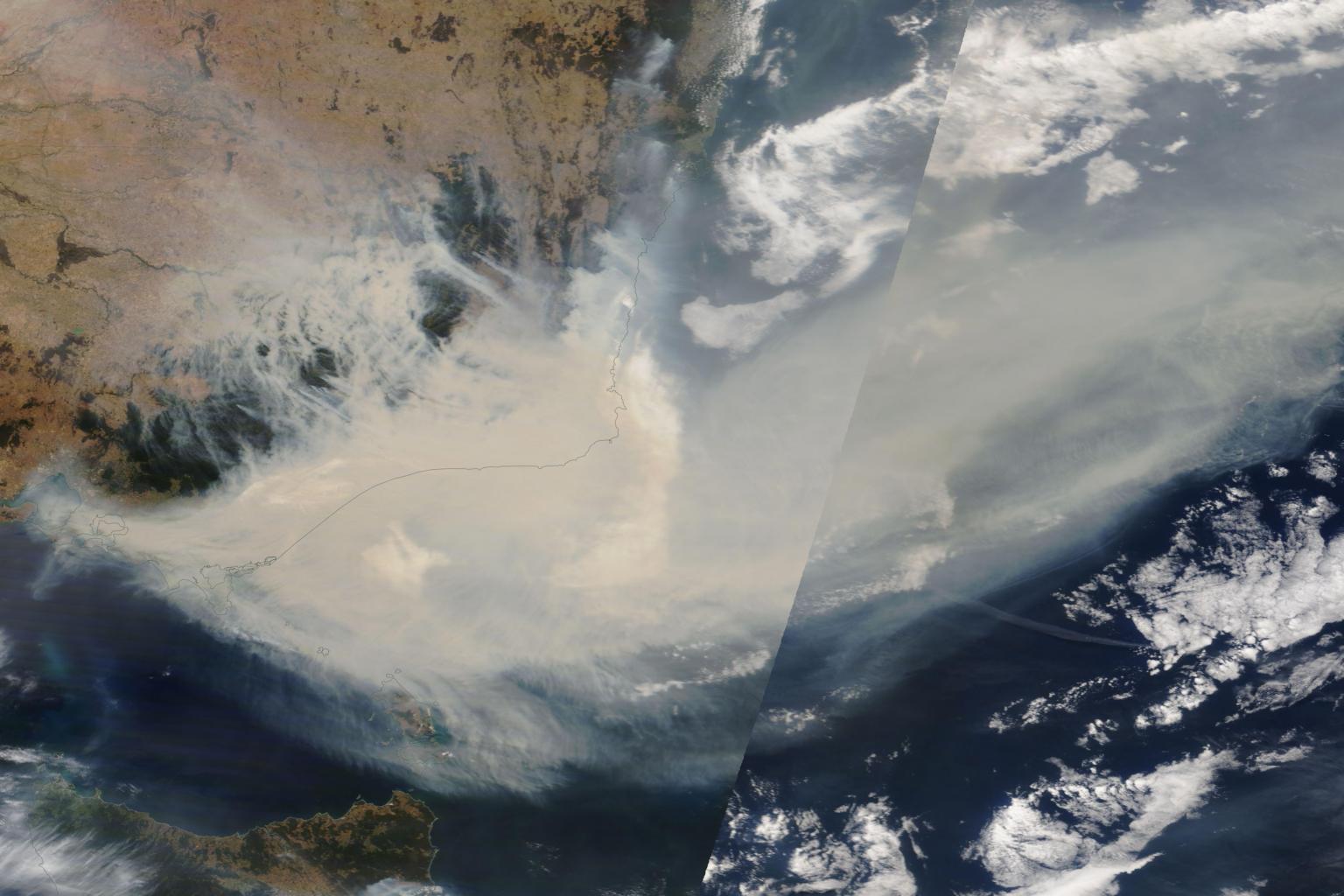
A handout satellite image made available by NASA shows thick smoke moving into the Tasman Sea from the states of New South Wales and Victoria on Jan 3, 2020.
PHOTO: EPA-EFE
SINGAPORE - The vast clouds of smoke from Australia's historic bush fires are expected to circle the Earth and return to the country, Nasa says.
The US agency said satellites have been monitoring the movement of the smoke high in the atmosphere as it swirled east towards South America and beyond.
By Jan 8, "the smoke had travelled halfway around Earth, crossing South America, turning the skies hazy and causing colourful sunrises and sunsets," Nasa said on its website.
"The smoke is expected to make at least one full circuit around the globe, returning once again to the skies over Australia."
The agency, in a posting dated Jan 10, said over the past week: "Nasa satellites have observed an extraordinary amount of smoke injected into the atmosphere from the Australian fires and its subsequent eastward dispersal."
More than 11 million hectares of Australian forests and farmlands have been scorched since the fires began in September, several months before the traditional start to Australia's summer fire season.
The fires have been particularly bad in the states of New South Wales and Victoria along the forested east coast.
As the thick smoke crossed the Tasman Sea, it brought severe air pollution to parts of New Zealand and turned snow in the mountains brown. Days later, it was reported over South America.
According to Nasa, fire-generated storms called pyrocumulonimbus injected large amounts of smoke into the stratosphere more than 16km above the earth. Ash, smoke and burning material were lifted into the atmosphere via super-heated updrafts.
"Once in the stratosphere, the smoke can travel thousands of miles from its source, affecting atmospheric conditions globally," Nasa said.
Agency staff had counted 20 pyrocumulonimbus firestorms during one week this month. These storms, usually dry thunderstorms, also generate lightning that can spark new fires.
"By our measures, this is the most extreme pyrocumulonimbus storm outbreak in Australia," the agency quoted Dr Mike Fromm and his colleagues from the Naval Research Laboratory in Washington. Dr Fromm tracks pyrocumulonimbus storms using satellite imagery from Nasa.
The agency said two instruments aboard Nasa-NOAA's Suomi National Polar-orbiting Partnership satellite - VIIRS and OMPS-NM - provided data and tracking information on the smoke cloud.


