SINGAPORE – New way-finding signs have been installed in the city centre, to make it easier for pedestrians and cyclists to get around.
The signs are part of a way-finding system that the Land Transport Authority (LTA) is trialling in the Central area and Yishun from December for a period of six to nine months.
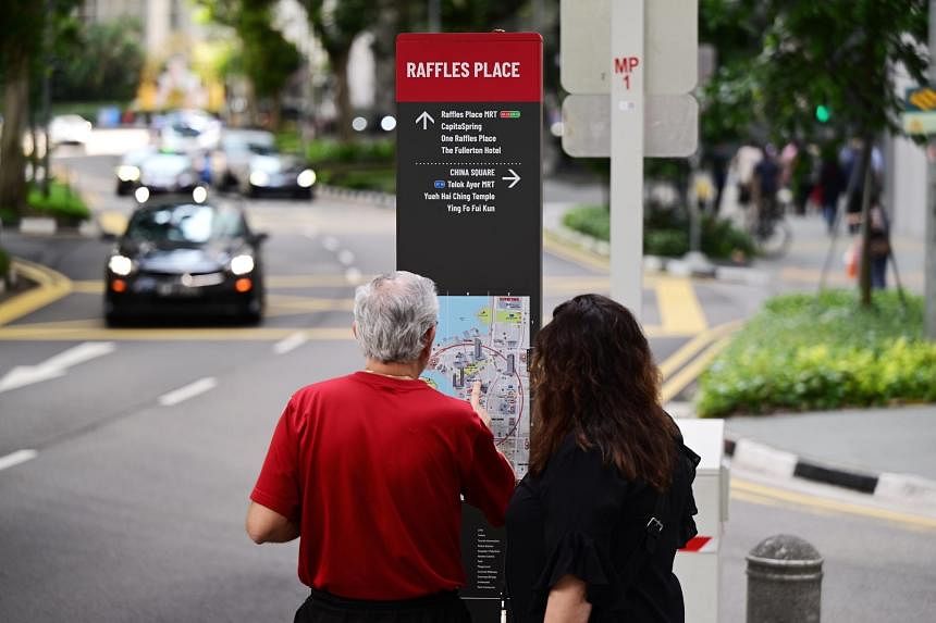
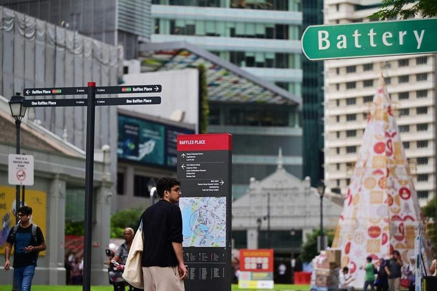
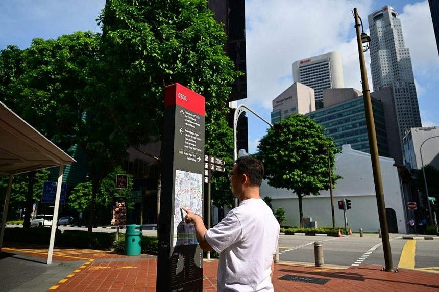
They come in three variations: a larger-sized kiosk sign that displays a wider area of the vicinity in its map, a medium-sized totem sign that features a narrower map of the immediate surroundings, and a thin finger post sign to confirm that road users are headed in the right direction.
The LTA said at a media preview on Dec 15 that the new system will complement existing way-finding signs built by other Government agencies and plug any gaps in pedestrians’ navigational needs.
These signs have a heads-up map display – the map is rotated to sync with the user’s point of view and direction of travel.
Four out of 20 signs have been installed in the Central area so far – opposite UOB Plaza, near OCBC Centre East, near Far East Square, and opposite exit A of Telok Ayer MRT station.
The remaining 16 will be installed in the first half of 2024, in places such as the vicinity of Chinatown and Tanjong Pagar MRT stations, said the LTA.
Another 15 signs will be installed in Yishun within that same period, including some near Yishun MRT station along Yishun Central and Yishun Avenue 5.
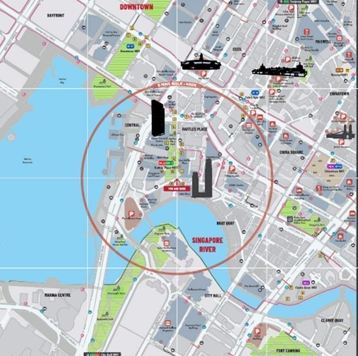
To cater to colour-blind users who might not be able to identify shades of green, LTA added texture to its visual representations of green spaces and parks on its maps.
The signs are also designed with wheelchair users in mind, with the maps deliberately placed below the eye level of a standing person. This allows wheelchair users to tilt their heads up slightly, instead of craning their necks, to view the map with ease.
The maps have other features such as a five minutes’ walk radius indicator, 3D diagrams of key landmarks and icons to indicate where public transport nodes and cycling paths are located. There is also a street-finder grid that enables users to locate streets in the area by name.
For now, the signs only have English text to avoid cluttering the maps.
LTA said it will survey users on whether the signs should be translated into mother tongue languages after the trial ends.
LTA said it selected the Central area and Yishun for the trial as both locations are distinct and have cycling paths – which will allow the authority to evaluate if the system is also useful for cyclists.
In the Central area, the aim is to make it easier for both locals and foreign visitors to find landmarks and MRT stations.
At Yishun, LTA hopes the signs will guide pedestrians and cyclists – especially those less familiar with the area – to nearby facilities and recreational spaces.
Mr Foong Keng Yi, senior planner in active mobility at LTA, said the authority looked at data to determine key pedestrian and cyclist routes, as well as key decision points such as intersections, in deciding where to install the signs.
Similar way-finding signs can be found in other cities, such as New York and London.
If the trial is successful, LTA will use the new system along its expanding cycling path network as well as for its Friendly Streets scheme – which improves the walking experience and safety for pedestrians.
Mr Anthony Lau, a tourist from Hong Kong, was “pleasantly surprised” by the details on the map, which highlighted the key landmarks to visit in the area.
The business owner, 28, hopes to see these road signs rolled out across a wider range of locations that tourists frequent, such as Chinatown and Kampong Glam.
But Mr Lau, who is 1.9m tall, found the position of the map too low.
Avid cyclist Woon Taiwoon, 49, said the way-finding system will be especially useful for newer cyclists.
The product design manager added that these signs might only be helpful for cyclists who are already familiar with the Central area or Yishun if they also include the new cycling paths that will be built by 2030.
Ms Bu Siew See, 39, however, found the map confusing when using it to make her way to Amoy Street for a company lunch.
The IT sales executive said the street-finder grid was not obvious enough, and suggested that the street-finder legend be placed directly below the map.