MIAMI (BLOOMBERG) - Tropical Storm Sally looks set to reach New Orleans and south-eastern Louisiana stronger than earlier forecasts, bringing a dangerous storm surge, flooding rains and potentially causing up to US$3 billion (S$4.1 billion) damage and losses.
Louisiana's governor declared a state of emergency as the state braces for its second large storm in a month. Sally has also sparked evacuations on some offshore energy platforms. Landfall is likely to be Tuesday morning (Sept 15).
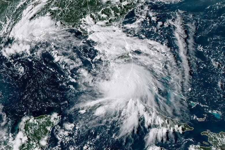
Sally's winds could reach 160 kilometres per hour as it approaches south-east Louisiana, possibly near the mouth of the Mississippi River.
Hurricane and storm surge warnings have been posted for the coastal region, including New Orleans, the National Hurricane Center said in an advisory early on Sunday (Sept 13). The storm would be a Category 2 hurricane on the five-step Saffir-Simpson scale, and could raise ocean levels 2 to 3 metres at the mouth of the Mississippi River.
"Heavy rain and surge are probably the two biggest sources of damage," said Adam Douty, a meteorologists with AccuWeather Inc. "There could be flooding issues across a lot of these low lying areas."
The storm's track has shifted to the west, which means the threat to New Orleans is rising and it could potentially lead to at least US$3 billion in damage and losses, said Mr Chuck Watson, a disaster modeller with Enki Research. That price tag could rise if Sally gets stronger or takes more time moving through the area.
Sally will sweep the eastern edge of the offshore production area, probably halting oil and natural gas drilling for a short time and adding further disruption to the industry, said Mr Jim Rouiller, lead meteorologist with the Energy Weather Group.
Hurricanes Marco and Laura, as well as Tropical Storm Cristobal, all halted work across the Gulf this season.
Chevron Corp said on Saturday it's evacuating workers and shutting in production at its Blind Faith and Petronius platforms.
Along with its storm surge, which can vary due to tides and exactly where the storm makes landfall, Sally will bring 30cm of rain across the Gulf Coast from Louisiana to Florida, the hurricane centre said. Some areas could get as much as 50cm and heavy rain is forecast to spread well inland later in the week.
Sally is 2020's 18th named storm in the Atlantic. That's the earliest the mark has been reached in records going back to 1851, said Mr Phil Klotzbach, lead author of Colorado State University's seasonal hurricane forecast.
The previous record was set by Stan, which formed in October 2005. So far seven storms have hit the US in 2020, including Laura, which devastated south-west Louisiana, and Hurricane Isaias, which temporarily knocked out power to millions in the North-east.
In addition to Sally, Tropical Storm Paulette is forecast to strengthen into a hurricane as it nears Bermuda late on Sunday; a hurricane warning has been issued. Another Atlantic storm, Rene, has weakened to a tropical depression.
It's possible there could be five tropical cyclones in the Atlantic soon, which hasn't happened since September 1971, said Mr Rouiller.
Another tropical depression, currently dubbed "20", could soon form into Tropical Storm Teddy and is about 3,200km east of the Caribbean Leeward Islands. Yet another area of low pressure sits west of the Cabo Verde Islands.