PARIS - Europe's hot, dry summer has broken temperature records, triggered deadly wildfires and scorched farmers' fields.
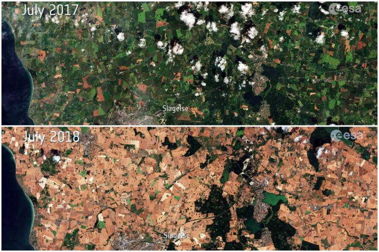
In a dramatic illustration of just how hot and dry it is, the European Space Agency on Wednesday (July 25) released images from the Sentinel-2 satellite comparing a region in Denmark in July 2017 with the same spot this month.
Instead of green, most fields are brown.
Neighbouring Germany has also suffered from the wilting temperatures. The German Fire Brigade Association (DFV) warned on Wednesday that the heatwave and lack of rain could spark forest fires in Germany, Xinhua news agency reported.
In Sweden, where 21 fires were still raging on Thursday (July 26), authorities are urging timber companies to stop logging after wildfires swept through large parts of forested land, Bloomberg reported.
"Due to the extreme drought and the extremely high fire risk" in large parts of the country, "the Swedish Forest Agency recommends that no forestry work is done in those areas," it said in a statement.