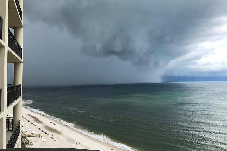
NEW YORK (NYTIMES) - The United States' first named storm of the season - Subtropical Storm Alberto - made landfall on Florida's Panhandle on Monday (May 28), officials said.
Emergency management officials in Florida said the storm struck Laguna Beach just before 5pm Eastern time (5am Tuesday Singapore time) with wind speeds of about 45 mph (72 kph). And although some gusts were said to have been stronger, officials have signalled that they are even more worried about the potential for torrential rain and severe flooding.
An array of mandatory and voluntary evacuation orders have been issued for parts of Franklin, Gulf and Walton counties. With the heavy toll of Hurricane Irma in the state's rearview mirror, Governor Rick Scott has already declared a state of emergency in all 67 Florida counties.
"Remember, the track of these storms can change without notice," he said in a statement. "Everyone in our state must be prepared."
Forecasters said they expect the Florida Panhandle as well as parts of eastern and central Alabama and western Georgia to get between 4 inches (10cm) and 8 inches of rain through Tuesday, with some isolated areas getting as much as a foot (30cm); they warned that flash flooding was possible in Florida, much of Alabama, and western Georgia.
Storm surge in Florida could cause water to rise as high as 3 feet from the Aucilla River to Mexico Beach, they said. Isolated tornadoes were also possible over parts of Georgia and southeast Alabama.
In an advisory issued around 11pm ET on Monday, the National Hurricane Center said the storm had weakened to a subtropical depression with winds of about 35 mph.
After the exceptionally destructive season last year, forecasters said last week that the possibility of a weak El Niño, along with near-average sea surface temperatures, suggest that this year's hurricane season will be normal or only slightly more active than average.
The National Oceanic and Atmospheric Administration's forecasters predicted a 70 per cent likelihood of 10 to 16 named storms this year with winds of 39 mph or higher.
Hurricane season runs from June 1 until Nov 1 and peaks from mid-August through late October.
Last year (2017), there were 17 named storms, 10 of which became hurricanes; the first named storm was Arlene - a rare preseason tropical storm that arrived in April.
"We're not expecting the season to be one of the most active on record," said Gerry Bell, lead hurricane season forecaster with NOAA's Climate Prediction Center. But, he added, "It's time to start getting prepared."