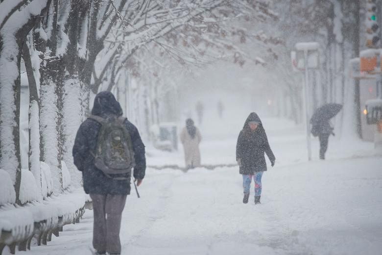
NEW YORK (BLOOMBERG) - A gusty winter storm remains on track to batter the East Coast, threatening to tie up roads and air travel, cause power outages and dump snow from Washington to New England.
New York City could get as much as 10 inches (25cm) starting late Friday (Jan 28) through Saturday with eastern Long Island getting more and the Hudson Valley receiving less, said Mr James Tomasini, a National Weather Service meteorologist in Upton, New York.
There still uncertainty on the storm's track and that could mean more snow for Manhattan and the other four boroughs - or practically nothing at all.
"There is a pretty sharp gradient and there is still quite a bit of spread in some of the guidance," Mr Tomasini said by telephone, noting that the snow depth will vary wildly over just a few miles. "But our expected totals are 8 to 10 inches."
A storm of this size will cause airlines to cancel flights and most likely lead to reductions in commuter and long-distance train schedules.
The National Weather Service has issued winter storm warnings and storm watches from North Carolina to Maine, and offshore ships are being warned of high winds and waves up to 9 feet (2.74m).
The worst of the storm should hit east of Interstate 95, a major US highway that links Maine to Florida and passes through many of the corridor's largest cities.
Boston could get 12 to 18 inches, while south-eastern Massachusetts, including the resort areas of Cape Cod, could get as much as two feet, the weather service said.
Philadelphia could get upwards to 6 inches, while Atlantic City could receive as much as 18 inches. Washington will likely get less than 1 inch.
"It could be an all-out, classic blizzard for New England," said Mr Paul Walker, a meteorologist with commercial forecaster AccuWeather Inc. "Eastern Long Island up into New England will be taking the brunt of the storm. The question mark remains how far west the good snow goes; will it be back to New York or Philadelphia?"
Winds of 30 to 50 miles (48km to 81km) per hour will sweep eastern Massachusetts and Rhode Island, almost certainly bringing blizzard conditions Saturday and raising the risk for widespread power outages, Mr Walker said.
The liquefied natural gas tanker Cadiz Knutsen docked Wednesday at Exelon Corp.'s Everett LNG import terminal. New England relies on LNG imports to meet heating needs.
The Cadiz Knutsen's arrival comes as Boston gas futures rose 15 per cent Thursday to US$20.278 per million British thermal units.
On Thursday, US gas futures climbed for a fifth day in New York. The looming nor'easter, as well as tensions in Ukraine, are contributing to the gains.
On Thursday, futures prices were also propelled higher due to a short squeeze. US north-east peak power prices are hovering at the highest levels for this time of year since 2017.
Spot prices for New York City are averaging US$180 a megawatt-hour, up 32 per cent from the same period Wednesday, according to grid data compiled by MCG Energy Solutions.
The storm should clear out by Sunday, but gusty winds will lead to snow drifts, Mr Walker said.