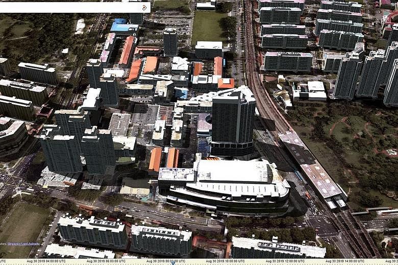
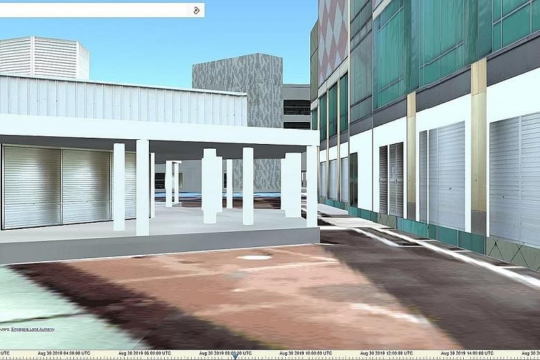

Users will be able to digitally navigate through void decks, or even capture the view from a specific floor of a building, when the Singapore Land Authority's (SLA) integrated map system OneMap goes three-dimensional.
The upgrade, which is expected to go live by the end of next year, was announced yesterday by Ms Indranee Rajah, Minister in the Prime Minister's Office and Second Minister for Finance and Education.
Instead of acting as a map service that relies on real-life street photos, the 3D version will use models and renderings to project how buildings look like in a neighbourhood. This can be done even for buildings that are not yet built.
This will allow home buyers, for example, to get a better idea of the view from a specific floor of an apartment building, or even conduct shadow analysis to see where shadows cast by the sun will fall.
The 3D upgrade was announced at the launch of the inaugural Singapore Geospatial Week, a five-day event promoting the importance and growth of geospatial - or location-based data - technology in Singapore.
Members of the public can visit geoworks.sg/geospatial-week to sign up for events such as a hands-on mapping session to map accessible routes with wheelchair-friendly ramps.
Noting in her opening address that geospatial technology is a "key enabler of our Smart Nation initiative", Ms Indranee underlined its importance, citing how it is integral to everyone, from public agencies to businesses to citizens.
Businesses such as ride-hailing firm Grab, for example, analyse geospatial data in real time to better match its drivers with passengers, while members of the public tap the technology daily to locate facilities and amenities through various navigation devices, Ms Indranee said.
OneMap, which was launched in 2010, is a free local intelligent map service that is regularly updated with information contributed by government agencies.
Besides using it to navigate their way around Singapore, users can search for information such as which schools are within 1km of a selected building, or find out population information, such as the number of people in a certain age group who live in a specific area.
Now, users of OneMap's mobile app can also search for private sector locations, such as food and beverage options, following a partnership between SLA and location data firm Foursquare, said Ms Indranee.
This feature is available for Android users, while the iOS version is slated for release at the end of the month.