

Updating maps of Singapore's waters is a tedious process and can take a team of four people months to complete.
But the maps are crucial for improving safety of navigation for ships travelling in one of the busiest ports in the world, said the Maritime and Port Authority (MPA).
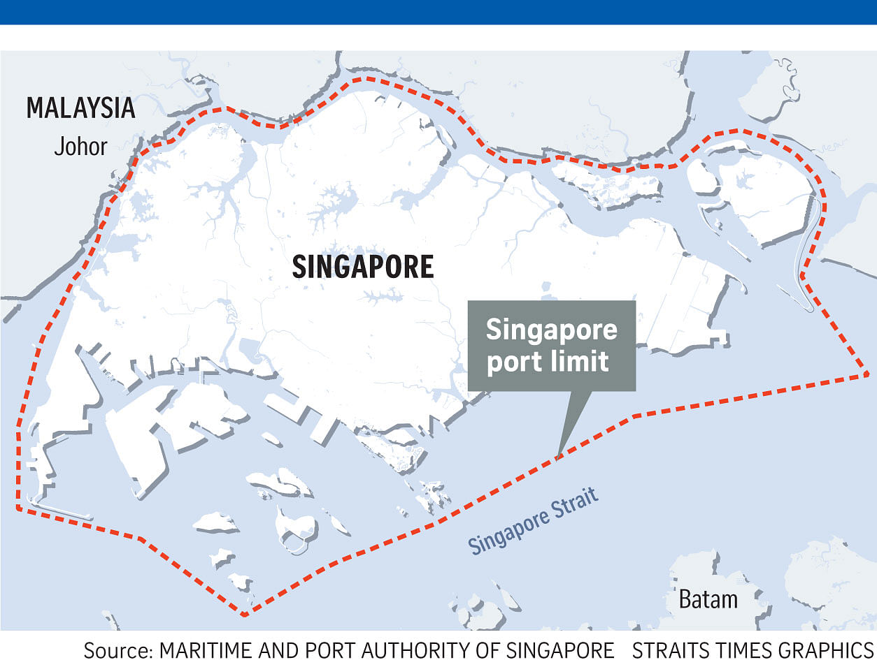
The Singapore Strait, which lies beyond the country's port limit, is also a high-traffic waterway, with 84,000 vessels transiting through it last year.
The importance of maritime trade and activity is why Singapore, Indonesia and Malaysia signed an agreement on Oct 2 to continue efforts to map the straits of Malacca and Singapore. It includes using multi-beam sonar technology that produces high-resolution 3D models of the seabed.
This second phase of a joint hydrographic survey aims to map out the remaining areas of the Traffic Separation Scheme within the straits of Malacca and Singapore which are shallower than 30m.
In Phase One of the operations, five areas believed to be around 20m or shallower, based on previous maps, were charted in five months. Phase One was launched in 2015. Both phases were supported by the Malacca Strait Council of Japan.
MPA, as the national hydrographic office, is responsible for keeping accurate maps of Singapore's surrounding waters.
The Singapore port receives an average of 380 vessels a day, or nearly 139,000 vessels a year.
Four hydrographic surveyors ensure accurate and updated nautical charts of Singapore's waters up to the port limit, and they do both the field work and the processing of data gathered.
The use of technology has helped speed up the process.
With single-beam sonar technology, it took five days to survey 500 sq m of water. The technology has been around since the 1940s.
But MPA acquired the multi-beam technology in 2000, and in two years, it completed the survey of Singapore waters up to the port limit. The technology uses three multi-beam sonar systems costing $400,000 each, which are also commercially available.
MPA continues to do regular surveys - every six to eight months - in areas like the channels and anchorages of Singapore to ensure any debris, wrecks or other obstructions are accurately reflected.
"This is because the seabed is dynamic - it is prone to siltation and erosion," said MPA's assistant chief hydrographer (hydrographic survey) Lee Weng Choy, 42.
Even with the latest technology, it can still take eight hours of field work to survey an area of 1 sq km.
These efforts have led to a reduction in the average number of major incidents in recent years.
"The maps form the base layer for advanced tracking technology like the Vessel Traffic Information System (VTIS) and radars, so that vessels can be monitored and guided past dangerous spots - shallow areas, or places with wrecks or rocks," said Mr Lee, who has worked at MPA for 17 years.