Four Indonesian provinces - including one that sits on Singapore's doorstep - are officially on disaster alert after a rising number of hot spots were detected within their boundaries.
Riau, South Sumatra, West Kalimantan and Central Kalimantan provinces have declared a disaster alert status, Dr Sutopo Purwo Nugroho, spokesman for the country's disaster management agency BNPB, said in a statement yesterday. All four provinces are located around the equator, with Riau being the closest to Singapore.
When contacted, Singapore's National Environment Agency (NEA) said the dry weather conditions in Sumatra and Kalimantan are "expected to gradually ease, and an increase of shower activities will help to subdue the hot spots in Sumatra and Kalimantan".
The NEA added: "The likelihood of transboundary haze affecting Singapore is currently assessed to be low."
For Indonesia, the disaster alert status means that the national government in Jakarta will be able to step in more easily and with less red tape to deal with raging fires, deploy troops and provide logistics and funds, Dr Sutopo said.
In the 24 hours to 7am yesterday, there were a total of 78 hot spots across the country, according to the Terra and Aqua satellites.
West Kalimantan province recorded the highest number with 23 hot spots, while Central Kalimantan recorded 12, Riau had nine, and South Sumatra had one.

Several other provinces also recorded hot spots, with 14 in West Java, and four each in the Riau Islands and Papua.
Indonesian provinces located near the equator are now in their first phase of the dry season, which usually runs from early in the year to March. The rainy season then sets in for these provinces in March and lasts until May, before another, more intense dry season from June to September.
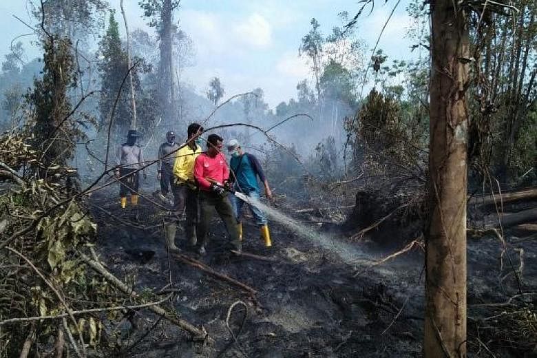
Indonesia is deploying joint forces from the BNPB's provincial branches, the armed forces, forestry agency fire fighters, city firefighters and civil security officers, among others, said Dr Sutopo.
The BNPB has also kept aircraft ready for cloud seeding and helicopters for water bombing.
The hot spots recorded in Riau province are located in Indragiri Hilir, Bengkalis and Pelalawan, with an area of more than 500ha affected, exposing some residents to choking haze, the Indosiar national television reported, citing Riau disaster management agency head Edwar Sanger.