
Distance: 10km
Level of difficulty: Challenging
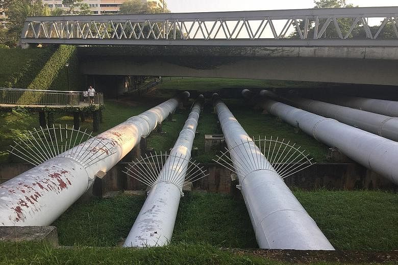
Most Singaporeans know that Malaysia supplies Singapore with water, but how many have seen the water pipes?
The Pipeline Trail traces the passage of these pipelines from Woodlands to as far as Jalan Anak Bukit in Upper Bukit Timah. The route is fascinating as you get to see some of the exposed pipelines, all of which are fully functioning.
I start from Dairy Farm Road, intending to make my way north towards Woodlands, armed with my mobile phone which has a pre- loaded map of the trail.
But the trail is largely unmarked, which means that for most of the way, I am not sure where exactly I am. I know only via my Global Positioning System-enabled phone that as long as I continue northwards, I will be all right.
There is not a lot of information about the trail available online and no markers that I could make out.

At one point, while passing under what my map tells me is Bukit Timah Expressway, I meet an elderly man - singlet-clad and with a bird cage in tow - and ask him if I am going the right way.
He says he does not know, but tells me he had seen people walk the same way before.
I cling onto the fact like my life depends on it and trudge on.
The trail takes me through the mountain bike tracks along Bukit Timah Expressway and Mandai Forest, which are largely untouched, undulating swathes of land. I mostly walk through these as the uphill parts are quite taxing to run.
But I maintain a brisk-walking pace, mostly because I get a bit intimidated by the "Protected Area" signs I see around me - with the icon of a soldier pointing his gun at a trespassing civilian.
But these stand only along the side of the trail, so I know I am safe and am not breaking any laws.
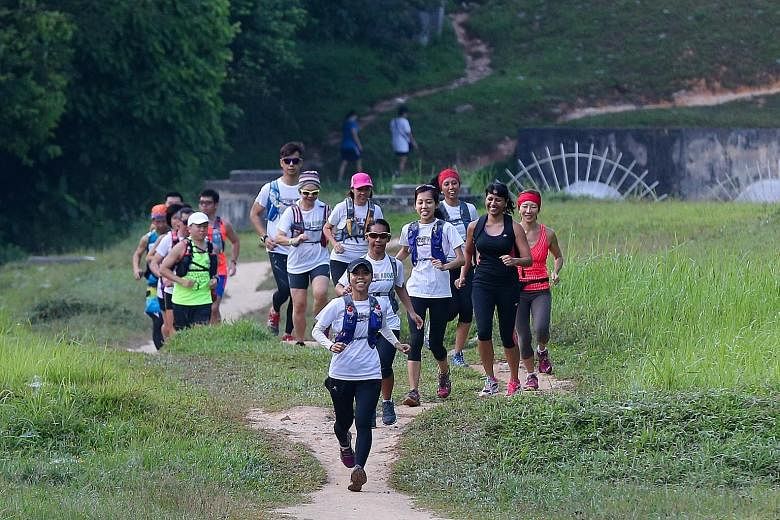
Those moments aside, it is quite refreshing to feel alone in Singapore, and when I do come across a group of hikers three-quarters into my run, I am somewhat disappointed.
Of course, the point of the trail is to see the pipelines and I remember seeing five sets in total.
You can walk on some of the pipelines - those without metal spikes on or fences around them - quite safely.
A frisson of excitement goes through me as I walk on my first pipeline near the Seletar Expressway. I take a dozen photos as this is the highlight of the trail for me.
Not only could I pretend to be a character in a game, traversing a deep ravine on a log, but this also validates my entire self-doubting journey.
As I catch sight of Housing Board flats in Woodlands Street 41, which spells the end of my journey, I feel a tinge of sadness knowing that my two-hour-plus adventure is ending.
Ultimately, I am glad that I have kept this trail for last, as it is more challenging than the MacRitchie Nature Trail and Green Corridor combined.
Hopping on the MRT with mud caking my ankles and shoes at 9am on a Sunday, I feel a sense of achievement. You just cannot put a price on the feeling.