SYDNEY (AFP) - The earthquake that devastated Nepal and left thousands of people dead shifted the earth beneath Kathmandu by up to several metres south, but the height of Mount Everest likely stayed the same, experts said Tuesday.
The massive 7.8-magnitude quake on Saturday was the Himalayan nation's deadliest disaster in more than 80 years, killing more than 4,300 people and causing massive destruction.
According to early seismological data obtained from sound waves that travel through Earth after an earthquake, the ground beneath the capital Kathmandu may have moved about 3m southward, said University of Cambridge tectonics expert James Jackson.
His analysis was similar to that of Sandy Steacy, head of the physical sciences department at the University of Adelaide: "It's likely that the earthquake occurred on the Himalayan Thrust fault, a plate boundary that separates the northern moving Indian sub-continent from Eurasia.
"The fault dips about 10 degrees to the north-north-east. The relative movement across the fault zone was on the order of three metres at its greatest, just north of Kathmandu."
The fault lies between two tectonic plates - one bearing India pushing northward into a plate carrying Europe and Asia at a rate of about 2cm per year - the process that created the Himalayas in the first place.
Mr Mark Allen, from the Department of Earth Sciences at the University of Durham in Britain, explained that the rocks on top of the fault moved southwards over the rocks underneath it, causing an overall shortening of the Earth's crust in the region.
"It would be simplistic to say that Kathmandu was relocated by 3m," he said.
"There may have been 3m of slip on the fault at the earthquake nucleation point at 15km depth. But this dies out in all directions, including upwards to the surface."
It remains unclear whether the shifts may be large enough to necessitate adjustments to high-precision world maps.
While Kathmandu moved, it is unlikely that the height of Mount Everest - the highest peak in the world - changed more than a few millimetres, with the mountain not directly above the faultline.
"The main slip was west of Everest, the mountain was not directly above the fault plane," said Steacy.
"In addition, the dip of the fault is very shallow so three metres in a horizontal direction doesn't mean much vertically."
Mr Allen concurred, adding that "there may be an effect if an avalanche has dislodged some of the snow cover on the summit".
Dr Ian Main, a professor of seismology and rock physics at the University of Edinburgh, said there may have been a small change in height but it was too soon to tell.
"We will know soon if any detectable height change has occurred, when those working on satellite-based 'synthetic aperture radar' look at the difference in snapshots of the ground surface position before and after the event," he said.
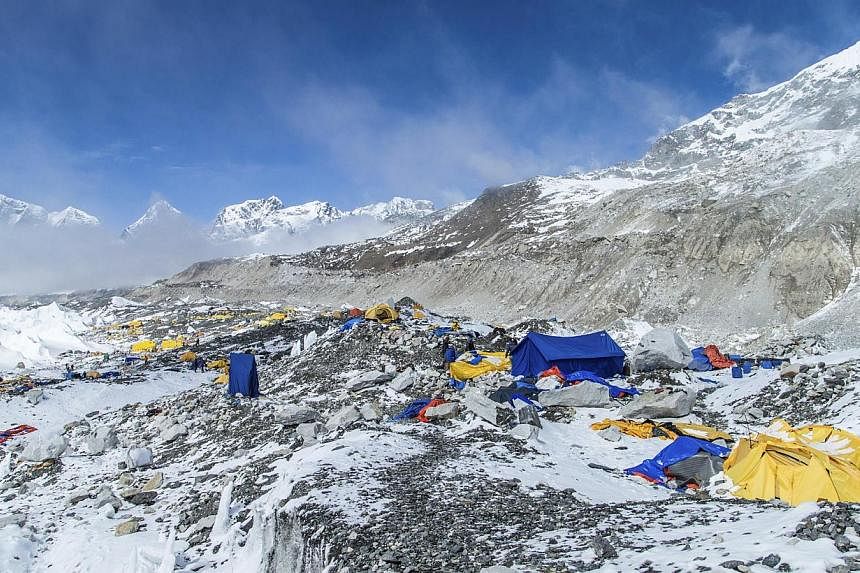
Everest stands at 8,848m above sea level, with Saturday's quake triggering an avalanche on the mountain that killed at least 18 people at base camp.
Experts warned that more aftershocks were likely, possibly for months to come.
"The slip on the April 25 earthquake will have increased the stress on other segments of the same fault, or of adjacent faults, such that they are more likely to rupture themselves," said Mr Allen.
"There may be earthquakes for months in the region, which likely relate to the main event."