A study carried out six years ago by the Geological Society of London that accurately predicted a possible major hazard emerging from Anak Krakatau volcano could have been used as a basis to prevent Indonesia's latest natural disaster, which has killed more than 400 people.
The 2012 study said a tsunami could be triggered by a collapse of Anak Krakatau's flank as the volcano is partly built on a steep wall of the caldera resulting from the 1883 eruptions.
Using a numerical model, it simulates both Anak Krakatau landslides and the tsunami propagations, detailing the tsunami's possible travel time and wave amplitude when hitting various coastal areas including Sumur, Carita, Labuan and Anyer in Banten province - on the western tip of Indonesia's most populous island, Java - and parts of Lampung province, in the southern tip of the country's second-most populous island, Sumatra.
On Dec 22, the calamity struck, with the highlighted areas mentioned in the study being those with the highest level of devastation.
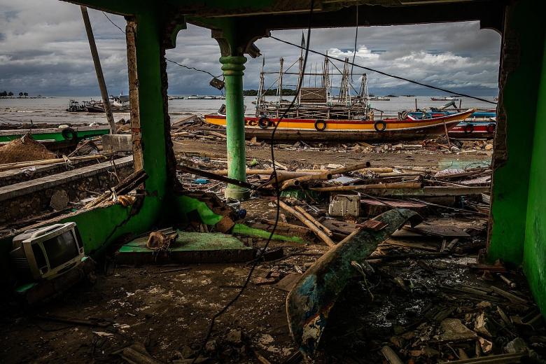
A section of the volcano's slope collapsed after the Dec 22 eruption and slid into the ocean, which displaced massive amounts of water, generating waves up to 5m high that then inundated the nearby coastlines of Java and Sumatra.
At least 431 people have been killed, over 7,000 others injured and another 15 are still unaccounted for.
Sumur district, which consists of seven coastal villages, became the worst hit and rescuers are still searching for victims' bodies under the rubble of houses and fallen trees, and more excavators are needed.
The 2012 study - jointly prepared by T. Giachetti, R. Paris, K. Kelfoun and B. Ontowirjo of the Geological Society of London - was called "Tsunami hazard related to a flank collapse of Anak Krakatau volcano, Sunda Strait, Indonesia".
It underlined that the volcano was largely built on the steep north-eastern wall of the 1883 Krakatau eruption caldera and was growing towards the south-west, making the structure quite unstable, and thus landslides - involving a debris avalanche volume of more than 200 million metre cubic - can be unavoidable.
The volcanic island, the name of which means "Child of Krakatau", emerged around 1927 after its "parent" Krakatau erupted 44 years previously, killing more than 36,000 people.
The study report also elaborated that a hypothetical flank collapse directed south-westwards could trigger giant waves that would then spread across the Sunda Strait at an average speed of 80kmh to 100kmh.
"The tsunami would reach the areas on the western coast of Java, 35 to 45 minutes after the onset of collapse... These waves present a non-negligible risk," the report warned.
It also made a bold recommendation: "A rapid detection of the collapse by the volcano observatory, together with an efficient alert system on the coast, would possibly prevent this hypothetical event from being deadly."
The tsunami struck at night without warning. The Indonesian authorities said the country's early warning system can be activated only if a tsunami is preceded by an earthquake.
The Geological Society of London report presented a table detailing, among other things, that Carita could be hit by waves as high as 2.9m, Labuan 3.4m, and Sumur 1.2m. The tsunami travel time to these places, respectively, could be within 37 minutes, 40 minutes and 36 minutes. This was calculated partly based on the distance and water depth in various parts of the Sunda Strait - the shallower it is, the faster the speed.
When asked by The Straits Times on Friday about this Sunda Strait tsunami hazard, Indonesia's national geological agency's secretary Antonius Ratdomopurbo said that the agency would be overwhelmed if it were to keep track of all the studies that have been done. "There are a lot of them," said Mr Antonius. "One thousand pieces of research, and one of them is correct. How could we go about this?"
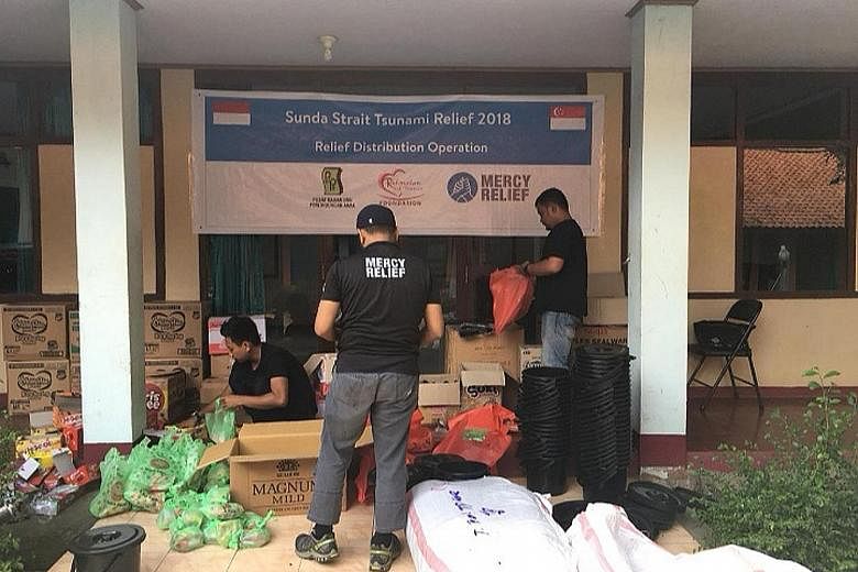
Meanwhile, Singapore's humanitarian aid group Mercy Relief is providing water and supplementary feeding to women and children, as well as blankets, hygiene kits and other supplies for survivors in the affected areas.
The non-governmental organisation has also started raising funds. Donations to Mercy Relief can be made via credit card, cheque, cash or bank transfers to its DBS current account 054-900741-2.
SEE HOME


