KATHMANDU, Nepal (NYTIMES)- Mount Everest is the tallest mountain in the world, but precisely how tall is it?
It's not such a simple question.
In the past, geologists have disagreed about what to include in their calculations: Should the summit's snowcap be included? Or should surveyors drill down to the peak's rock base?
What about the recent earthquakes in Nepal, which geologists believe shrunk the mountain by about three centimeters, or a little more than 1 inch? Or the fact that wind speed affects how much snow covers the summit at any given time?
Then there is the challenge of geography: Reaching the summit of Everest is only possible a few weeks each year, and measuring the mountain's height from sea level has presented difficulties in the past.
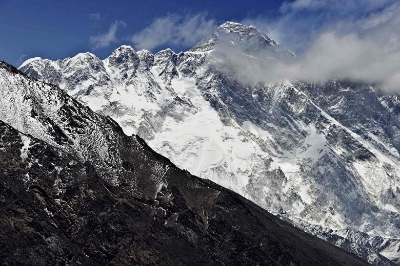
Today, Everest's height is widely recognised as 29,029 feet (8848m).
But teams from around the world, including China, Denmark, Italy, India and the United States, have come up with other calculations, which have sometimes strayed a little bit higher, or a little bit lower, than that figure.
Italy, in 1992, lopped 7 feet off the standard height, measuring it at 29,022 feet. In 1999, a measurement by US scientists pushed the peak a little higher, saying the mountain reached 29,035 feet.
These measurement expeditions have typically excluded experts from Nepal, which shares the mountain with China and is one of the poorest countries in Asia.
Now, for the first time, Nepali surveyors are limiting intervention from foreign powers and sending a team to the summit to settle the height question for themselves. In addition to the science, a bit of national pride is at stake.
"Mount Everest is our treasure," said Buddhi Narayan Shrestha, former director general of Nepal's Department of Survey.
"What will happen if foreign experts continue to reduce the height of our mountain without us participating?"
To prepare for the country's own expedition, Nepali surveyors will collect measurements this month along the country's southern plains, where they plan to calculate sea level.
A team of Sherpas are also being trained to bring a GPS receiver to the summit. The cost to measure the mountain is estimated at US$250,000 (S$329,957).