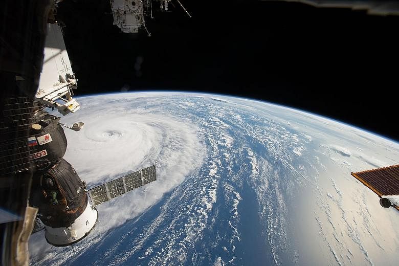
A handout photo from the National Aeronautics and Space Administration (Nasa) showing Super Typhoon Noru in the northern Pacific Ocean, as seen from the International Space Station on Tuesday. According to media reports, the typhoon has maximum winds of up to 170kmh and is listed as a Category 2 hurricane. The storm was expected to reach southern Japan by today after passing through a low-wind shear, high-water temperature area - possibly gathering strength along the way. People living in a wide swathe of south-west Japan, including areas devastated by torrential rain last month, were bracing themselves for more rainfall as the typhoon - at one point the world's strongest storm this year - churned closer to the country's main islands.
An eye on the storm
Join ST's Telegram channel and get the latest breaking news delivered to you.
A version of this article appeared in the print edition of The Straits Times on August 05, 2017, with the headline An eye on the storm. Subscribe