


SINGAPORE - Work to transform Ang Mo Kio into a model walking and cycling town have begun.
In a joint statement on Thursday (Dec 3), the Land Transport Authority and Urban Redevelopment Authority said the first phase, which includes a 4km cycling path looping around Ang Mo Kio Avenues 1, 3, and 8, is expected to be completed by the first half of next year.
The remaining work, which features a 16km cycling path network, including a 2.6km cycling and walking corridor connecting the MRT viaduct between Yio Chu Kang MRT station and Bishan-Ang Mo Kio Park, is expected to be mostly completed by 2018.
Plans to transform Ang Mo Kio into Singapore's first model walking and cycling town were first unveiled by the two authorities in December 2014.
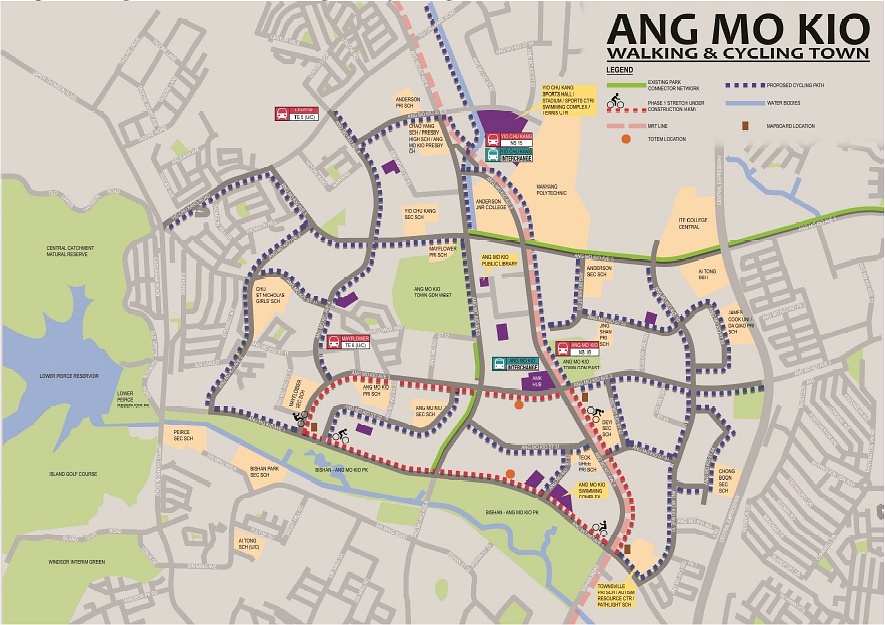
When the first phase is completed, cyclists and pedestrians can go seamlessly and safely from Ang Mo Kio Swimming Complex , along Avenue 1, to Ang Mo Kio MRT station.
LTA chief executive Chew Men Leong said: "Ang Mo Kio will be the first model walking and cycling town in Singapore, where we will go beyond providing basic walking and cycling infrastructure and test out new concepts and ideas to make the town even more walkable and cyclist-friendly."
URA chief executive Ng Lang described the project as "an important pilot" that aims to "encourage walking and cycling as alternative modes of green mobility".
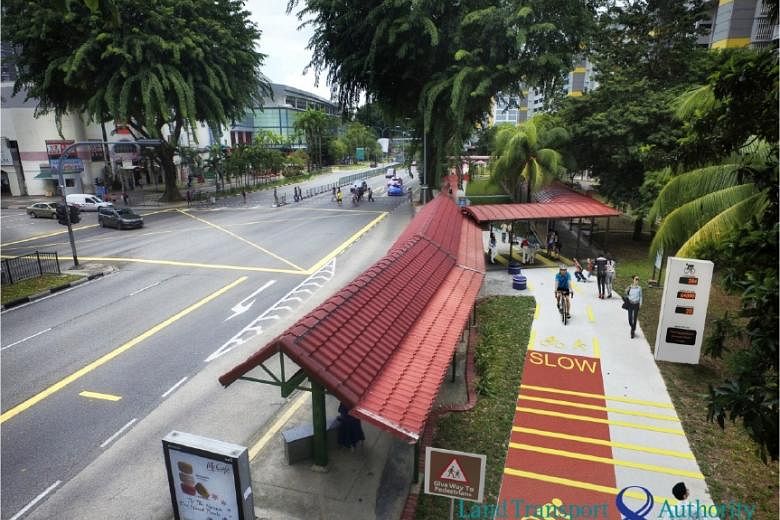
When completed, Ang Mo Kio will have a 20km cycling path network - the longest in any residential town. The network will be marked out in red; and pedestrian priority zones will be created in areas where pedestrians and cyclists often come into contact with each other, such as behind bus stops.
These priority zones will include rumble strips to slow cyclists down to a safe speed, and contrast markings to help pedestrians and cyclists keep to their side of the path. Easy-to-read mapboards - highlighting key amenities and transport nodes - will help users to navigate the network. Totem boards with speed check functions will also be installed at strategic locations.
The LTA said it will work with URA, NParks and the Housing Board to explore how these features can be extended to other towns.