
Work to transform Ang Mo Kio into a model walking and cycling town has begun.
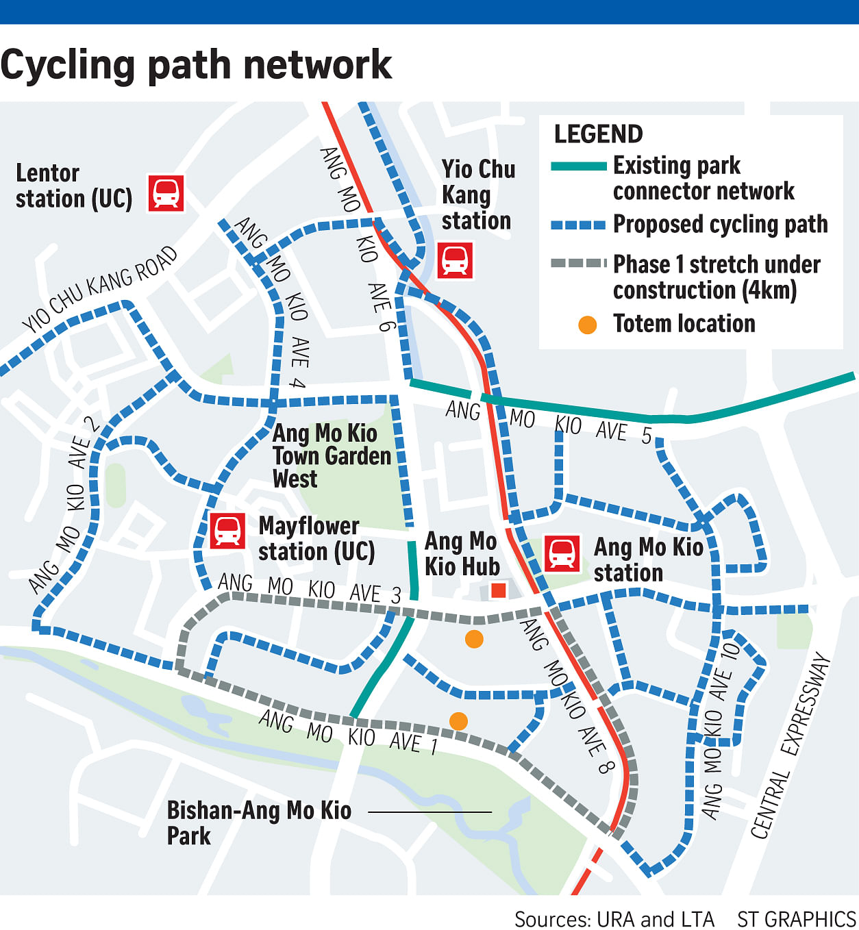
In a joint statement yesterday, the Land Transport Authority (LTA) and Urban Redevelopment Authority (URA) said the first phase of the project, which includes a 4km cycling path looping around Ang Mo Kio Avenues 1, 3 and 8, is expected to be completed by next June. By then, cyclists and pedestrians will be able to travel seamlessly from the swimming complex along Avenue 1 to the Ang Mo Kio MRT station.
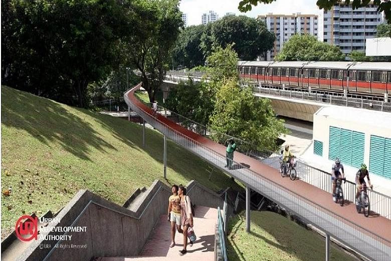
The remaining work, which features a 16km cycling path network, including a 2.6km cycling and walking corridor connecting the MRT viaduct between Yio Chu Kang MRT station and Bishan-Ang Mo Kio Park, is expected to be mostly completed by 2018.
The network will also link up with Mayflower and Lentor stations along the future Thomson line.
URA chief executive Ng Lang yesterday described the project as "an important pilot" that aims to "encourage walking and cycling as alternative modes of green mobility".
LTA chief executive Chew Men Leong said: "We will go beyond providing basic walking and cycling infrastructure, and test out new concepts and ideas to make the town even more walkable and cyclist-friendly."
For instance, a large terrarium housing special orchids as well as uncommon and native forest plants will be built below the viaduct.
Fitness stations and play equipment will also be erected.
When completed, Ang Mo Kio will have a 20km cycling path network - the longest in any residential town. The network will be marked out in red, and pedestrian priority zones will be created in areas where pedestrians and cyclists often come into contact with each other, such as behind bus stops. These priority zones will include rumble strips to slow cyclists down, and markings to help pedestrians and cyclists keep to their side of the path. Mapboards highlighting key amenities and transport nodes will help users navigate the network. Totem poles with speed check functions will also be set up.
The LTA said the safety of traffic junctions and crossings will be enhanced with features to slow motorists down. Motorists will be alerted to the presence of pedestrians and cyclists.
Cycling advocate Han Jok Kwang said: "It's important to get one model town done and done well, so that it can be a benchmark."
He added that Ang Mo Kio, being relatively compact, and with MRT and park connector access, allows for benefits of such a network to be felt more immediately.
The LTA would not say how much the project is likely to cost, as tenders for the second phase have not been called.
But in 2013, the authority said it was working on building cycling paths in nine neighbourhoods, which would cost up to $43 million. The Marina Bay's own network is estimated to cost $23 million.
By 2020, cyclists can expect around 190km of paths.