When Kennie Ting, 39, group director of museums at the National Heritage Board lived in New York City, he embarked on a project titled Manhattan In 12 Streets.
He walked, photographed and wrote about these streets, which he felt "captured the diversity of the neighbourhoods, communities and architectural styles in Manhattan".
You can explore the project online here.
Upon returning to Singapore in 2013, Mr Ting, who is also the director of the Asian Civilisations Museum, started thinking about his project in a local context.
"I thought carefully about which 12 streets best captured Singapore, past, present and future," he said.
Here, he shares his Singapore In 12 Streets and encourages others to add to it, or come up with their own list.
Read the Life Interview with Mr Ting here.
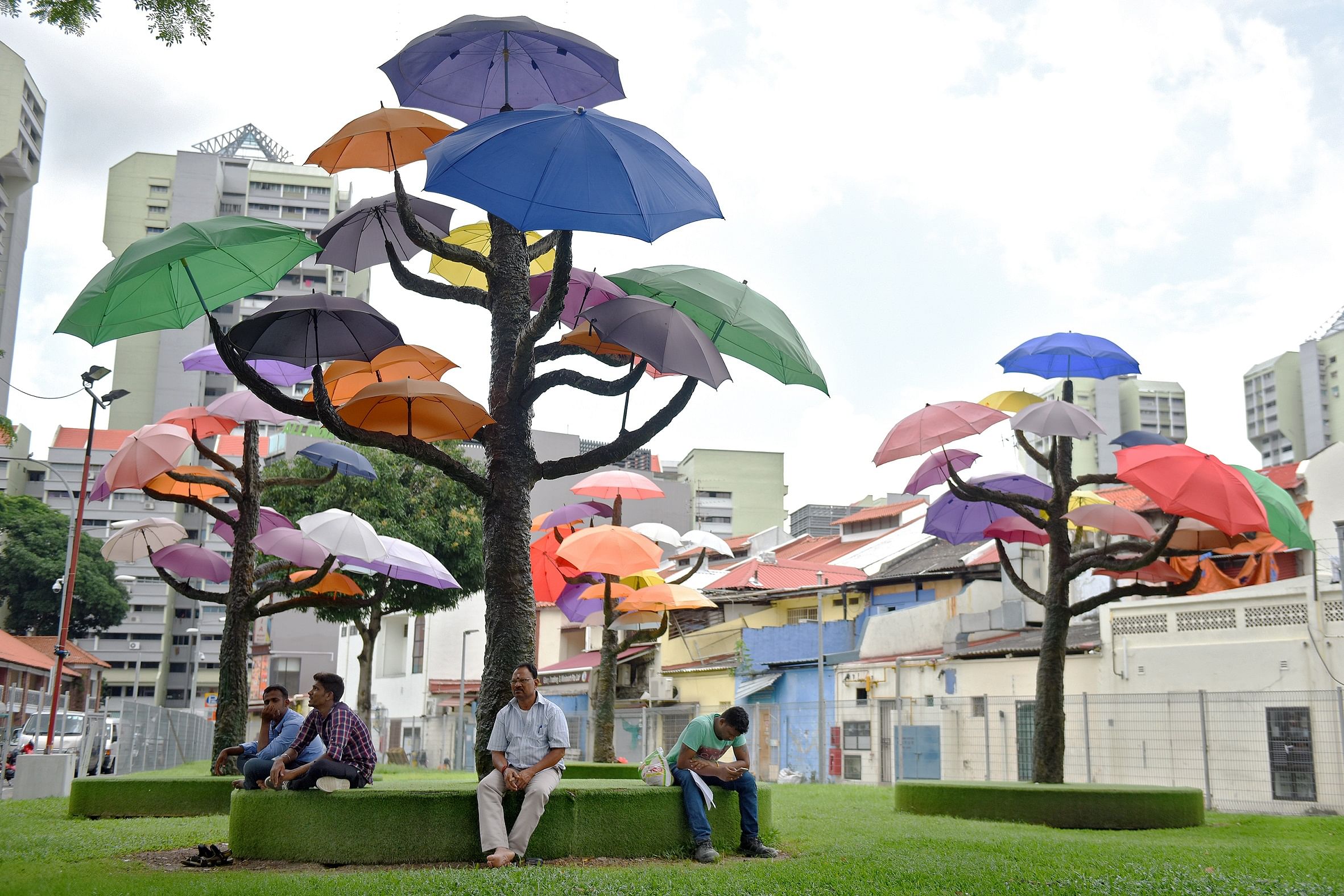
1. North and South Bridge Roads: Old Singapore
North and South Bridge Roads - really one single, long road - are two of the oldest thoroughfares in Singapore, having first appeared in the 1822 Town Plan commissioned by Raffles and executed by Lieutenant Phillip Jackson.
The roads lay north and south, respectively, of the footbridge across the Singapore River - today's Elgin Bridge.
They functioned, also, as a "bridge across cultures", linking the segregated racial enclaves to each other - the Malay kampungs and the Royal Quarter in the north, European (or "White") Town at the centre, and the Chinese and Indian quarters at Telok Ayer in the south.
Almost 200 years later, North and South Bridge Roads are still "bridges", joining Kampong Glam to the civic district and Bras Basah to Chinatown. A walk down the roads is a walk through Singapore's pre-colonial and colonial history.
Start the morning at Sultan Mosque and head west, stopping in at the historic Raffles Hotel along the way. At Coleman Street, either head north, up Fort Canning Hill to explore pre-colonial Singapore, or south towards the monuments and the museums at the Padang and Empress Place.
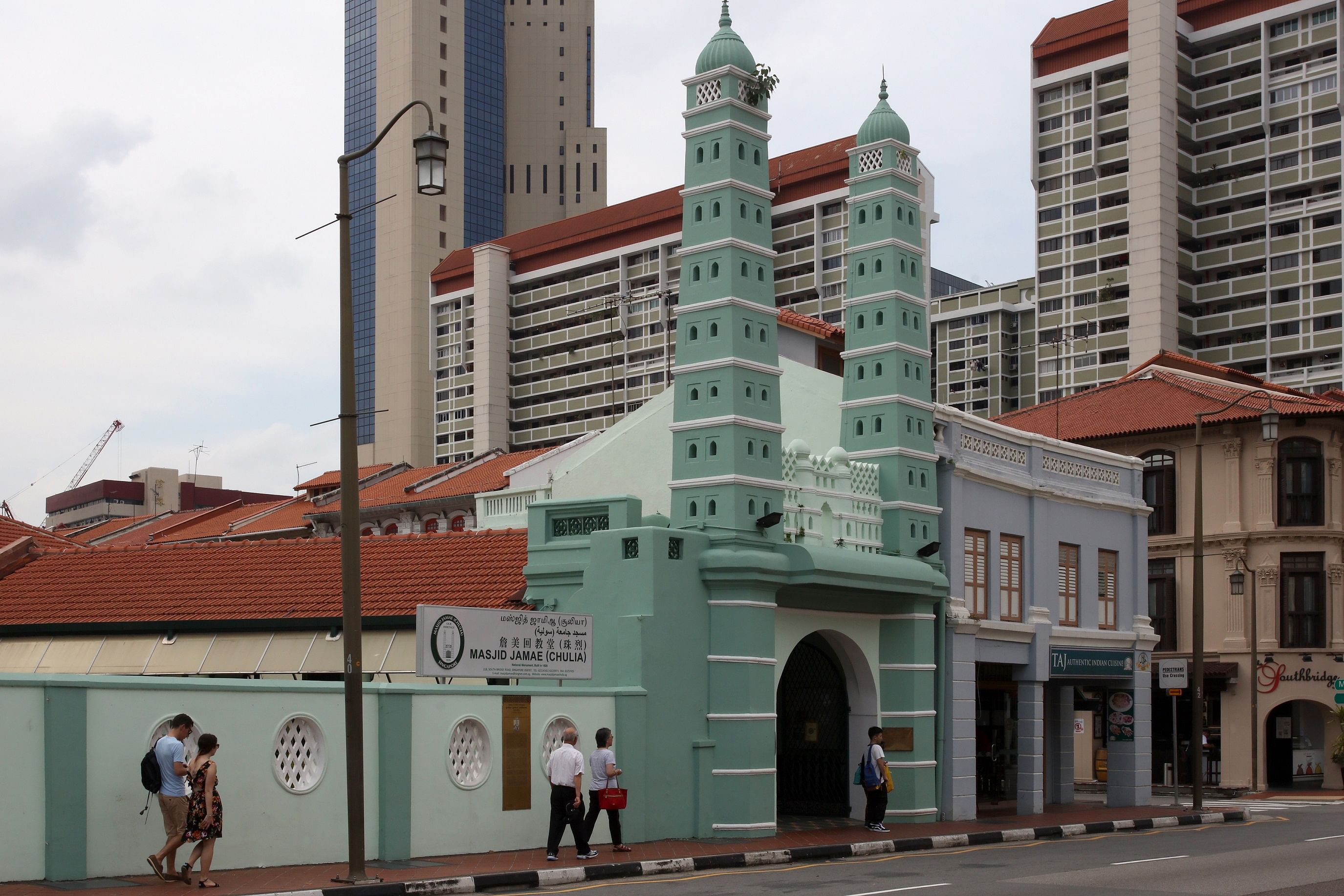
Cross the river into Boat Quay and South Bridge Road. Take in the many important places of worship here, including the mosque Masjid Jamae Chulia, the Sri Mariamman Hindu Temple and the recently built Buddha Tooth Relic Temple. End the day at Chinatown Complex Market and Food Centre.
2. Robinson Road (& Collyer Quay): Empire, Trade and Commerce
Robinson Road leading to Collyer Quay is the heart of Singapore's commercial district. To the south sits the Victorian-style Telok Ayer Market - the city's old bazaar, which still stands today as the Lau Pa Sat (or old market in Hokkien).
Along the waterfront sat Singapore's equivalent of the Shanghai Bund - imposing commercial facades that trumpeted the colony's wealth.
Iconic landmarks here in the early 1900s included the Hong Kong and Shanghai Bank Building, the Alkaff Arcade and the General Post Office. Of the three, only the post office - today's Fullerton Hotel - still stands and looks as it originally did.

At historic Clifford Pier, cruise ships from all over the world would dock, disgorging thousands of visitors each year who would stopover on their round-the-world tour.
To the north of Robinson Road sat the old city's financial and trading centre - previously Commercial Square, now Raffles Place.
Once it was an impressive showcase of neo-classical and renaissance architecture this side of London; today, it is an equally impressive forest of towering glass and steel.
3. Waterloo and Queen Streets: All the World's Religions and Cultures
Waterloo and Queen Streets are "streets of harmony" - on and around them sit places of worship representing almost all the world's major religions. South of Middle Road, the streets sat in former European Town, and so one finds here major historic cathedrals and churches - the Cathedral of the Good Shepherd, the Church of Saints Peter and Paul and St Joseph's Church, sacred to the Portuguese Eurasian community in Singapore.
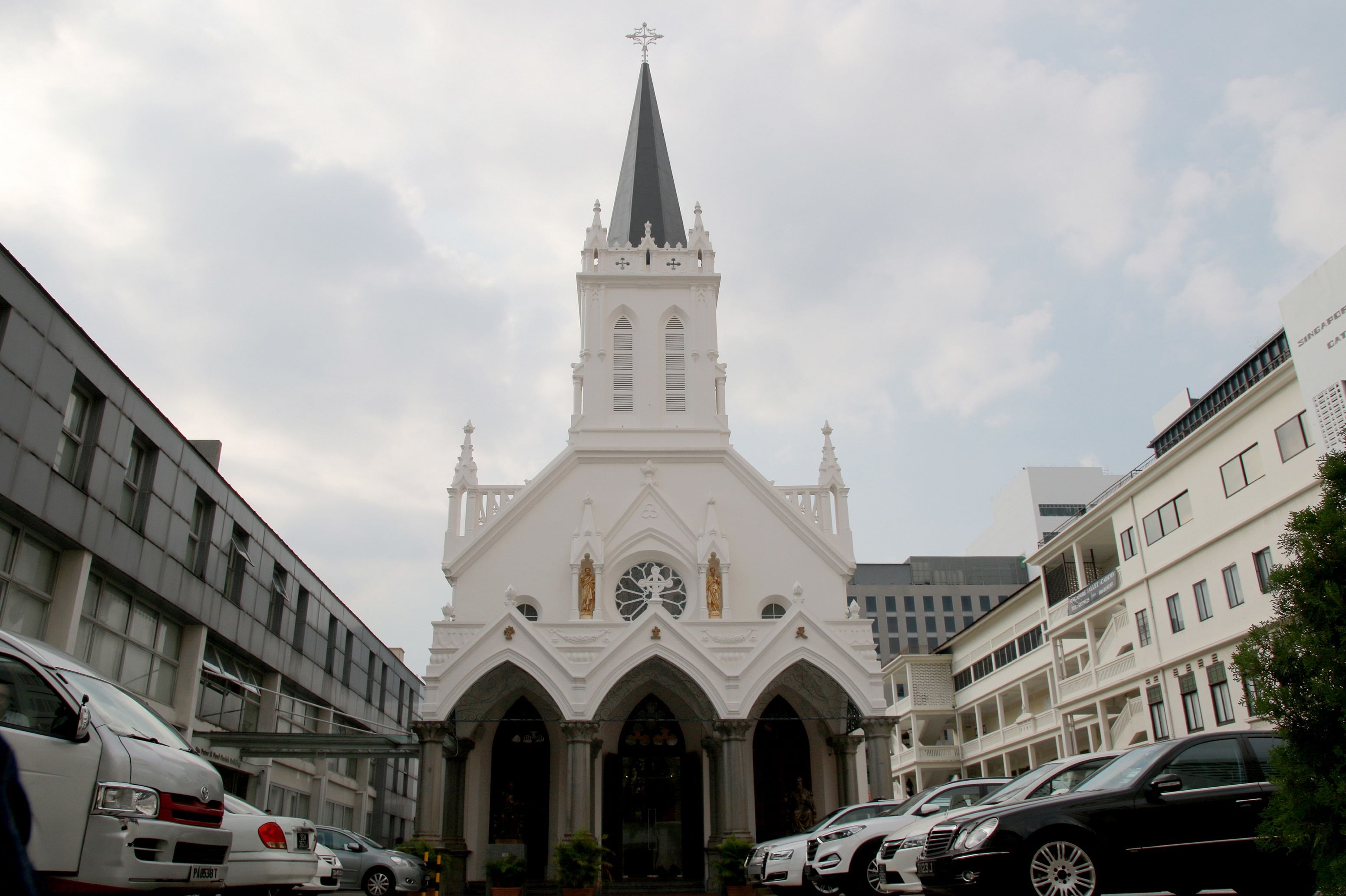
This part of town was also once host to a sizeable Jewish community and so one also finds the city's oldest Jewish synagogue Maghain Aboth here.
The area around the streets further plays host to a significant number of arts, culture and design institutions and companies, with the National Museum of Singapore, the Singapore Art Museum, the National Design Centre and the National Library within walking distance.
North of Middle Road, the streets extend into an area where many ethnic communities existed side by side. On Waterloo Street, one finds the most vivid illustration of Singapore's religious harmony - the Kwan Im Thong Hood Cho (Goddess of Mercy) Temple sits right beside the Sri Krishnan Hindu Temple.
4. Orchard Road: From Suburb to Shopping Haven
As its name suggests, Orchard Road was a landscape of fruit and spice orchards and plantations in the 1830s. From the mid 1800s to the early 1900s, the road was suburban in outlook, with Europeans building ornate villas north of the street in the Tanglin area, while wealthy Straits Chinese families established stunning mansions in the vicinity of Emerald Hill.
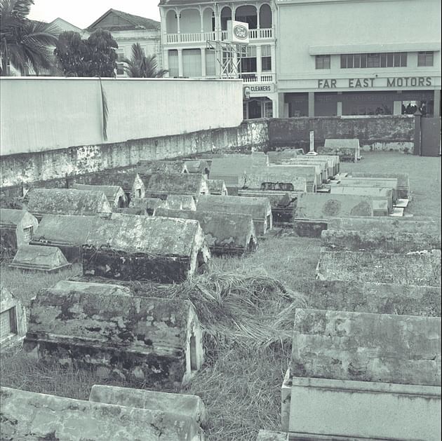
Amid these residential enclaves were cemeteries, in particular a Jewish Cemetery (where Dhoby Ghaut MRT station is today) and a cemetery for the Teochew community (where Ngee Ann City stands today).
Orchard Road became a popular destination for shopping and entertainment from the 1930s, with a string of glitzy cinemas and major departmental stores opening branches along the road.
After Singapore's independence, the road continued to be developed and positioned as a shopping and retail area by the tourism authorities. Today, it has become Singapore's foremost shopping destination, playing host to luxurious shopping malls and five-star hotels.
5. Holland Road: Urban Villages

Holland Road is named after a certain Mr Hugh Holland, who was an architect and a resident of the city at the turn of the 19th century. It is a long thoroughfare cutting through some of the most verdant parts of Singapore, and stringing together half a dozen suburban districts that have a laidback village-y feel.
The road proper begins at the entrance to the Singapore Botanic Gardens, the city's green lung and as yet, its only UNESCO World Heritage Site.
Driving along the road with the Gardens to the right, one quickly comes to Dempsey Village - a former colonial-era military barracks converted into a sprawling and laidback lifestyle and restaurant cluster where one can spend a leisurely afternoon and evening.
A short way down sits Holland Village, one of the oldest and most popular watering holes for expatriates and young Singaporeans alike.
North of Holland Village lie a succession of exclusive, residential "urban villages" along Coronation Road West, Jalan Jelita, Greenleaf Drive and Mount Sinai Drive.
6. Bukit Timah Road: Tropical Splendour
Bukit Timah Road is Singapore at its tropical finest, with the island's greatest concentration of wealth and privilege sitting alongside its largest expanse of rainforest.
At one end of Bukit Timah Road sits Newton Circus, a hawker centre and popular spot for late-night suppers. Driving west from Newton, one passes dozens of luxury condominiums, and a landscape of landed properties.
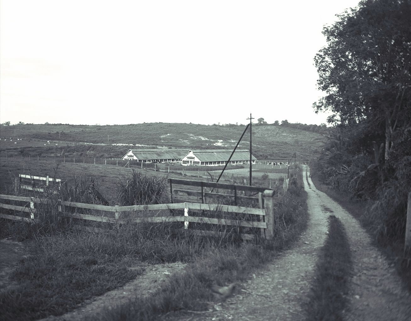
Then there is Turf City, once the Singapore Turf Club where the city's elite would descend to enact their version of the Royal Ascot.
Bukit Timah Road is also home to some of the oldest and finest schools on the island - Nanyang Primary School, Singapore Chinese Girls' School, the former Chinese High School (today's Hwa Chong Institution), Anglo-Chinese School (Barker Road) and Methodist Girls' School, to name a few.
Bukit Timah Road becomes Upper Bukit Timah Road at the foothills of Bukit Timah Nature Reserve.
7. Tiong Bahru Road: Housing and Hipsters

A drive down Tiong Bahru Road is a history lesson in early public housing. The road starts in Tiong Bahru Housing Estate proper - the earliest public housing estate, built between the 1930s and 1950s by the Singapore Improvement Trust, a department of the British Colonial Government. The apartment blocks here were mostly designed in the Art Deco style, and many buildings were gazetted as conservation buildings in 2003.
Today, Tiong Bahru has become an uber-cool hipster enclave of bars, restaurants and boutiques. Near Tiong Bahru is Bukit Ho Swee Estate, once a squatter settlement that was destroyed in the famous Bukit Ho Swee fire incident in 1961. Bukit Merah, Henderson and Redhill Estates go by in quick succession - these were among the earliest Housing Development Board estates built in post-independence Singapore.
Tiong Bahru Road ends off in Queenstown Estate, the first housing estate built on the "New Town", or satellite town model, which would provide residents with amenities such as shops, schools, libraries and markets. It is home to a very strong, community-led heritage conservation movement.
8. Pasir Panjang Road: The Western Waterfront

The view along Pasir Panjang Road and Singapore's western waterfront is dominated by port and industry, but the area is still home to a number of interesting and off-the-beaten path attractions.
The first is the Southern Ridges, a 9-km walking trail that includes a breathtaking path through the tropical rainforest canopy.
Tiny Labrador Park sits right on the water and is known for its World War II-era structures as much as for its unique tidal ecology.
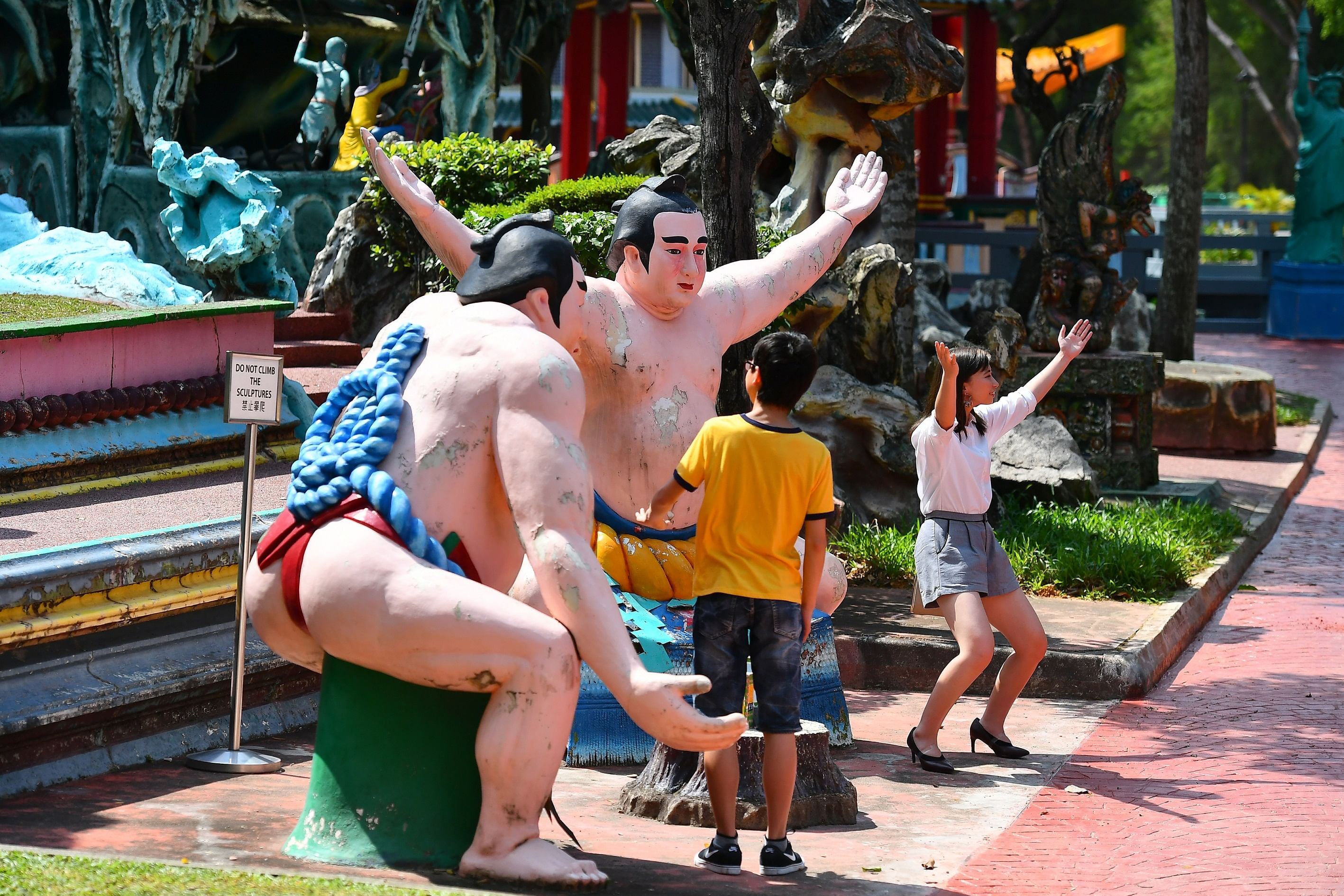
Further down the road, past the enormous and brand-new Pasir Panjang Container Port Terminal sits Haw Par Villa, also known as Tiger Balm Gardens. A highly popular attraction in the 1970s and 1980s, the park - with its many statues depicting Chinese myths, legends, folk and morality tales - have been somewhat forgotten by locals and visitors alike.
At the junction of Science Park Road, look out for the Pasir Panjang Pillbox, one of the last surviving WWII-era defensive pillboxes.
Just beyond is Kent Ridge and the sprawling campus of the National University of Singapore.
9. Serangoon Road: Local Flavours
Food is the quintessential Singaporean pastime and Serangoon Road offers some of the best places for local grub.
We start off in Little India, the heart of the Indian community in Singapore, an exuberant tapestry of colour, sound, scent and historic architecture; and evidently the best place for local Indian food.
After stopping off at the brand-new Indian Heritage Centre, make a detour to Muthu's Curry at Race Course Road for its delectable fish head curry.
A little further down is the famous Mustafa Centre - a gigantic, 24-hr hyper-mart where one can get quite possibly anything under the sun.
Past Little India is the Jalan Besar /Lavender area, where one finds even more historic architecture (check out the row of conserved shophouses along Petain Road) and a cornucopia of local flavours.
The rest of Serangoon Road is a mix of residential and industrial estates (Boon Keng, Bendemeer), but well worth a drive to observe pre- and post-war era shophouses and industrial buildings standing across the road from towering skyscrapers - this is typical Singaporean urban typology.
10. Ang Mo Kio Avenue 6: The Heartlands

Ang Mo Kio Avenue 6 runs through Ang Mo Kio New Town, built in the 1970s by the Housing Development Board.
These satellite towns were planned to be self-contained mini-cities, and a leisurely drive down the road provides an overview of just how efficient and revolutionary they were.
Start at the northern end of Avenue 6 and head south, along the MRT (Mass Rapid Transit) tracks to Yio Chu Kang MRT Station. Pay attention to the bus lanes at left and the regular bus services plying the route - transport connectivity was a basic feature of New Towns.
Past Ang Mo Kio Avenue 5 sits Ang Mo Kio Central (the heart of the New Town), complete with schools (primary, secondary, tertiary), places of worship, a community club, mall and entertainment amenities and public gardens.
At the southern end of Ang Mo Kio Avenue 6 is the 62 hectare Bishan-Ang Mo Kio Park - a success story in re-introduced biodiversity.
The old concrete canal that once ran through the park had been de-concretised and re-landscaped into a lovely, meandering minor tributary of the Kallang River. Birds and mammals moved in, including a well-loved family of Asian small-clawed otters familiarly known as the "Bishan otters". Keep a look out for them.
11. Joo Chiat Road: The Idyllic East

Joo Chiat Road evokes sandy beaches, swaying palms and the sound of waves crashing on the surf.
While it does not actually run along the coast, it is certainly one of Singapore's prettiest and most idyllic streets.
Begin early in the morning at East Coast Park and make your way through Marine Parade estate to Joo Chiat Road proper. The southern end of Joo Chiat Road cuts across Katong, where in the late 1800s and early 1900s many of the wealthy built their sea-side villas and mansions.

The area specifically around Joo Chiat Road was an Eurasian enclave and a quick detour takes one to the Eurasian Heritage Centre and the city's famous Eurasian restaurant - Quentin's.
Joo Chiat Road is perhaps best known for its row after row of immaculately conserved Straits Chinese-style shophouses, with their eclectic mix of European, Malay and Chinese architecture and symbolism.
The Straits Chinese also settled in this area, and Joo Chiat is today still the best place to go for Peranakan cuisine. The northern end of Joo Chiat takes one to Geylang Serai Market, famed for its Ramadan Bazaar and one of the best places for Malay food.
12. Marina Boulevard: New Singapore

If North and South Bridge Roads represented Old Singapore, Marina Boulevard - one of the newest roads on the island - represents New Singapore.
The road sits in Marina Bay, a new financial centre and downtown precinct built on land reclaimed from the sea. Singaporeans born before the 1990s would remember a vast tract of reclaimed land sitting to the South of Collyer Quay. Today, this plot of land is perhaps the most valuable piece of real estate in Singapore.
Begin the walk at Collyer Quay and head south, past The Sail - one of Singapore's most expensive and exclusive residential addresses. To the left, the Promontory extends out over Marina Bay - once an actual Bay open to the sea, but today a reservoir, closed off from the Singapore Straits by the Marina Barrage. Stop here to take in the view of Marina Bay Sands - its spaceship-in-the-sky architecture dominating the Singapore skyline.
Head further south to take in the brand-new Marina Bay Financial Centre, where the headquarters of many of the city's banks and financial institutions are located.
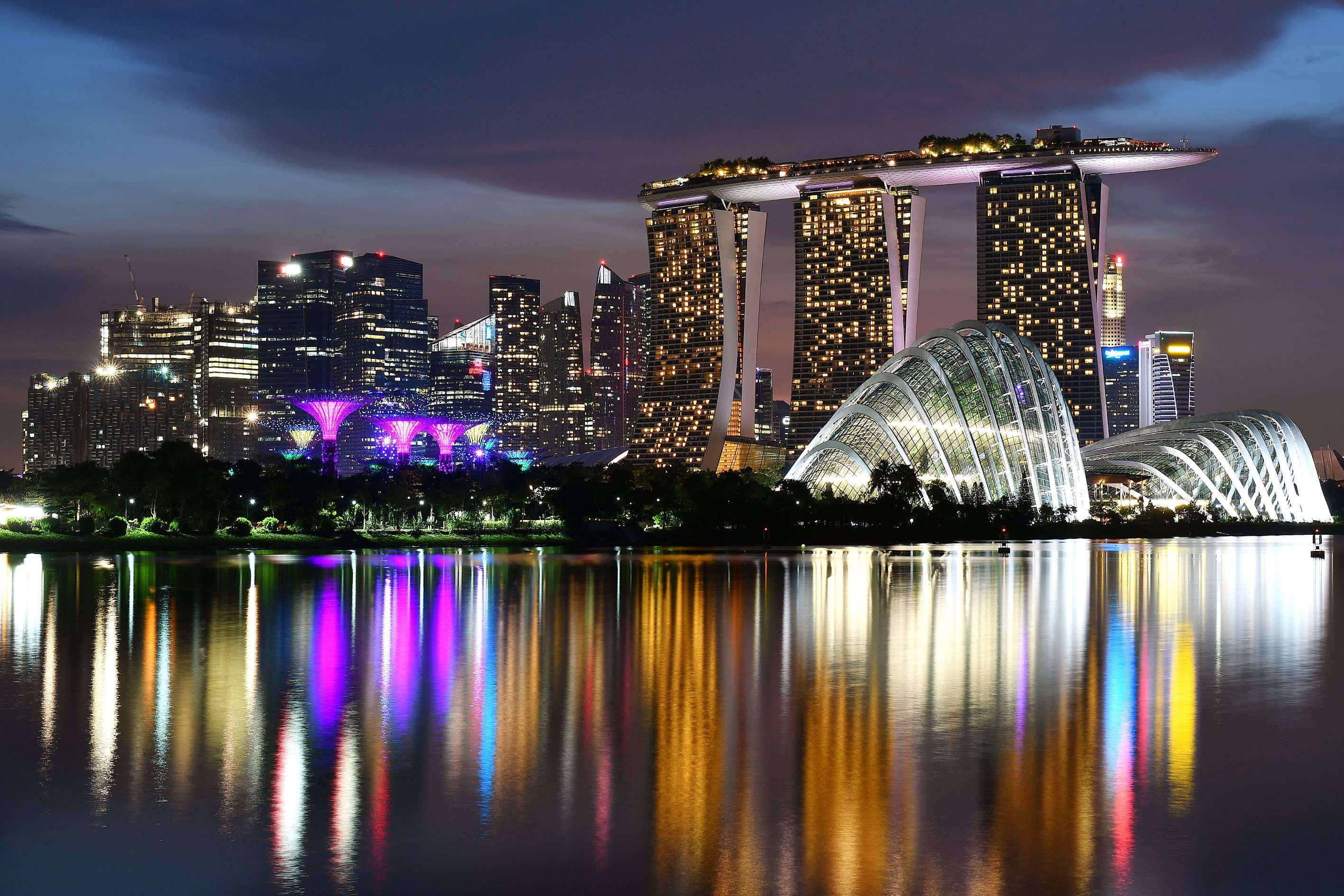
End the walk - and this tour of Singapore through 12 Streets - at the sprawling Gardens by the Bay with its majestic Super Trees and the surreal, ginormous twin glass domes that house the Flower Dome and Cloud Forest.
Here, one gets a confident glimpse of the future: Singapore as a space-age city in a garden.
Other streets that did not make the list:
- Geylang Road, for a view of how Singapore's underbelly and "vice" economy co-exists with the mainstream
- Lim Chu Kang Road for a rare glimpse of rural, high-tech and high-tech-rural Singapore
- Admiralty Road West for a journey through historical military barracks and the far north leading to the Causeway to Johor
- Pan-Island Expressway - the longest "street" in Singapore - for a survey of port, airport, industry, central water catchment and defence infrastructure.