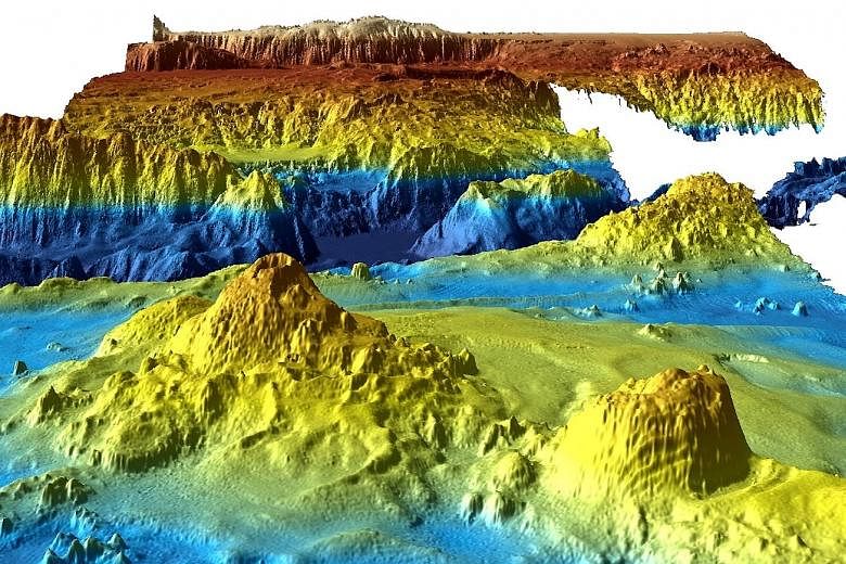
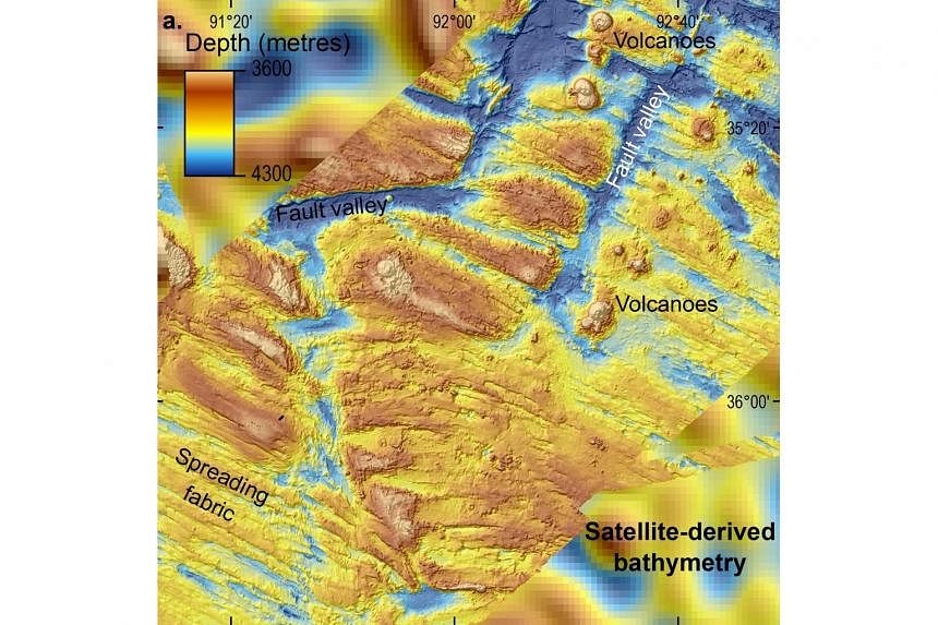
SYDNEY • The painstaking search for missing Flight MH370 has uncovered a previously unknown undersea world of volcanoes, deep valleys and soaring ridges, detailed maps released by Australia show.
Although no trace of the Malaysia Airlines plane was found during the search in the southern Indian Ocean - the most expensive of its kind - large volumes of data showing a detailed picture of the sea floor had to be collected to guide the probe. Scientists are hopeful the new maps will give their community greater insight into oceans.
"It is estimated that only 10 to 15 per cent of the world's oceans have been surveyed with the kind of technology used in the search for MH370," Geoscience Australia's environmental geoscience chief Stuart Minchin said on Wednesday.
"(That makes) this remote part of the Indian Ocean among the most thoroughly mapped regions of the deep ocean on the planet.
"So this data is unique both because of the remote location of the search area, and because of the sheer scale of the area surveyed."
Dr Minchin said the maps would also be useful for future scientific research, such as oceanographic and habitat modelling.
Australia, Malaysia and China suspended the deep sea hunt in January, almost three years after the Boeing 777 disappeared with 239 people on board. Canberra has said the search could be restarted if new evidence about the specific location of the aircraft emerges.
The hunt, based on satellite analysis of the jet's likely trajectory after it diverted from its flight path, covered a 120,000 sq km zone, an area slightly smaller than England.
Two shipwrecks were found during the search but no trace of the plane, deepening one the most enduring mysteries of the aviation age. However, the data revealed ridges 6km wide and 15km long that rise 1,500m above the sea floor, as well as fault valleys 1,200m deep and 5km wide.
A second set of data will be released in mid-2018.
AGENCE FRANCE-PRESSE